Lambayeque Province, Administrative province in northern Peru
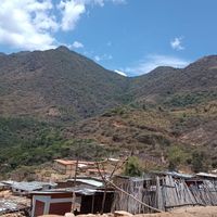
Lambayeque is an administrative province in northern Peru spanning roughly 9,300 square kilometers between the Pacific Ocean and inland areas. The territory is divided into twelve districts and features both coastal and inland terrain.
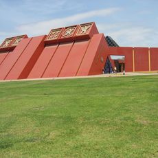
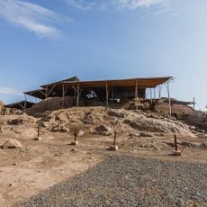
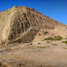
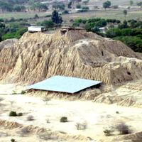
The province was home to the Moche civilization, which built complex societies along the coast and left behind structures like the Túcume pyramids. These archaeological remains show the region's long settlement history before Spanish arrival.
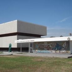
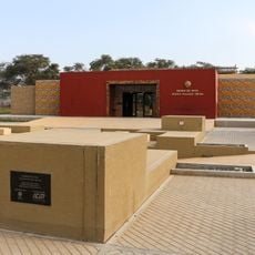
The Royal Tombs of Sipán Museum displays artwork and objects from a Moche burial site, revealing the craftsmanship and spiritual beliefs of this ancient society. Visitors can observe the fine ceramic and metalwork that defined this civilization's artistic traditions.
The Pan-American Highway connects the province to other regions and allows access to all twelve district centers. Regular bus services between towns provide convenient ways to travel through the area and visit different locations.
The beaches of San José feature traditional reed fishing boats called caballitos de totora that have been used by fishermen for centuries. These handmade boats represent a living link to the region's pre-Hispanic fishing practices.
Location: Lambayeque Department
Capital city: Lambayeque
Shares border with: Chiclayo province, Ferreñafe Province, Jaén Province, Huancabamba Province, Morropón Province, Piura Province, Sechura Province
GPS coordinates: -6.70466,-79.90708
Latest update: December 22, 2025 12:56
The Royal Tombs of Sipan Museum
859 m
Túcume
22.1 km
Pómac Forest Historical Sanctuary
29.5 km
Huaca Rajada
35.4 km
Batán Grande
28.9 km
Ventarron
19.9 km
Laquipampa Wildlife Refuge
61.3 km
St. Mary's Cathedral, Chiclayo
10.7 km
Brüning Museum
370 m
Chotuna-Chornancap
5.4 kmPampa Grande
48.3 km
Museo de Sitio Huaca Rajada - Sipán
35.5 kmApurlec
53.1 km
Museo de Sitio Túcume
21.8 kmCerro Pátapo ruins
29.1 km
Palacio Municipal, Chiclayo
10.6 km
Sicán National Museum
16.2 kmHuaca Santa Rosa de Pucalá
32.3 kmHuacrupe-La Calera Forest Regional Conservation Area
97.8 kmMuseo de Sitio Huaca Chotuna-Chornancap
5.7 kmMoyán-Palacio Forest Regional Conservation Area
82.6 kmHuaca Bandera
33.2 kmPlaya La Huaca
36.2 kmPlaya Corral de Chancho
65.2 kmPlaya Dos Mujeres
41.5 kmSantos Vera Museum
23.9 km
Casa Montjoy
212 mLas Pirkas
34.5 kmVisited this place? Tap the stars to rate it and share your experience / photos with the community! Try now! You can cancel it anytime.
Discover hidden gems everywhere you go!
From secret cafés to breathtaking viewpoints, skip the crowded tourist spots and find places that match your style. Our app makes it easy with voice search, smart filtering, route optimization, and insider tips from travelers worldwide. Download now for the complete mobile experience.
A unique approach to discovering new places❞
— Le Figaro
All the places worth exploring❞
— France Info
A tailor-made excursion in just a few clicks❞
— 20 Minutes