Víctor Larco Herrera District

Log in to your account

AroundUs is a community-driven map of interesting places, built by curious explorers like you. It grows with every review, story, and photo you share.
Connect to save your favorite spots, contribute locations, and create personalized routes.
Continue with Google
Continue with Apple
Continue with X
Continue with Facebook
Continue with email
By continuing, you accept our Terms and Conditions and our Privacy Policy
Create an account

Víctor Larco Herrera District

Add to collection
Map
Suggest a change
Share

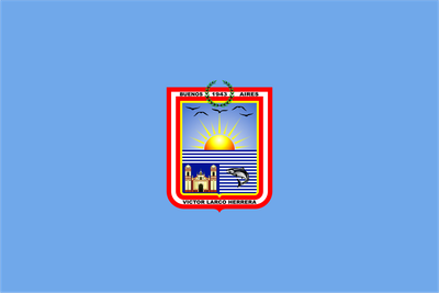
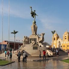
Víctor Larco Herrera District, Coastal district in Trujillo province, Peru.

Víctor Larco Herrera District is a coastal neighborhood in Trujillo province that stretches along the Pacific shoreline with mixed residential and commercial areas. The district sits at a low elevation above sea level and forms part of the broader urban landscape of the region.

The district was originally called Buenos Aires before being renamed in 1945 to honor a prominent philanthropist who contributed greatly to the development of Trujillo. This change in name reflected the community's recognition of influential figures in the region's growth.

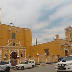
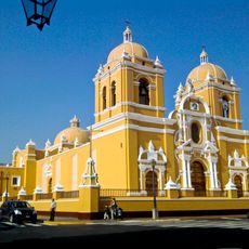
The Santiago de Huaman Church serves as a focal point for the community's religious life, where residents gather for celebrations and worship throughout the year. Local Catholic traditions remain woven into the rhythm of daily life in the neighborhood.

The district has several healthcare facilities including a health center and hospital that provide medical services to residents and visitors. Key services are accessible on foot or by local public transportation.

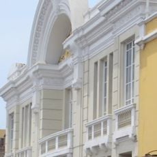
The district developed as a residential area for more affluent residents and retained this character through its infrastructure and available services over time. This background helps explain the neighborhood's current composition and amenities today.

Location: Trujillo province

Inception: January 21, 1943

Capital city: Buenos Aires

Elevation above the sea: 2 m

Shares border with: Huanchaco District, Trujillo district, Moche District

Website: http://munivictorlarco.gob.pe

GPS coordinates: -8.14355,-79.05608

Latest update: December 7, 2025 19:27

Photos
Reviews

Visited this place? Tap the stars to rate it and share your experience / photos with the community! Try now! You can cancel it anytime.

« Víctor Larco Herrera District - Coastal district in Trujillo province, Peru » is provided by Around Us (aroundus.com). Images and texts are derived from Wikimedia project under a Creative Commons license. You are allowed to copy, distribute, and modify copies of this page, under the conditions set by the license, as long as this note is clearly visible.

Discover hidden gems everywhere you go!

From secret cafés to breathtaking viewpoints, skip the crowded tourist spots and find places that match your style. Our app makes it easy with voice search, smart filtering, route optimization, and insider tips from travelers worldwide. Download now for the complete mobile experience.

Around Us App Screenshot

A unique approach to discovering new places

Le Figaro

All the places worth exploring

France Info

A tailor-made excursion in just a few clicks

20 Minutes