Chest opened
+${chestReward.xp} XP
Explorer
NOUVEAU ×${chestReward.collectible.quantity}
tapez pour fermer

See the monuments around you in AR Open chests in the app

Around Us is built for your phone — point your camera at the streets and discover the monuments and places around you in augmented reality. Around Us is built for your phone — chests unlock when you walk, explore and capture nearby places.

•

Enable Location

We need your location to show you interesting places around you

Discover nearby places

Find interesting locations and hidden gems around you

Precise directions

Get accurate directions and distances to places

Your location is never shared with other users. It's only used when you tap the location button.

Tainhas State Park

Log in to your account

Start exploring — it's free

Trusted by 92,813 travelers worldwide

Continue with Google
Continue with Apple
or

We will send you a code to connect

By continuing, you accept our Terms and Conditions and our Privacy Policy

Check your inbox

We've sent a pincode in your inbox. Please enter the code below.

Tainhas State Park

Tainhas State Park, State park in Rio Grande do Sul, Brazil

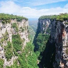
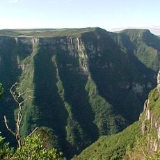
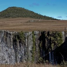
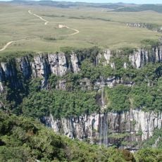
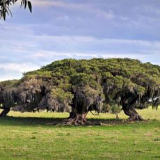
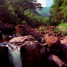
Tainhas State Park covers 6,654.67 hectares split between Jaquirana (69.8%), São Francisco de Paula (20.6%) and Cambará do Sul (9.6%), with its administrative center in São Francisco de Paula. The Tainhas River runs north through the valley toward the Rio das Antas, crossing flat-bottomed hills upstream and steep, forested residual relief downstream. Araucaria forest, upland grassland and peat bogs cover the terrain.

The park was created by state decree 23.798 on 12 March 1975 as a fully protected conservation unit. Its management plan was only published in September 2008, when 98 residents in 31 establishments were still raising cattle, practising family farming and forestry inside the area.

The Caaguara, called coroados for the feather headdresses they wore, lived in the Campos de Cima da Serra on fruits, seeds, game and fish. Portuguese sesmarias grants from around 1750 brought cattle ranching and family farming to the region. The Caaguara were wiped out in conflicts, first with the Kaingang and later with the bandeirantes.

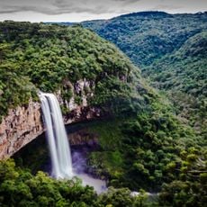
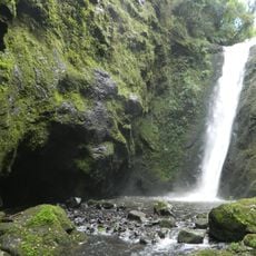
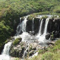
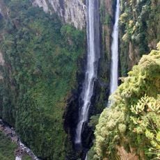
As of 2016 the park was not open to visitors, so access to the Passo do S waterfall cannot be assumed. The falls lie in Jaquirana, where the Tainhas River crosses an S-shaped rock ledge 80 m wide and 15 m high. Hunting, fishing and camping around the falls are prohibited. When the river is low, the crossing can be made on horseback or on foot.

The Passo do S waterfall, in Jaquirana, is 80 metres wide and 15 metres high, where the Tainhas River crosses an S-shaped rock ledge. When the river is low, the crossing can be made on foot or on horseback. Hunting, fishing and camping around the falls are prohibited.

The community of curious travelers

AroundUs brings together thousands of curated places, local tips, and hidden gems, enriched daily by 92,813 contributors worldwide.


Start exploring
Inception
1975
GPS coordinates
-29.08461,-50.36600
Latest update
October 25, 2026 21:54
Reviews
Share your experience

No review yet

Discussions
Start a discussion...

No discussion yet

« Tainhas State Park - State park in Rio Grande do Sul, Brazil » is provided by Around Us (aroundus.com). Images and texts are derived from Wikimedia project under a Creative Commons license. You are allowed to copy, distribute, and modify copies of this page, under the conditions set by the license, as long as this note is clearly visible.

Discover hidden gems everywhere you go!

From secret cafés to breathtaking viewpoints, skip the crowded tourist spots and find places that match your style. Our app makes it easy with voice search, smart filtering, route optimization, and insider tips from travelers worldwide. Download now for the complete mobile experience.
Around Us App Screenshot
❝

A unique approach to discovering new places❞

— Le Figaro

❝

All the places worth exploring❞

— France Info

❝

A tailor-made excursion in just a few clicks❞

— 20 Minutes

Around Us
Travel Guide & Maps
Download

Send to your phone

QR Code
1

Open the camera app on your mobile.

2

Point at the QR code with your camera. A notification will appear.

3

Tap the notification to open the link.