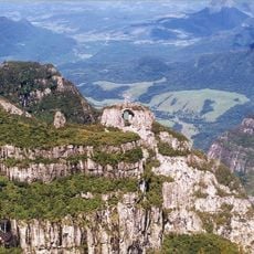
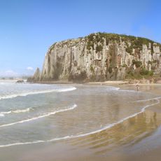
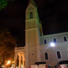
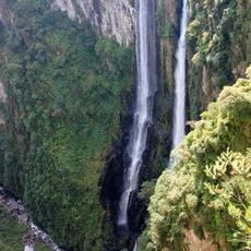
Jacinto Machado, Municipality in Santa Catarina, Brazil.
Jacinto Machado is a municipality in southern Santa Catarina that encompasses several communities and neighborhoods across its administrative territory. The municipal seat serves as the main hub where residents access local government services and facilities.
The municipality was established by bringing together several neighboring settlements in southern Santa Catarina into one administrative unit. This territorial organization continues to define how local governance operates today.
Local residents, known as jacinto-machadenses, participate in numerous municipal events throughout the year, including the annual Natal Encantado celebrations in November.
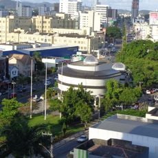
Visitors looking for municipal services can find government offices located in the downtown area where local matters are handled. It helps to plan a visit during regular business hours when these offices are actively serving the public.
The municipality maintains direct connections with eight different neighboring territories while operating under an administrative level 8 classification within the Brazilian system.
Location: Santa Catarina
Elevation above the sea: 28 m
Shares border with: Praia Grande, Santa Rosa do Sul, Cambará do Sul, Ermo, São João do Sul, Sombrio, Timbé do Sul, Turvo
Website: https://jacintomachado.sc.gov.br
GPS coordinates: -28.99694,-49.76389
Latest update: December 10, 2025 15:49
Aparados da Serra National Park
39 km
Itaimbezinho
37.5 km
Serra Geral National Park
22.6 km
Serra do Rio do Rastro
75 km
Pico do Monte Negro
42.3 km
São Joaquim National Park
94.1 km
Fortaleza Canyon
20.1 km
Praia da Guarita
39.6 km
Parque Estadual José Lutzenberger
39.9 km
Igreja Matriz de São Domingos
38.6 km
Tainhas State Park
59.4 km
São Francisco de Paula National Forest
76.8 km
Parque Estadual da Serra Furada
99.4 km
Museu Willy Zumblick
93.6 km
St. Joseph's Cathedral, Criciúma
52.4 km
Itapeva State Park
40.4 km
Araranguá Lighthouse
39.7 km
Museu da Colonização Uberto Brüning Schlickmann
94.1 km
Capão da Canoa Lighthouse
86.5 km
Faro de Torres
39 km
Mampituba North Mole Lighthouse
36.9 km
Mampituba South Mole Lighthouse
37 km
Torres Lighthouse
38.9 km
Malacara Canyon
28.3 km
Imóvel situado à Av. Presidente Vargas, 43
68.3 km
Tigre Preto Waterfall
23.4 km
Imóvel situado à Estrada Geral de Pedrinhas
85.2 km
Cachoeira das Andorinhas
35.7 kmVisited this place? Tap the stars to rate it and share your experience / photos with the community! Try now! You can cancel it anytime.
Discover hidden gems everywhere you go!
From secret cafés to breathtaking viewpoints, skip the crowded tourist spots and find places that match your style. Our app makes it easy with voice search, smart filtering, route optimization, and insider tips from travelers worldwide. Download now for the complete mobile experience.
A unique approach to discovering new places❞
— Le Figaro
All the places worth exploring❞
— France Info
A tailor-made excursion in just a few clicks❞
— 20 Minutes