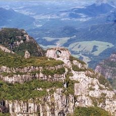
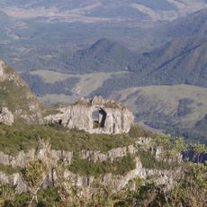
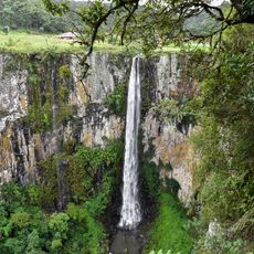
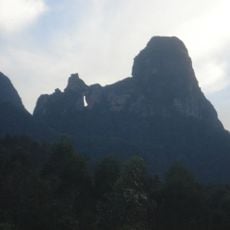
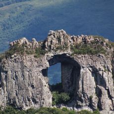
Serra do Rio do Rastro, Mountain chain in Santa Catarina, Brazil.
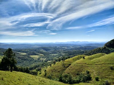
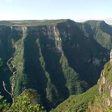
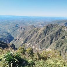
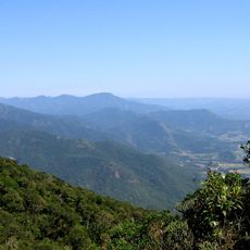
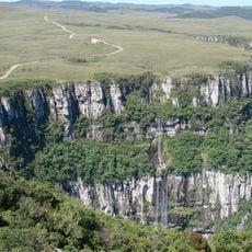
Serra do Rio do Rastro is a mountain range in southeastern Santa Catarina that extends across densely forested slopes and high plateaus. The road SC-390 winds through the landscape, linking the coastal region to the higher plateau of the state.
The road through the range was built starting in 1903 to connect coastal areas with higher altitude regions of Santa Catarina. Construction took several decades and made trade easier between different climate zones of the state.
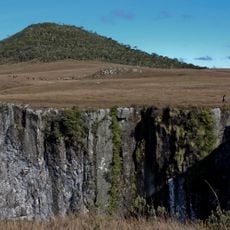
The name refers to the many streams that wind through the valleys and leave visible traces on the mountain slopes. Travelers often stop at viewpoints to photograph the serpentine road as it curves down the mountainside.
The mountain road requires careful driving, especially in winter when fog reduces visibility and temperatures may drop below freezing. It is best to drive during daylight hours in clear weather to navigate the many tight curves safely.
On very clear days, you can spot the ocean from the summit even though the coast is far away. Snow occasionally falls at higher elevations, a rarity in this part of Brazil.
Elevation above the sea: 1,460 m
GPS coordinates: -28.40722,-49.54611
Latest update: December 12, 2025 17:40
The South Region of Brazil brings together nature reserves, waterfalls, beaches, and mountain peaks. Here you find geological formations such as canyons and caves, plus islands with archaeological sites. The landscape ranges from the Atlantic coast to inland highlands, where subtropical rainforest...
Santa Marta Lighthouse
74.9 km
Serra Geral National Park
87.1 km
Serra do Rio do Rastro
6.2 km
Pico do Monte Negro
34.3 km
Serra do Tabuleiro State Park
86.6 km
São Joaquim National Park
25.5 km
Fortaleza Canyon
83.2 km
Museum Anita Garibaldi
75 km
Pedra Furada
31.1 km
Cascata do Avencal
40.7 km
Museu Casa de Anita
75.4 km
Parque Estadual da Serra Furada
30.8 km
Museu Willy Zumblick
52.5 km
St. Joseph's Cathedral, Criciúma
34.7 km
Cachoeira que Congela
61.4 km
Baleia Franca Environmental Protection Area
87.8 km
Araranguá Lighthouse
61.4 km
Imbituba lighthouse
90.2 km
Pedra Furada
31.1 km
Museu da Colonização Uberto Brüning Schlickmann
37 km
Praia do Rosa
94.4 km
Casa Pinto D'Ulisséa
75.5 km
Marco do Tratado de Tordesilhas
75 km
Imóvel situado à Av. Presidente Vargas, 43
25.5 km
Tigre Preto Waterfall
85.7 km
Imóvel situado à Estrada Geral de Pedrinhas
36.6 km
Monument to Anita Garibaldi
75.1 km
Cine Show Tubarão
54.2 kmVisited this place? Tap the stars to rate it and share your experience / photos with the community! Try now! You can cancel it anytime.
Discover hidden gems everywhere you go!
From secret cafés to breathtaking viewpoints, skip the crowded tourist spots and find places that match your style. Our app makes it easy with voice search, smart filtering, route optimization, and insider tips from travelers worldwide. Download now for the complete mobile experience.
A unique approach to discovering new places❞
— Le Figaro
All the places worth exploring❞
— France Info
A tailor-made excursion in just a few clicks❞
— 20 Minutes