Tefé, River port municipality in Amazonas, Brazil
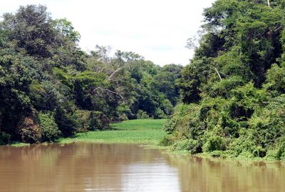
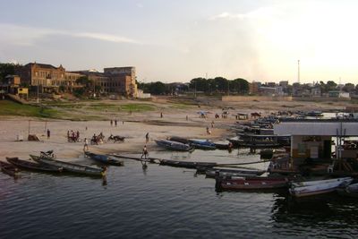
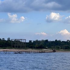
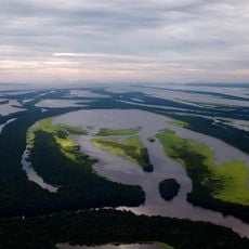
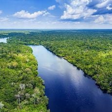
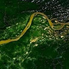
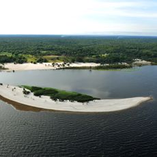
Tefé is a municipality situated on the north bank of the Solimões section of the Amazon River, positioned beside a water body created where the Tefé River meets the main channel. The town's layout follows the river, with waterfront areas serving as focal points for local activity.
Portuguese Carmelite missionaries initiated contact with Muras indigenous groups around Lake Tefé in 1620, establishing a settlement that became the foundation for the town. This early colonial encounter led to permanent occupation of the area.
Local indigenous communities depend on the river for fishing, transport, and agriculture, shaping how the town interacts with its surroundings. This relationship remains visible in daily routines and local trade.
Visitors can reach the town from Manaus either by plane or river boat, with boat journeys lasting approximately 12 hours. Water levels fluctuate seasonally, affecting accessibility and conditions in different parts of town.
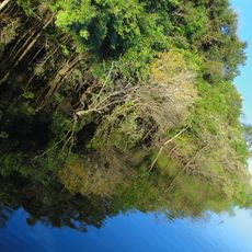
The municipality encompasses substantial portions of the Tefé National Forest and Catuá-Ipixuna Extractive Reserve, protecting vast forested areas. These conservation zones make the surroundings a significant location for preserving the Amazon ecosystem.
Location: Amazonas
Inception: 1759
Elevation above the sea: 93 m
Shares border with: Uarini, Alvarães, Carauari, Coari, Juruá, Maraã, Tapauá
GPS coordinates: -3.35389,-64.71083
Latest update: December 20, 2025 00:16
Pico da Neblina
484.4 km
Madeira-Mamoré Railroad
609.2 km
Praia de Ponta Negra
513.3 km
Amacayacu National Park
610.1 km
Pico da Neblina National Park
431.2 km
Pico 31 de Março
484.9 km
Ariau Towers
475.4 km
Anavilhanas National Park
434.7 km
Jaú National Park
267.5 km
Serranía La Neblina National Park
501.1 km
Amazon River
449.7 kmParque nacional natural Río Puré
618.6 km
Santa Rosa Island
590.7 km
Mamirauá Sustainable Development Reserve
162.6 km
Central Amazon Conservation Complex
321.2 km
Moon Beach
513.3 km
Morro dos Seis Lagos Biological Reserve
464.5 km
Mapinguari National Park
574.3 kmForte de São Gabriel da Cachoeira
445.9 km
Central Amazon Ecological Corridor
356.6 kmNascentes do Lago Jari National Park
356.7 kmAmanã Sustainable Development Reserve
109.8 kmAbufari Biological Reserve
277.1 km
Juma Sustainable Development Reserve
564.6 km
Médio Juruá Extractive Reserve
414.2 km
Ituxi Extractive Reserve
506.2 kmSamuel Ecological Station
646.8 km
Rio Negro Left Bank Environmental Protection Area
489.6 kmVisited this place? Tap the stars to rate it and share your experience / photos with the community! Try now! You can cancel it anytime.
Discover hidden gems everywhere you go!
From secret cafés to breathtaking viewpoints, skip the crowded tourist spots and find places that match your style. Our app makes it easy with voice search, smart filtering, route optimization, and insider tips from travelers worldwide. Download now for the complete mobile experience.
A unique approach to discovering new places❞
— Le Figaro
All the places worth exploring❞
— France Info
A tailor-made excursion in just a few clicks❞
— 20 Minutes