Enable Location

We need your location to show you interesting places around you

Discover nearby places

Find interesting locations and hidden gems around you

Precise directions

Get accurate directions and distances to places

Your location is never shared with other users. It's only used when you tap the location button.

Gunung Galunggung

Log in to your account

Start exploring — it's free

Trusted by 62,903 travelers worldwide

Continue with Google
Continue with Apple
or

We will send you a code to connect

By continuing, you accept our Terms and Conditions and our Privacy Policy

Check your inbox

We've sent a pincode in your inbox. Please enter the code below.

Gunung Galunggung
Discussion Reviews 1 Photos
48.1k Popularity

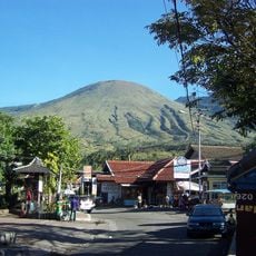
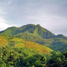
Gunung Galunggung, Stratovolcano in Tasikmalaya, Indonesia

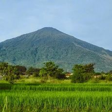
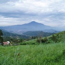
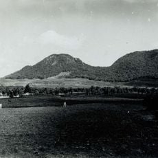
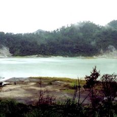
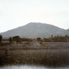
Gunung Galunggung is a stratovolcano in Tasikmalaya on Java that rises to 2168 meters (7113 feet) above sea level and features a horseshoe-shaped crater with a lake at its center. The crater walls drop steeply while dense forests cover the outer slopes and several trails lead up to the rim.

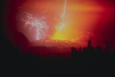
An eruption in 1822 lasted several months and claimed around 4000 lives through pyroclastic flows and lahars. The 1982 eruption began in April and continued for nine months, during which ash clouds damaged two passenger jets in flight and killed more than 60 people on the ground.

The name comes from a Javanese word meaning to roll, referring to a legend about a princess who rolled down the slopes. Pilgrimage sites near the crater rim draw believers who offer prayers and light incense.

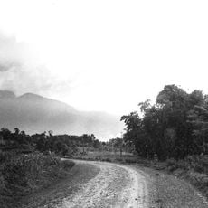
The climb takes around two to three hours and follows partly steep stairs and paths through the forest. Vendors at the crater rim sell fresh vegetables such as fern shoots and watercress that grow on the fertile slopes.

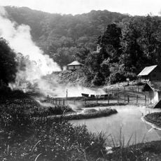
A tunnel completed in 1994 drains water from the crater lake and prevents overflow that could trigger mudflows. The drained water irrigates rice paddies and fish ponds in surrounding villages, turning the resource into farmland supply.

The community of curious travelers

AroundUs brings together thousands of curated places, local tips, and hidden gems, enriched daily by 60,000 contributors worldwide.

Start exploring
Location
Elevation above the sea
2,168 m
GPS coordinates
-7.25615,108.07609
Latest update
December 14, 2025 19:17
Reviews
Share your experience

No review yet

Discussions
Start a discussion...

No discussion yet

« Gunung Galunggung - Stratovolcano in Tasikmalaya, Indonesia » is provided by Around Us (aroundus.com). Images and texts are derived from Wikimedia project under a Creative Commons license. You are allowed to copy, distribute, and modify copies of this page, under the conditions set by the license, as long as this note is clearly visible.

Discover hidden gems everywhere you go!

From secret cafés to breathtaking viewpoints, skip the crowded tourist spots and find places that match your style. Our app makes it easy with voice search, smart filtering, route optimization, and insider tips from travelers worldwide. Download now for the complete mobile experience.

Around Us App Screenshot

A unique approach to discovering new places

Le Figaro

All the places worth exploring

France Info

A tailor-made excursion in just a few clicks

20 Minutes

Around Us
Travel Guide & Maps
Download

Send to your phone

QR Code
1

Open the camera app on your mobile.

2

Point at the QR code with your camera. A notification will appear.

3

Tap the notification to open the link.