Chest opened
+${chestReward.xp} XP
Explorer
NOUVEAU ×${chestReward.collectible.quantity}
tapez pour fermer

See the monuments around you in AR Open chests in the app

Around Us is built for your phone — point your camera at the streets and discover the monuments and places around you in augmented reality. Around Us is built for your phone — chests unlock when you walk, explore and capture nearby places.

•

Enable Location

We need your location to show you interesting places around you

Discover nearby places

Find interesting locations and hidden gems around you

Precise directions

Get accurate directions and distances to places

Your location is never shared with other users. It's only used when you tap the location button.

Log in to your account

Start exploring — it's free

Trusted by 89,873 travelers worldwide

Continue with Google
Continue with Apple
or

We will send you a code to connect

By continuing, you accept our Terms and Conditions and our Privacy Policy

Check your inbox

We've sent a pincode in your inbox. Please enter the code below.

Discussion Reviews Photo
196k Popularity

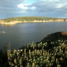
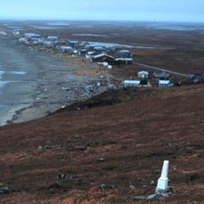
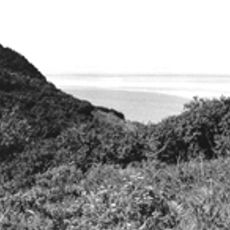
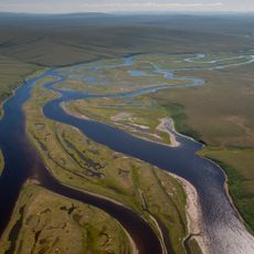
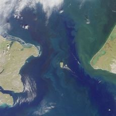
Bering Strait crossing, Proposed railway tunnel between Alaska, United States and Chukotka, Russia.

Audio guide · About one minute
Preparing your audio guide… The audio guide could not be loaded, please retry.Sign in to listen to the audio guide

The Bering Strait crossing is a proposed underwater tunnel that would span approximately 85 kilometers across the sea, connecting Alaska with Russia's Chukotka region. It would link two major transportation networks that are currently separated by water.

The project was first considered in 1906 under Tsar Nicholas II but never advanced beyond planning stages due to World War I. The idea has been revisited several times since, yet has never become a reality.

The tunnel would bring people from Alaska and Chukotka closer together, potentially fostering exchange between these isolated communities.

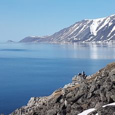
Building this tunnel would be an extremely complex undertaking, facing challenges from ocean currents, ice formation, and harsh weather conditions in the region. Visitors can observe the width of the strait from either shore on clear days.

The project would have theoretically allowed people to take a train from London stations through Asia to North America without crossing water. This would have been one of the few ways to connect Europe and North America by rail directly.

The community of curious travelers

AroundUs brings together thousands of curated places, local tips, and hidden gems, enriched daily by 60,000 contributors worldwide.
Start exploring
Location
GPS coordinates
65.78333,-169.01667
Latest update
August 31, 2026 11:13
Around this place
Whale Bone Alley
Russian Federation

Whale Bone Alley

128.7 mi
Beringia National Park
Russian Federation

Beringia National Park

158.7 mi
Ipiutak Site
United States of America

Ipiutak Site

186.6 mi
Monument to Semyon Dezhnev
Russian Federation

Monument to Semyon Dezhnev

25.5 mi
Trail Creek Caves
United States of America

Trail Creek Caves

158.8 mi
Pilgrim Hot Springs
United States of America

Pilgrim Hot Springs

127 mi
Cape Nome Mining District Discovery Sites
United States of America

Cape Nome Mining District Discovery Sites

135.3 mi
Old St. Joseph's Catholic Church
United States of America

Old St. Joseph's Catholic Church

137.4 mi
Nome River
United States of America

Nome River

133.9 mi
Snake River
United States of America

Snake River

130 mi
Chamisso Wilderness
United States of America

Chamisso Wilderness

204.5 mi
Wales Site
United States of America

Wales Site

29.2 mi
Kougarok River
United States of America

Kougarok River

125.2 mi
Squirrel River
United States of America

Squirrel River

240.8 mi
Kuzitrin River
United States of America

Kuzitrin River

136.3 mi
Swanberg Dredge
United States of America

Swanberg Dredge

138.7 mi
Solomon Roadhouse
United States of America

Solomon Roadhouse

157.6 mi
Niukluk River
United States of America

Niukluk River

158.2 mi
Iyatayet Site
United States of America

Iyatayet Site

238.1 mi
Kugruk River
United States of America

Kugruk River

181.4 mi
Shishmaref Inlet
United States of America

Shishmaref Inlet

94.1 mi
Salmon River
United States of America

Salmon River

280 mi
Noxapaga River
United States of America

Noxapaga River

141.4 mi
Bureau of Indian Affairs Unalakleet School
United States of America

Bureau of Indian Affairs Unalakleet School

275.7 mi
Slavyanka Cove
Russian Federation

Slavyanka Cove

159.7 mi
Историко-культурный комплекс Пловер
Russian Federation

Историко-культурный комплекс Пловер

160.2 mi
Kugururok River
United States of America

Kugururok River

270.8 mi
Памятный знак в честь 250-летия Первой Камчатской экспедиции (Провидения)
Russian Federation

Памятный знак в честь 250-летия Первой Камчатской экспедиции (Провидения)

155.2 mi
Show the full map
Reviews
Share your experience

No review yet

Discussions
Start a discussion...

No discussion yet

« Bering Strait crossing - Proposed railway tunnel between Alaska, United States and Chukotka, Russia » is provided by Around Us (aroundus.com). Images and texts are derived from Wikimedia project under a Creative Commons license. You are allowed to copy, distribute, and modify copies of this page, under the conditions set by the license, as long as this note is clearly visible.

Discover hidden gems everywhere you go!

From secret cafés to breathtaking viewpoints, skip the crowded tourist spots and find places that match your style. Our app makes it easy with voice search, smart filtering, route optimization, and insider tips from travelers worldwide. Download now for the complete mobile experience.
Around Us App Screenshot
❝

A unique approach to discovering new places❞

— Le Figaro

❝

All the places worth exploring❞

— France Info

❝

A tailor-made excursion in just a few clicks❞

— 20 Minutes

Around Us
Travel Guide & Maps
Download

Send to your phone

QR Code
1

Open the camera app on your mobile.

2

Point at the QR code with your camera. A notification will appear.

3

Tap the notification to open the link.