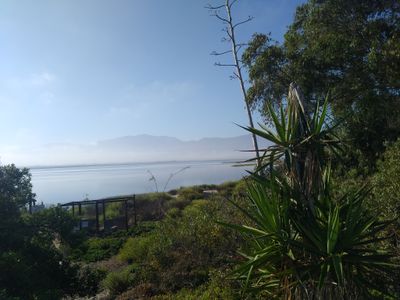
Estero Punta Banda, Protected wetland in Ensenada, Mexico.
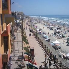
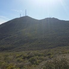
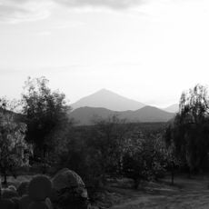
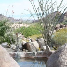
Estero Punta Banda is a protected wetland on the Pacific coast of Baja California that encompasses multiple habitats within its boundaries. The landscape includes intertidal marshes, mud flats, sand flats, and seagrass beds that together form a complex natural system.
The wetland gained international protection status as a Ramsar site in 2006, marking official recognition of its environmental importance. This designation reflected growing awareness of the need to conserve coastal ecosystems in the region.
The name reflects the local geography, with 'estero' meaning an inlet or tidal creek in Spanish. Today, people from nearby towns visit to observe wildlife and experience the quiet shoreline where water meets land.
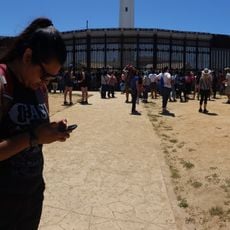
The wetland is easily accessible from nearby coastal roads and offers good opportunities for wildlife observation. Visitor access is straightforward, though timing your visit around calmer periods helps maximize chances of seeing active animal life and enjoying the natural surroundings.
The site hosts dolphins, whales, and sea lions that appear regularly in its waters, drawing visitors interested in marine mammals. These large animals represent a key part of the ecosystem and offer memorable encounters for those patient enough to wait and observe.
Location: Ensenada
GPS coordinates: 31.75000,-116.61667
Latest update: December 6, 2025 17:46
Baja California is a Mexican peninsula that offers striking contrasts in its landscapes. Desert valleys meet sandy beaches, while marine reserves protect coastal waters. The region holds ancient cave paintings, volcanic peaks, and colonial-era buildings that tell stories of human settlement. Canyons...
Richard J. Donovan Correctional Facility
97.6 km
Cross Border Xpress
95 km
San Ysidro Port of Entry
96.5 km
Playas de Tijuana
97.9 km
Friendship Park
99.5 km
Centro Cultural Tijuana
94.8 km
Constitution 1857 National Park
58.4 km
Christ of the Sacred Heart
67.6 km
The Trompo Interactive Museum
88.3 km
Otay Mountain
96.4 km
El Vallecito
92.1 km
Dorian's
96 km
Tijuana México Temple
87.3 kmAuditorio Fausto Gutierrez Moreno
91.4 km
Hospital Angeles Tijuana
93.1 km
Tecate Peak
92.6 km
Guadalupe Canyon Hot Springs
92 km
Park Towers
99 km
Green View Tower
92.7 km
El Cubo
94.9 km
Pacific Southwest Railway Museum Association
97.1 km
Museo del Coleccionista
95.4 km
Estación de Inspección de los Estados Unidos-Tecate
92 km
History Museum Tijuana
96 km
Tijuana Lighthouse
98.8 km
Amber Interactive Center
88.8 km
Islas de Todos Santos Lighthouse
19.4 km
Cine Zaragoza
93.1 kmVisited this place? Tap the stars to rate it and share your experience / photos with the community! Try now! You can cancel it anytime.
Discover hidden gems everywhere you go!
From secret cafés to breathtaking viewpoints, skip the crowded tourist spots and find places that match your style. Our app makes it easy with voice search, smart filtering, route optimization, and insider tips from travelers worldwide. Download now for the complete mobile experience.
A unique approach to discovering new places❞
— Le Figaro
All the places worth exploring❞
— France Info
A tailor-made excursion in just a few clicks❞
— 20 Minutes