Castro Peak

Log in to your account

AroundUs is a community-driven map of interesting places, built by curious explorers like you. It grows with every review, story, and photo you share.
Connect to save your favorite spots, contribute locations, and create personalized routes.
Continue with Google
Continue with Apple
Continue with X
Continue with Facebook
Continue with email
By continuing, you accept our Terms and Conditions and our Privacy Policy
Create an account
Add to collection
Map
Suggest a change
Share

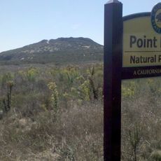
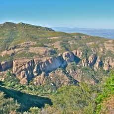
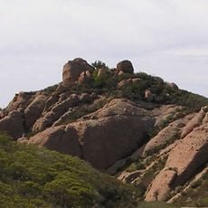
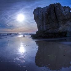
Castro Peak, Mountain summit in Santa Monica Mountains, California, United States.

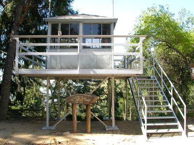
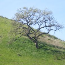
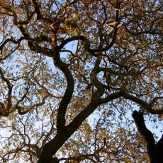
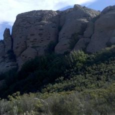
Castro Peak is a summit in the Santa Monica Mountains with an elevation of 3,500 feet (1,067 meters). The area features a network of trails that traverse diverse plant life and open hillsides throughout the surrounding terrain.

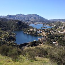
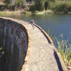
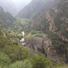
The peak sits within the Santa Monica Mountains, which have been explored by hikers for many decades. The area received protected status as part of a national recreation zone to safeguard the natural landscape.

The mountain trails serve as meeting grounds for local hiking groups, fostering connections between outdoor enthusiasts through organized weekly expeditions.

Visitors should bring sturdy footwear and plenty of water when hiking the trails in this area. The paths can be demanding and take several hours, so starting early in the day is advisable.

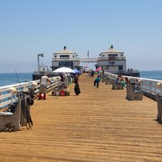
On clear days, visitors from the summit can see both the San Fernando Valley and the Pacific Ocean far below. This dual view makes the location special for those seeking broad vistas.

Location: California

GPS coordinates: 34.08563,-118.78545

Latest update: December 14, 2025 14:23

Photos
Around this place
Point Dume State Beach
United States of America

Point Dume State Beach

9.6 km
Zuma Beach
United States of America

Zuma Beach

8.4 km
Malibu Creek State Park
United States of America

Malibu Creek State Park

7.1 km
Sherwood Country Club
United States of America

Sherwood Country Club

10.5 km
Leo Carrillo State Park
United States of America

Leo Carrillo State Park

14.4 km
Adamson House
United States of America

Adamson House

11.4 km
Santa Monica Mountains National Recreation Area
United States of America

Santa Monica Mountains National Recreation Area

16.9 km
Malibu Hindu Temple
United States of America

Malibu Hindu Temple

7 km
Jungleland USA
United States of America

Jungleland USA

11.4 km
Malibu Lagoon State Beach
United States of America

Malibu Lagoon State Beach

11.4 km
Malibu Pier
United States of America

Malibu Pier

11.5 km
Backbone Trail
United States of America

Backbone Trail

14.6 km
Upper Las Virgenes Canyon Open Space Preserve
United States of America

Upper Las Virgenes Canyon Open Space Preserve

13.4 km
Thousand Oaks Civic Arts Plaza
United States of America

Thousand Oaks Civic Arts Plaza

11.4 km
Firestone Fieldhouse
United States of America

Firestone Fieldhouse

8.7 km
Case Study House No. 28
United States of America

Case Study House No. 28

12.9 km
The Rock Store
United States of America

The Rock Store

2.7 km
Boney Peak
United States of America

Boney Peak

14.7 km
Gardens of the World
United States of America

Gardens of the World

11.7 km
Robert H. Meyer Memorial State Beach
United States of America

Robert H. Meyer Memorial State Beach

9.8 km
Grant R. Brimhall Library
United States of America

Grant R. Brimhall Library

13.8 km
Sherwood Dam
United States of America

Sherwood Dam

8.9 km
Conejo Valley Botanical Garden
United States of America

Conejo Valley Botanical Garden

15 km
Banning Dam
United States of America

Banning Dam

8.3 km
Exchange Peak
United States of America

Exchange Peak

15.1 km
South Malibu Canyon Road
United States of America

South Malibu Canyon Road

8.5 km
Leonis Adobe
United States of America

Leonis Adobe

15.6 km
Encinal Beach
United States of America

Encinal Beach

11 km
Show the full map
Reviews

Visited this place? Tap the stars to rate it and share your experience / photos with the community! Try now! You can cancel it anytime.

« Castro Peak - Mountain summit in Santa Monica Mountains, California, United States » is provided by Around Us (aroundus.com). Images and texts are derived from Wikimedia project under a Creative Commons license. You are allowed to copy, distribute, and modify copies of this page, under the conditions set by the license, as long as this note is clearly visible.

Discover hidden gems everywhere you go!

From secret cafés to breathtaking viewpoints, skip the crowded tourist spots and find places that match your style. Our app makes it easy with voice search, smart filtering, route optimization, and insider tips from travelers worldwide. Download now for the complete mobile experience.

Around Us App Screenshot

A unique approach to discovering new places

Le Figaro

All the places worth exploring

France Info

A tailor-made excursion in just a few clicks

20 Minutes