Enable Location

We need your location to show you interesting places around you

Discover nearby places

Find interesting locations and hidden gems around you

Precise directions

Get accurate directions and distances to places

Your location is never shared with other users. It's only used when you tap the location button.

Sherwood Dam

Log in to your account

Start exploring — it's free

Trusted by 61,324 travelers worldwide

Continue with Google
Continue with Apple
or

We will send you a code to connect

By continuing, you accept our Terms and Conditions and our Privacy Policy

Check your inbox

We've sent a pincode in your inbox. Please enter the code below.

Sherwood Dam

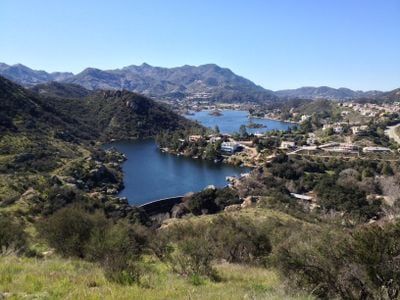
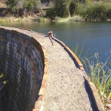
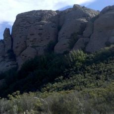
Sherwood Dam, Gravity dam in Ventura County, United States.

Description

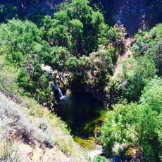
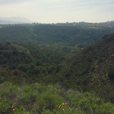
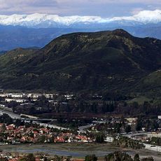
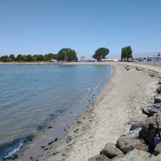
Sherwood Dam is a concrete barrier that forms Lake Sherwood reservoir across a valley in Ventura County. The impounded water creates a recreational body of water where visitors can pursue water-based activities year-round.

History

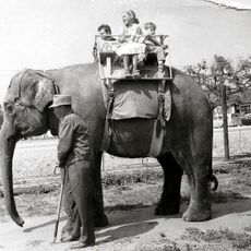
This structure was built in 1904 by W.H. Matthiessen as Alturas Dam, making it California's first artificial lake created for irrigation and water supply. The site later became a filming location for multiple productions after William Randolph Hearst acquired the property in the late 1920s.

Culture

The lake earned its name during 1920s film productions of Robin Hood with Douglas Fairbanks, when the location served as a stand-in for Sherwood Forest. This movie connection shaped how people think of the place and remains woven into local identity today.

Practical

The area around the reservoir provides access to water for swimming, fishing, and boating throughout the year. Visitors should check local guidelines for these activities and prepare for variable weather conditions that may affect water-based recreation.

Did you know?

The lake served as a filming location for numerous Hollywood productions beyond Robin Hood, becoming a backdrop for adventure films throughout the 20th century. This lesser-known aspect of its history shows how small California locations shaped the movie industry.

Location
GPS coordinates
34.13920,-118.85700
Latest update
December 13, 2025 11:42

AroundUs brings together thousands of curated places, local tips, and hidden gems, enriched daily by 60,000 contributors worldwide. Discover all places nearby (Ventura County).

Around this place
747 Wing House
United States of America

747 Wing House

11.4 km
Sherwood Country Club
United States of America

Sherwood Country Club

2.7 km
Leo Carrillo State Park
United States of America

Leo Carrillo State Park

12.7 km
Santa Monica Mountains National Recreation Area
United States of America

Santa Monica Mountains National Recreation Area

23.7 km
Jungleland USA
United States of America

Jungleland USA

4 km
Wildwood Regional Park
United States of America

Wildwood Regional Park

11 km
Arroyo Conejo Open Space
United States of America

Arroyo Conejo Open Space

10.3 km
Backbone Trail
United States of America

Backbone Trail

7.8 km
Thousand Oaks Civic Arts Plaza
United States of America

Thousand Oaks Civic Arts Plaza

4 km
Conejo Grade
United States of America

Conejo Grade

11.6 km
Case Study House No. 28
United States of America

Case Study House No. 28

4.2 km
Boney Peak
United States of America

Boney Peak

8.1 km
Joel McCrea Ranch
United States of America

Joel McCrea Ranch

11.7 km
Gardens of the World
United States of America

Gardens of the World

4.2 km
Robert H. Meyer Memorial State Beach
United States of America

Robert H. Meyer Memorial State Beach

11.3 km
Conejo Mountain
United States of America

Conejo Mountain

12.9 km
Grant R. Brimhall Library
United States of America

Grant R. Brimhall Library

6.7 km
Conejo Valley Botanical Garden
United States of America

Conejo Valley Botanical Garden

6.4 km
Rancho Sierra Vista
United States of America

Rancho Sierra Vista

10 km
Banning Dam
United States of America

Banning Dam

633 m
Timber School
United States of America

Timber School

7.7 km
Castro Peak
United States of America

Castro Peak

8.9 km
Pederson House and Water Tower
United States of America

Pederson House and Water Tower

9.3 km
Hollywood Storage Center of Thousand Oaks
United States of America

Hollywood Storage Center of Thousand Oaks

10.2 km
Tri Peaks
United States of America

Tri Peaks

8.8 km
Exchange Peak
United States of America

Exchange Peak

8.6 km
Encinal Beach
United States of America

Encinal Beach

11.6 km
El Matador State Beach
United States of America

El Matador State Beach

11.5 km
Show the full map
« Sherwood Dam - Gravity dam in Ventura County, United States » is provided by Around Us (aroundus.com). Images and texts are derived from Wikimedia project under a Creative Commons license. You are allowed to copy, distribute, and modify copies of this page, under the conditions set by the license, as long as this note is clearly visible.

Discover hidden gems everywhere you go!

From secret cafés to breathtaking viewpoints, skip the crowded tourist spots and find places that match your style. Our app makes it easy with voice search, smart filtering, route optimization, and insider tips from travelers worldwide. Download now for the complete mobile experience.

Around Us App Screenshot

A unique approach to discovering new places

Le Figaro

All the places worth exploring

France Info

A tailor-made excursion in just a few clicks

20 Minutes

Around Us
Travel Guide & Maps
Download

Send to your phone

QR Code
1

Open the camera app on your mobile.

2

Point at the QR code with your camera. A notification will appear.

3

Tap the notification to open the link.