Chest opened
+${chestReward.xp} XP
Explorer
NOUVEAU ×${chestReward.collectible.quantity}
tapez pour fermer
Chest locked

Open chests in the app

Around Us is built for your phone — chests unlock when you walk, explore and capture nearby places.

Enable Location

We need your location to show you interesting places around you

Discover nearby places

Find interesting locations and hidden gems around you

Precise directions

Get accurate directions and distances to places

Your location is never shared with other users. It's only used when you tap the location button.

Log in to your account

Start exploring — it's free

Trusted by 72,878 travelers worldwide

Continue with Google
Continue with Apple
or

We will send you a code to connect

By continuing, you accept our Terms and Conditions and our Privacy Policy

Check your inbox

We've sent a pincode in your inbox. Please enter the code below.

Discussion Reviews Photo
30k Popularity

Mission Hills, Residential neighborhood in San Fernando Valley, Los Angeles, United States.

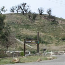
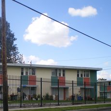
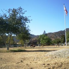
Mission Hills is a residential neighborhood in the San Fernando Valley bounded by Sepulveda Boulevard, Interstate 405, Interstate 5, Van Nuys Boulevard, and Lassen Street. The area sits at approximately 280 meters elevation and contains schools, parks, and commercial zones mixed throughout.

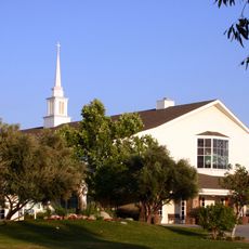
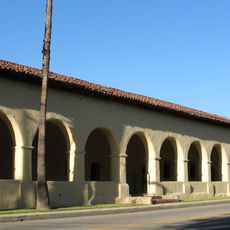
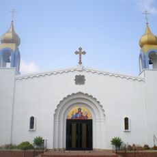
The area was originally called Hickson before taking its current name from the nearby Mission San Fernando Rey de España, founded in 1784. The mission's presence shaped how the region developed and attracted early settlers to the area.

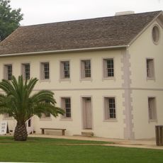
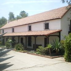
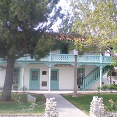
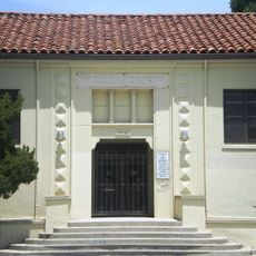
The neighborhood preserves the Andrés Pico Adobe, one of the oldest residences in Los Angeles that reflects Spanish colonial building methods. Walking through the area, you notice how this structure connects to the region's early settlement period.

The neighborhood is crossed by two major interstates and has several large medical centers nearby. Visitors should know that traffic can be heavy during peak hours, especially on the main roads running through the area.

The San Fernando Mission Cemetery is one of the oldest continuously operating burial grounds in the region, used since the mission's early days. Its graves tell the story of the valley's early settlement and growth over generations.

The community of curious travelers

AroundUs brings together thousands of curated places, local tips, and hidden gems, enriched daily by 60,000 contributors worldwide.

Start exploring
Location
Elevation above the sea
278 m
Shares border with
Granada Hills
GPS coordinates
34.25722,-118.46722
Latest update
March 5, 2026 21:06
Around this place
Mission San Fernando Rey de España
United States of America

Mission San Fernando Rey de España

1.9 km
Sepulveda Dam
United States of America

Sepulveda Dam

10.1 km
The Master's Seminary
United States of America

The Master's Seminary

5.9 km
Nethercutt Collection
United States of America

Nethercutt Collection

5.5 km
The Great Wall of Los Angeles
United States of America

The Great Wall of Los Angeles

10 km
The Japanese Garden
United States of America

The Japanese Garden

8.3 km
Shepherd of the Hills Church
United States of America

Shepherd of the Hills Church

9.2 km
Los Encinos State Historic Park
United States of America

Los Encinos State Historic Park

11.2 km
Matadome
United States of America

Matadome

5.7 km
Pacoima Dam
United States of America

Pacoima Dam

10.8 km
Rómulo Pico Adobe
United States of America

Rómulo Pico Adobe

1.3 km
United States of America

Van Nuys City Hall

8.3 km
Convento Building
United States of America

Convento Building

1.9 km
Valley Beth Shalom
United States of America

Valley Beth Shalom

11.3 km
O'Melveny Park
United States of America

O'Melveny Park

7.7 km
San Fernando Gardens
United States of America

San Fernando Gardens

4.9 km
Sylmar Converter Station
United States of America

Sylmar Converter Station

6.2 km
California State University Northridge Botanic Garden
United States of America

California State University Northridge Botanic Garden

5.9 km
Lopez Adobe
United States of America

Lopez Adobe

3.6 km
Oviatt Library
United States of America

Oviatt Library

6 km
San Fernando Pioneer Memorial Cemetery
United States of America

San Fernando Pioneer Memorial Cemetery

7.3 km
Cathedral of St. Mary Byzantine Catholic Church
United States of America

Cathedral of St. Mary Byzantine Catholic Church

10 km
Van Nuys Branch
United States of America

Van Nuys Branch

8.2 km
Valley Relics Museum
United States of America

Valley Relics Museum

5.7 km
Munch Box
United States of America

Munch Box

12.2 km
Playtime Co.
United States of America

Playtime Co.

7.1 km
Chandler Valley Center Studios
United States of America

Chandler Valley Center Studios

5.9 km
Griffith Ranch Historical Monument
United States of America

Griffith Ranch Historical Monument

6.3 km
Show the full map
Reviews
Share your experience

No review yet

Discussions
Start a discussion...

No discussion yet

« Mission Hills - Residential neighborhood in San Fernando Valley, Los Angeles, United States » is provided by Around Us (aroundus.com). Images and texts are derived from Wikimedia project under a Creative Commons license. You are allowed to copy, distribute, and modify copies of this page, under the conditions set by the license, as long as this note is clearly visible.

Discover hidden gems everywhere you go!

From secret cafés to breathtaking viewpoints, skip the crowded tourist spots and find places that match your style. Our app makes it easy with voice search, smart filtering, route optimization, and insider tips from travelers worldwide. Download now for the complete mobile experience.

Around Us App Screenshot

A unique approach to discovering new places

Le Figaro

All the places worth exploring

France Info

A tailor-made excursion in just a few clicks

20 Minutes

Around Us
Travel Guide & Maps
Download

Send to your phone

QR Code
1

Open the camera app on your mobile.

2

Point at the QR code with your camera. A notification will appear.

3

Tap the notification to open the link.