Chest opened
+${chestReward.xp} XP
Explorer
NOUVEAU ×${chestReward.collectible.quantity}
tapez pour fermer
Chest locked

Open chests in the app

Around Us is built for your phone — chests unlock when you walk, explore and capture nearby places.

Enable Location

We need your location to show you interesting places around you

Discover nearby places

Find interesting locations and hidden gems around you

Precise directions

Get accurate directions and distances to places

Your location is never shared with other users. It's only used when you tap the location button.

Log in to your account

Start exploring — it's free

Trusted by 73,084 travelers worldwide

Continue with Google
Continue with Apple
or

We will send you a code to connect

By continuing, you accept our Terms and Conditions and our Privacy Policy

Check your inbox

We've sent a pincode in your inbox. Please enter the code below.

Manzanita Diegueño Band
Discussion Reviews Photo
3.4k Popularity

Manzanita Diegueño Band, Native American reservation in southeastern San Diego County, United States.

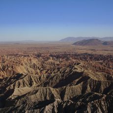
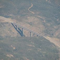
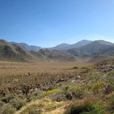
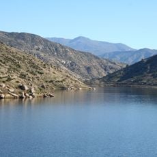
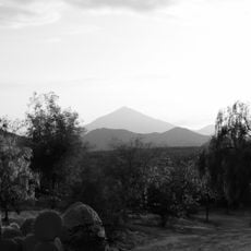
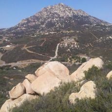
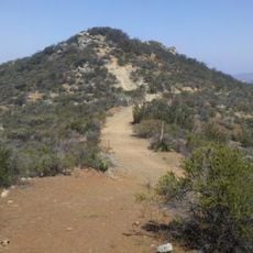
Manzanita Diegueño Band is a Native American reservation in the southeastern part of San Diego County, California. The land sits in a hilly area near the Mexican border, surrounded by other tribal territories in the region.

The reservation was set aside in 1893 and later enlarged through a federal order in 1907. Those two decisions established the land base that the community has built on ever since.

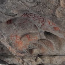
The Manzanita community belongs to the Kumeyaay people, who have lived across the border region between what is now southern California and northern Mexico for centuries. Traces of this connection appear in the language spoken here, the local place names, and the traditions that still shape daily life.

The tribal headquarters is based in Boulevard, California, which is the main point of contact for the community. Visitors should reach out to the tribe before coming, as this is inhabited tribal land and access may require prior arrangements.

Every tribal member aged 18 and older is automatically part of the general council, meaning decisions are made collectively by all adult members rather than by a small elected group. This form of direct governance is relatively rare among tribal governments in the United States.

The community of curious travelers

AroundUs brings together thousands of curated places, local tips, and hidden gems, enriched daily by 60,000 contributors worldwide.

Start exploring
Location
GPS coordinates
32.75111,-116.34589
Latest update
March 3, 2026 13:59
Around this place
Anza-Borrego Desert State Park
United States of America

Anza-Borrego Desert State Park

56.8 km
Goat Canyon Trestle
United States of America

Goat Canyon Trestle

15.4 km
Cuyamaca Rancho State Park
United States of America

Cuyamaca Rancho State Park

29.9 km
Cuyamaca Peak
United States of America

Cuyamaca Peak

32.7 km
Marshal Scotty's Playland Park
United States of America

Marshal Scotty's Playland Park

51.4 km
Desert View Tower
United States of America

Desert View Tower

25.3 km
Mount Laguna Observatory
United States of America

Mount Laguna Observatory

12.7 km
Mud Caves
United States of America

Mud Caves

24.3 km
Otay Mountain
United States of America

Otay Mountain

49.9 km
Pine Valley Creek Bridge
United States of America

Pine Valley Creek Bridge

21.6 km
El Vallecito
Mexico

El Vallecito

27.7 km
Sawtooth Mountains Wilderness
United States of America

Sawtooth Mountains Wilderness

16.9 km
Santa Ysabel Asistencia
United States of America

Santa Ysabel Asistencia

52.4 km
El Capitan Reservoir
United States of America

El Capitan Reservoir

45.9 km
El Cajon Mountain
United States of America

El Cajon Mountain

48 km
Fish Creek Mountains Wilderness
United States of America

Fish Creek Mountains Wilderness

39.9 km
Viejas Mountain
United States of America

Viejas Mountain

37.6 km
Barrett Dam
United States of America

Barrett Dam

31.4 km
Tecate Peak
United States of America

Tecate Peak

37.4 km
Loveland Dam
United States of America

Loveland Dam

42.1 km
La Posta Astro-Geophysical Observatory
United States of America

La Posta Astro-Geophysical Observatory

11.7 km
Lyons Peak
United States of America

Lyons Peak

39.5 km
McGinty Mountain
United States of America

McGinty Mountain

48.2 km
Morena Reservoir
United States of America

Morena Reservoir

19 km
Pacific Southwest Railway Museum Association
United States of America

Pacific Southwest Railway Museum Association

19.3 km
"Camp Alaska" Site Museum
Mexico

"Camp Alaska" Site Museum

35.4 km
Estación de Inspección de los Estados Unidos-Tecate
United States of America

Estación de Inspección de los Estados Unidos-Tecate

32.7 km
San Vicente Golf Club
United States of America

San Vicente Golf Club

51.4 km
Show the full map
Reviews
Share your experience

No review yet

Discussions
Start a discussion...

No discussion yet

« Manzanita Diegueño Band - Native American reservation in southeastern San Diego County, United States » is provided by Around Us (aroundus.com). Images and texts are derived from Wikimedia project under a Creative Commons license. You are allowed to copy, distribute, and modify copies of this page, under the conditions set by the license, as long as this note is clearly visible.

Discover hidden gems everywhere you go!

From secret cafés to breathtaking viewpoints, skip the crowded tourist spots and find places that match your style. Our app makes it easy with voice search, smart filtering, route optimization, and insider tips from travelers worldwide. Download now for the complete mobile experience.

Around Us App Screenshot

A unique approach to discovering new places

Le Figaro

All the places worth exploring

France Info

A tailor-made excursion in just a few clicks

20 Minutes

Around Us
Travel Guide & Maps
Download

Send to your phone

QR Code
1

Open the camera app on your mobile.

2

Point at the QR code with your camera. A notification will appear.

3

Tap the notification to open the link.