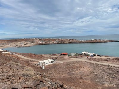
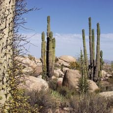
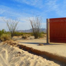
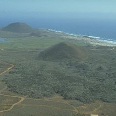
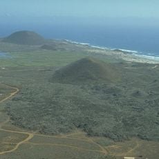
Puertecitos, Coastal locality in Ensenada, Mexico
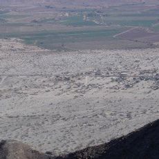
Puertecitos is a coastal settlement located about 90 kilometers south of San Felipe along the Gulf of California, with several hundred homes scattered across rolling hills. The community spreads across the terrain with a mix of year-round residences and part-time vacation homes.
Rafael Orozco established the first permanent home here in 1949, marking the beginning of settlement on this stretch of the Baja California coast. Development progressed slowly because the isolated location remained difficult to reach for many years.
The community brings together Mexican residents and people from north of the border, with fishing and water-based activities woven into everyday routines.
Fill up your fuel tank in San Felipe before arriving, since local supplies are limited and service stations operate unpredictably. Travel during cooler months to avoid extreme heat and find better road conditions.
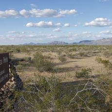
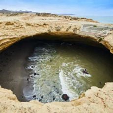
Natural hot springs emerge along the rocky shoreline, and access to them depends on tide levels that change throughout the day. This hidden feature makes the thermal waters a surprising discovery for visitors exploring the desert coast.
Location: Ensenada
Elevation above the sea: 15 m
GPS coordinates: 30.35060,-114.63900
Latest update: December 6, 2025 17:42
Baja California is a Mexican peninsula that offers striking contrasts in its landscapes. Desert valleys meet sandy beaches, while marine reserves protect coastal waters. The region holds ancient cave paintings, volcanic peaks, and colonial-era buildings that tell stories of human settlement. Canyons...
El Pinacate y Gran Desierto de Altar Biosphere Reserve
196.1 km
Sierra de San Pedro Mártir National Park
103.1 km
Cerro Prieto
238.8 km
Archangel Island
176.2 km
National Astronomical Observatory of San Pedro Mártir
110.4 km
Valle de los Cirios
62.3 km
El Camino Del Diablo
225.7 km
Picacho del Diablo
100.1 km
Constitution 1857 National Park
230.3 km
Cabeza Prieta National Wildlife Refuge
238.4 km
Upper Gulf of California and Colorado River Delta biosphere reserve
154.6 km
San Lorenzo Marine Archipelago National Park
236.9 km
El Elegante Crater
204.6 km
Bahía de San Quintín
127.8 km
Cabeza Prieta Wilderness
242.9 km
Playa Bonita Resort
149.4 km
Hermosillo
241.9 km
San Quintín Volcanic Field
131.3 km
Temple of Immaculate Conception of Our Lady of Caborca
242 km
Guadalupe Canyon Hot Springs
228.2 kmEl Gallo Formation
115.1 km
Coronado
178.2 km
Museo Comunitario del Asalto a las Tierras
243.8 km
Colonia La Puerta
229.8 km
Juan Garcia Aldama Community Museum
206.6 km
Valle de Los Gigantes
59.5 km
Catavina Rock Paintings
67.4 km
La Lobera
113.7 kmVisited this place? Tap the stars to rate it and share your experience / photos with the community! Try now! You can cancel it anytime.
Discover hidden gems everywhere you go!
From secret cafés to breathtaking viewpoints, skip the crowded tourist spots and find places that match your style. Our app makes it easy with voice search, smart filtering, route optimization, and insider tips from travelers worldwide. Download now for the complete mobile experience.
A unique approach to discovering new places❞
— Le Figaro
All the places worth exploring❞
— France Info
A tailor-made excursion in just a few clicks❞
— 20 Minutes