Enable Location

We need your location to show you interesting places around you

Discover nearby places

Find interesting locations and hidden gems around you

Precise directions

Get accurate directions and distances to places

Your location is never shared with other users. It's only used when you tap the location button.

Log in to your account

Start exploring — it's free

Trusted by 64,034 travelers worldwide

Continue with Google
Continue with Apple
or

We will send you a code to connect

By continuing, you accept our Terms and Conditions and our Privacy Policy

Check your inbox

We've sent a pincode in your inbox. Please enter the code below.

Discussion Reviews Photo
3.9k Popularity

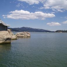
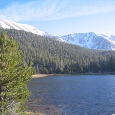
Cedar Lake, artificial lake in the San Bernadino Mountains, San Bernadino County, California

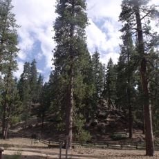
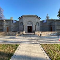
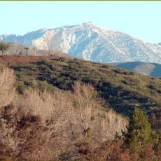
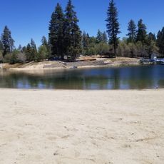
Cedar Lake is an artificial lake in the San Bernardino Mountains at about 7,200 feet (2,200 meters) elevation, surrounded by thick conifer forests. This small three-acre (1.2-hectare) body of water was created by a dam across a stream and is now operated as a retreat center.

The lake was created in 1928 when a dam was built across a small stream to provide water for the area and recreation. From the 1940s onward, it became a popular filming location for Western movies due to its natural scenery.

The lake serves as a gathering place for organized groups and educational programs focused on outdoor learning and teamwork. Visitors experience how the mountain setting fosters connection with nature and collaborative problem-solving among participants.

The lake is accessible by winding mountain roads about two hours from Los Angeles or San Diego. Bring warm clothing as nights get cold, with temperatures dropping into the 30s and 40s Fahrenheit (0-10 Celsius), especially in fall and spring.

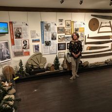
The lake served as a filming location for numerous Western movies from the 1940s through 1960s, offering film fans a chance to see the actual locations where classic scenes were shot. An old grain mill still stands near the dam, a remnant of the area's earlier use.

The community of curious travelers

AroundUs brings together thousands of curated places, local tips, and hidden gems, enriched daily by 60,000 contributors worldwide.

Start exploring
GPS coordinates
34.23102,-116.94128
Latest update
February 7, 2026 11:40
Around this place
San Gorgonio Mountain
United States of America

San Gorgonio Mountain

18.2 km
Big Bear Lake
United States of America

Big Bear Lake

3.5 km
San Bernardino National Forest
United States of America

San Bernardino National Forest

92.1 km
Deep Creek Hot Springs
United States of America

Deep Creek Hot Springs

24.8 km
Lake Arrowhead Reservoir
United States of America

Lake Arrowhead Reservoir

22.4 km
Sand to Snow National Monument
United States of America

Sand to Snow National Monument

29.3 km
Santa's Village
United States of America

Santa's Village

21.5 km
Big Bear Solar Observatory
United States of America

Big Bear Solar Observatory

3.6 km
San Gorgonio Wilderness
United States of America

San Gorgonio Wilderness

28.9 km
Lake Arrowhead Village Beach
United States of America

Lake Arrowhead Village Beach

22.9 km
Alpine Slide
United States of America

Alpine Slide

2.1 km
Big Bear Discovery Center
United States of America

Big Bear Discovery Center

4.9 km
Mill Creek Zanja
United States of America

Mill Creek Zanja

25.2 km
Redlands Santa Fe Depot District
United States of America

Redlands Santa Fe Depot District

29.4 km
A. K. Smiley Public Library
United States of America

A. K. Smiley Public Library

29.8 km
Big Bear Snow Play
United States of America

Big Bear Snow Play

7.4 km
Smiley Park Historic District
United States of America

Smiley Park Historic District

29.9 km
Goode Solar Telescope
United States of America

Goode Solar Telescope

3.6 km
Jepson Peak
United States of America

Jepson Peak

16.8 km
Highland Historic District
United States of America

Highland Historic District

27.1 km
Empire Bowl
United States of America

Empire Bowl

29.9 km
Henry Washington Survey Marker
United States of America

Henry Washington Survey Marker

12.4 km
Arboreto Heaps Peak
United States of America

Arboreto Heaps Peak

18.4 km
Lincoln Memorial Shrine
United States of America

Lincoln Memorial Shrine

29.8 km
Mountain History Museum
United States of America

Mountain History Museum

25 km
Yucaipa Regional Park
United States of America

Yucaipa Regional Park

22.1 km
Keller Peak Lookout
United States of America

Keller Peak Lookout

10.7 km
Tavern Bay Beach
United States of America

Tavern Bay Beach

22.8 km
Show the full map
Reviews
Share your experience

No review yet

Discussions
Start a discussion...

No discussion yet

« Cedar Lake - artificial lake in the San Bernadino Mountains, San Bernadino County, California » is provided by Around Us (aroundus.com). Images and texts are derived from Wikimedia project under a Creative Commons license. You are allowed to copy, distribute, and modify copies of this page, under the conditions set by the license, as long as this note is clearly visible.

Discover hidden gems everywhere you go!

From secret cafés to breathtaking viewpoints, skip the crowded tourist spots and find places that match your style. Our app makes it easy with voice search, smart filtering, route optimization, and insider tips from travelers worldwide. Download now for the complete mobile experience.

Around Us App Screenshot

A unique approach to discovering new places

Le Figaro

All the places worth exploring

France Info

A tailor-made excursion in just a few clicks

20 Minutes

Around Us
Travel Guide & Maps
Download

Send to your phone

QR Code
1

Open the camera app on your mobile.

2

Point at the QR code with your camera. A notification will appear.

3

Tap the notification to open the link.