Chest opened
+${chestReward.xp} XP
Explorer
NOUVEAU ×${chestReward.collectible.quantity}
tapez pour fermer
Chest locked

Open chests in the app

Around Us is built for your phone — chests unlock when you walk, explore and capture nearby places.

Enable Location

We need your location to show you interesting places around you

Discover nearby places

Find interesting locations and hidden gems around you

Precise directions

Get accurate directions and distances to places

Your location is never shared with other users. It's only used when you tap the location button.

Alamo River

Log in to your account

Start exploring — it's free

Trusted by 72,887 travelers worldwide

Continue with Google
Continue with Apple
or

We will send you a code to connect

By continuing, you accept our Terms and Conditions and our Privacy Policy

Check your inbox

We've sent a pincode in your inbox. Please enter the code below.

Alamo River
Discussion Reviews 1 Photos
10k Popularity

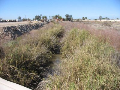
Alamo River, River system in Imperial Valley, United States.

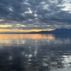
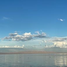
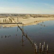
The Alamo River is a waterway that flows from the Mexicali Valley through the Imperial Valley and eventually reaches the Salton Sea in southern California. It was created as part of irrigation and drainage infrastructure for the surrounding agricultural region.

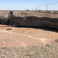
The river system originated in 1904 when a Colorado River overflow through an irrigation canal created new water channels across the valley. This unintended water diversion became a permanent geographic feature.

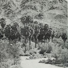
The river receives its name from the Fremont cottonwood trees, known as alamos in Spanish, which populate the surrounding landscape of this waterway.

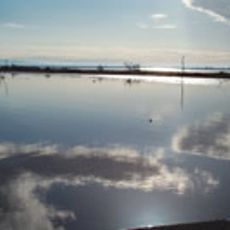
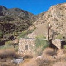
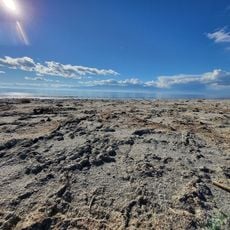
The area is open for public access mainly along dikes and observation points near the water. Visitors should wear appropriate footwear and bring plenty of water, especially during warmer months.

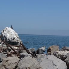
The river was never naturally part of the landscape but rather originated from an irrigation project that became a permanent ecological system. Today birdwatchers visit to spot species that have adapted to this human-made waterway.

The community of curious travelers

AroundUs brings together thousands of curated places, local tips, and hidden gems, enriched daily by 60,000 contributors worldwide.

Start exploring
Location
Location
GPS coordinates
33.20650,-115.61400
Latest update
December 10, 2025 15:56
Around this place
Salvation Mountain
United States of America

Salvation Mountain

14.2 km
Anza-Borrego Desert State Park
United States of America

Anza-Borrego Desert State Park

73.3 km
Algodones Dunes
United States of America

Algodones Dunes

56.6 km
Goat Canyon Trestle
United States of America

Goat Canyon Trestle

75.2 km
Salton Buttes
United States of America

Salton Buttes

914 m
Niland Geyser
United States of America

Niland Geyser

9.4 km
Tahquitz Canyon
United States of America

Tahquitz Canyon

72.4 km
General George S. Patton Memorial Museum
United States of America

General George S. Patton Memorial Museum

51.7 km
Sonny Bono Salton Sea National Wildlife Refuge
United States of America

Sonny Bono Salton Sea National Wildlife Refuge

12.7 km
Desert View Tower
United States of America

Desert View Tower

75.9 km
Galleta Meadows Estate
United States of America

Galleta Meadows Estate

71.5 km
Salton Sea State Recreation Area
United States of America

Salton Sea State Recreation Area

39.3 km
North Shore Beach and Yacht Club
United States of America

North Shore Beach and Yacht Club

44.8 km
Mud Caves
United States of America

Mud Caves

62.1 km
Santa Rosa Wilderness
United States of America

Santa Rosa Wilderness

73.9 km
Fish Creek Mountains Wilderness
United States of America

Fish Creek Mountains Wilderness

45.3 km
Corn Springs
United States of America

Corn Springs

53.9 km
Museo Sol del Niño
Mexico

Museo Sol del Niño

63 km
Calexico Carnegie Library
United States of America

Calexico Carnegie Library

60.9 km
Martinez Canyon Rockhouse
United States of America

Martinez Canyon Rockhouse

74.1 km
Ruby Lee Mill Site
United States of America

Ruby Lee Mill Site

73 km
Cottonwood Visitor Center
United States of America

Cottonwood Visitor Center

63.4 km
Sneaker Beach
United States of America

Sneaker Beach

44.1 km
Betz Beach
United States of America

Betz Beach

41.9 km
Salton Beach
United States of America

Salton Beach

38.6 km
Cottonwood Campground Amphitheater
United States of America

Cottonwood Campground Amphitheater

62.6 km
Punta Este Corporativo

Punta Este Corporativo

64.8 km
Sea View Beach
United States of America

Sea View Beach

21.4 km
Show the full map
Reviews
Share your experience

No review yet

Discussions
Start a discussion...

No discussion yet

« Alamo River - River system in Imperial Valley, United States » is provided by Around Us (aroundus.com). Images and texts are derived from Wikimedia project under a Creative Commons license. You are allowed to copy, distribute, and modify copies of this page, under the conditions set by the license, as long as this note is clearly visible.

Discover hidden gems everywhere you go!

From secret cafés to breathtaking viewpoints, skip the crowded tourist spots and find places that match your style. Our app makes it easy with voice search, smart filtering, route optimization, and insider tips from travelers worldwide. Download now for the complete mobile experience.

Around Us App Screenshot

A unique approach to discovering new places

Le Figaro

All the places worth exploring

France Info

A tailor-made excursion in just a few clicks

20 Minutes

Around Us
Travel Guide & Maps
Download

Send to your phone

QR Code
1

Open the camera app on your mobile.

2

Point at the QR code with your camera. A notification will appear.

3

Tap the notification to open the link.