Chest opened
+${chestReward.xp} XP
Explorer
NOUVEAU ×${chestReward.collectible.quantity}
tapez pour fermer
Chest locked

Open chests in the app

Around Us is built for your phone — chests unlock when you walk, explore and capture nearby places.

Enable Location

We need your location to show you interesting places around you

Discover nearby places

Find interesting locations and hidden gems around you

Precise directions

Get accurate directions and distances to places

Your location is never shared with other users. It's only used when you tap the location button.

Log in to your account

Start exploring — it's free

Trusted by 72,891 travelers worldwide

Continue with Google
Continue with Apple
or

We will send you a code to connect

By continuing, you accept our Terms and Conditions and our Privacy Policy

Check your inbox

We've sent a pincode in your inbox. Please enter the code below.

Coachella Canal
Discussion Reviews Photo
8.3k Popularity

Coachella Canal, Aqueduct in Riverside County, California.

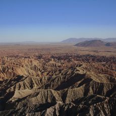
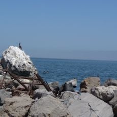
Coachella Canal is a concrete-lined waterway that carries water about 122 miles from the All-American Canal to the Coachella Valley area. The channel runs through desert landscape north of the Salton Sea and serves as the main water delivery system for the region.

Construction began in the 1930s and was paused during World War II, with water reaching the valley for the first time in 1949. This engineering project opened the desert to settlement and farming.

The canal transformed how people could live and farm in the desert, making agriculture the center of life in this region. Today, the waterway represents the connection between the river far away and the fields that feed communities here.

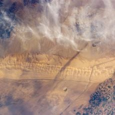
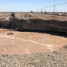
The waterway is lined with concrete to minimize water loss and can be viewed from several points when traveling through the valley. The area around it is generally flat and accessible, making it easy to approach the canal from different locations.

The canal brings Colorado River water across the desert to an area that receives almost no rainfall naturally, making farming possible where nature provides almost nothing. This engineering feat turned one of California's driest regions into productive farmland.

The community of curious travelers

AroundUs brings together thousands of curated places, local tips, and hidden gems, enriched daily by 60,000 contributors worldwide.

Start exploring
Location
GPS coordinates
33.33580,-115.55100
Latest update
December 10, 2025 16:02
Around this place
Salvation Mountain
United States of America

Salvation Mountain

11.7 km
Anza-Borrego Desert State Park
United States of America

Anza-Borrego Desert State Park

79.4 km
Algodones Dunes
United States of America

Algodones Dunes

60.5 km
United States of America

Humana Challenge

73.9 km
United States of America

California State Prison, Centinela

61.2 km
Chuckawalla Valley State Prison
United States of America

Chuckawalla Valley State Prison

64.8 km
Salton Buttes
United States of America

Salton Buttes

16.4 km
Niland Geyser
United States of America

Niland Geyser

6.1 km
Tahquitz Canyon
United States of America

Tahquitz Canyon

72.7 km
General George S. Patton Memorial Museum
United States of America

General George S. Patton Memorial Museum

39.6 km
Sonny Bono Salton Sea National Wildlife Refuge
United States of America

Sonny Bono Salton Sea National Wildlife Refuge

26.7 km
Galleta Meadows Estate
United States of America

Galleta Meadows Estate

76.9 km
Salton Sea State Recreation Area
United States of America

Salton Sea State Recreation Area

35 km
North Shore Beach and Yacht Club
United States of America

North Shore Beach and Yacht Club

40.1 km
Mud Caves
United States of America

Mud Caves

75 km
Shields Date Gardens
United States of America

Shields Date Gardens

78.2 km
Santa Rosa Wilderness
United States of America

Santa Rosa Wilderness

73.7 km
Fish Creek Mountains Wilderness
United States of America

Fish Creek Mountains Wilderness

58.9 km
Cibola National Wildlife Refuge
United States of America

Cibola National Wildlife Refuge

80.2 km
Corn Springs
United States of America

Corn Springs

38.5 km
Museo Sol del Niño
Mexico

Museo Sol del Niño

76.3 km
Calexico Carnegie Library
United States of America

Calexico Carnegie Library

74.4 km
Martinez Canyon Rockhouse
United States of America

Martinez Canyon Rockhouse

74.5 km
Ruby Lee Mill Site
United States of America

Ruby Lee Mill Site

61.4 km
Joshua Tree Wilderness
United States of America

Joshua Tree Wilderness

77.1 km
Jack Nicklaus Resort Golf Course
United States of America

Jack Nicklaus Resort Golf Course

73.8 km
Cottonwood Visitor Center
United States of America

Cottonwood Visitor Center

52.5 km
Punta Este Corporativo

Punta Este Corporativo

77.3 km
Show the full map
Reviews
Share your experience

No review yet

Discussions
Start a discussion...

No discussion yet

« Coachella Canal - Aqueduct in Riverside County, California » is provided by Around Us (aroundus.com). Images and texts are derived from Wikimedia project under a Creative Commons license. You are allowed to copy, distribute, and modify copies of this page, under the conditions set by the license, as long as this note is clearly visible.

Discover hidden gems everywhere you go!

From secret cafés to breathtaking viewpoints, skip the crowded tourist spots and find places that match your style. Our app makes it easy with voice search, smart filtering, route optimization, and insider tips from travelers worldwide. Download now for the complete mobile experience.

Around Us App Screenshot

A unique approach to discovering new places

Le Figaro

All the places worth exploring

France Info

A tailor-made excursion in just a few clicks

20 Minutes

Around Us
Travel Guide & Maps
Download

Send to your phone

QR Code
1

Open the camera app on your mobile.

2

Point at the QR code with your camera. A notification will appear.

3

Tap the notification to open the link.