Chest opened
+${chestReward.xp} XP
Explorer
NOUVEAU ×${chestReward.collectible.quantity}
tapez pour fermer
Chest locked

Open chests in the app

Around Us is built for your phone — chests unlock when you walk, explore and capture nearby places.

Enable Location

We need your location to show you interesting places around you

Discover nearby places

Find interesting locations and hidden gems around you

Precise directions

Get accurate directions and distances to places

Your location is never shared with other users. It's only used when you tap the location button.

Log in to your account

Start exploring — it's free

Trusted by 72,888 travelers worldwide

Continue with Google
Continue with Apple
or

We will send you a code to connect

By continuing, you accept our Terms and Conditions and our Privacy Policy

Check your inbox

We've sent a pincode in your inbox. Please enter the code below.

Discussion Reviews Photo
11.7k Popularity

Young, Census-designated place in Gila County, Arizona.

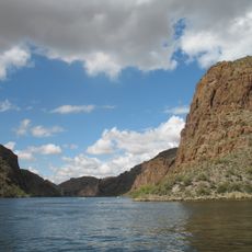
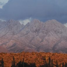
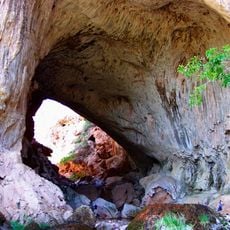
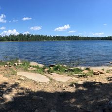
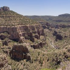
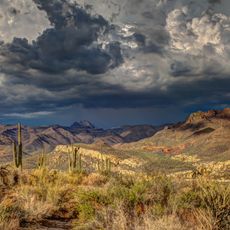
Young is a small mountain settlement in central Arizona situated in high terrain surrounded by national forest. The area features dense woodland and natural water sources that shape the surrounding landscape.

The settlement developed in the late 1800s as a small community of ranchers and settlers in this remote mountain region. It has remained a stable rural area since its founding.

The residents of Young maintain connections through regular community gatherings and local events that strengthen social bonds in this rural mountain settlement.

The settlement is reachable by mountain roads connecting to larger nearby towns and communities. Visitors should expect longer travel times and be prepared for remote conditions when visiting this area.

The geographical position at coordinates 34.1117°N and 110.929°W places Young in a region characterized by elevated terrain and natural mountain landscapes.

The community of curious travelers

AroundUs brings together thousands of curated places, local tips, and hidden gems, enriched daily by 60,000 contributors worldwide.

Start exploring
Location
Elevation above the sea
1,581 m
GPS coordinates
34.11170,-110.92900
Latest update
December 7, 2025 20:49
Around this place
Canyon Lake
United States of America

Canyon Lake

78.8 km
Four Peaks
United States of America

Four Peaks

60.1 km
Tonto Natural Bridge
United States of America

Tonto Natural Bridge

53.8 km
Blue Ridge Reservoir
United States of America

Blue Ridge Reservoir

53.9 km
Skeleton Cave
United States of America

Skeleton Cave

71.7 km
Willow Springs Lake
United States of America

Willow Springs Lake

22 km
Wet Beaver Wilderness
United States of America

Wet Beaver Wilderness

70.3 km
Salt River Canyon Wilderness
United States of America

Salt River Canyon Wilderness

52 km
Childs-Irving Hydroelectric Facilities
United States of America

Childs-Irving Hydroelectric Facilities

75.7 km
Sears-Kay Ruin
United States of America

Sears-Kay Ruin

44.3 km
Mormon Flat Dam
United States of America

Mormon Flat Dam

78.1 km
Fossil Springs Wilderness
United States of America

Fossil Springs Wilderness

67.8 km
Roosevelt Lake Bridge
United States of America

Roosevelt Lake Bridge

53.1 km
Verde River Sheep Bridge
United States of America

Verde River Sheep Bridge

71.8 km
Our Lady of the Blessed Sacrament Church
United States of America

Our Lady of the Blessed Sacrament Church

79.6 km
Sierra Ancha Wilderness
United States of America

Sierra Ancha Wilderness

32.6 km
Tonto Natural Bridge State Park
United States of America

Tonto Natural Bridge State Park

53.9 km
Fossil Creek Bridge
United States of America

Fossil Creek Bridge

71.7 km
Cedar Canyon Bridge
United States of America

Cedar Canyon Bridge

66.6 km
Strawberry Schoolhouse
United States of America

Strawberry Schoolhouse

63.4 km
Corduroy Creek Bridge
United States of America

Corduroy Creek Bridge

71.5 km
Pleasant Valley Ranger Station
United States of America

Pleasant Valley Ranger Station

1.1 km
Miami Community Church
United States of America

Miami Community Church

79.5 km
Tonto National Monument Visitor Center
United States of America

Tonto National Monument Visitor Center

54.6 km
Gila County Historical Museum
United States of America

Gila County Historical Museum

79.1 km
Boulder Creek Bridge
United States of America

Boulder Creek Bridge

79 km
Aztec Peak Lookout
United States of America

Aztec Peak Lookout

33.4 km
Moqui Lookout
United States of America

Moqui Lookout

55.1 km
Show the full map
Reviews
Share your experience

No review yet

Discussions
Start a discussion...

No discussion yet

« Young - Census-designated place in Gila County, Arizona » is provided by Around Us (aroundus.com). Images and texts are derived from Wikimedia project under a Creative Commons license. You are allowed to copy, distribute, and modify copies of this page, under the conditions set by the license, as long as this note is clearly visible.

Discover hidden gems everywhere you go!

From secret cafés to breathtaking viewpoints, skip the crowded tourist spots and find places that match your style. Our app makes it easy with voice search, smart filtering, route optimization, and insider tips from travelers worldwide. Download now for the complete mobile experience.

Around Us App Screenshot

A unique approach to discovering new places

Le Figaro

All the places worth exploring

France Info

A tailor-made excursion in just a few clicks

20 Minutes

Around Us
Travel Guide & Maps
Download

Send to your phone

QR Code
1

Open the camera app on your mobile.

2

Point at the QR code with your camera. A notification will appear.

3

Tap the notification to open the link.