Chest opened
+${chestReward.xp} XP
Explorer
NOUVEAU ×${chestReward.collectible.quantity}
tapez pour fermer
Chest locked

Open chests in the app

Around Us is built for your phone — chests unlock when you walk, explore and capture nearby places.

Enable Location

We need your location to show you interesting places around you

Discover nearby places

Find interesting locations and hidden gems around you

Precise directions

Get accurate directions and distances to places

Your location is never shared with other users. It's only used when you tap the location button.

Zinacantán

Log in to your account

Start exploring — it's free

Trusted by 72,885 travelers worldwide

Continue with Google
Continue with Apple
or

We will send you a code to connect

By continuing, you accept our Terms and Conditions and our Privacy Policy

Check your inbox

We've sent a pincode in your inbox. Please enter the code below.

Zinacantán
Discussion Reviews 1 Photos
12.5k Popularity

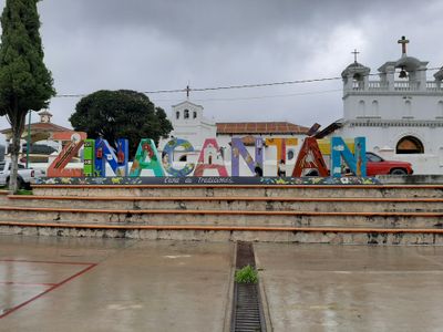
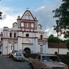
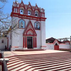
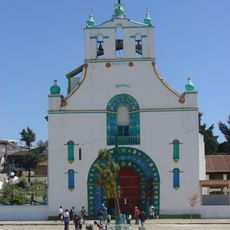
Zinacantán, Indigenous Tzotzil Maya settlement in Chiapas, Mexico.

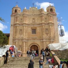
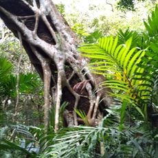
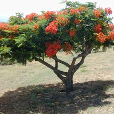
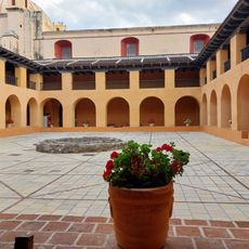
Zinacantán is an indigenous Tzotzil community situated in the highlands of Chiapas at approximately 2,160 meters (7,087 feet) elevation. The settlement consists of traditional adobe dwellings arranged across hillsides with agricultural plots used for flower cultivation and other crops.

The settlement maintained trade relationships with Aztec merchants before European arrival, exchanging goods such as salt and cacao with distant merchants. These commercial ties established the region as an important trading hub that persisted for centuries.

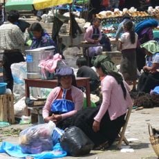
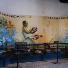
Local weavers produce textiles with intricate patterns passed down through generations, and residents speak Tzotzil as their primary language while maintaining community leadership structures. Walking through the settlement, you notice how these traditions shape daily life and social interactions among neighbors.

The settlement sits in mountainous terrain and is accessible from San Cristóbal de las Casas via the Pan American Highway in about half an hour by car. The road passes through agricultural areas and connects to other highland communities in the region.

The name translates to 'land of the bats' in both Nahuatl and Tzotzil, revealing how the region maintained linguistic connections across different indigenous groups. This bilingual origin story is often overlooked by visitors exploring the area.

The community of curious travelers

AroundUs brings together thousands of curated places, local tips, and hidden gems, enriched daily by 60,000 contributors worldwide.

Start exploring
Location
GPS coordinates
16.76012,-92.72358
Latest update
December 7, 2025 20:45
Reviews
Share your experience

No review yet

Discussions
Start a discussion...

No discussion yet

« Zinacantán - Indigenous Tzotzil Maya settlement in Chiapas, Mexico » is provided by Around Us (aroundus.com). Images and texts are derived from Wikimedia project under a Creative Commons license. You are allowed to copy, distribute, and modify copies of this page, under the conditions set by the license, as long as this note is clearly visible.

Discover hidden gems everywhere you go!

From secret cafés to breathtaking viewpoints, skip the crowded tourist spots and find places that match your style. Our app makes it easy with voice search, smart filtering, route optimization, and insider tips from travelers worldwide. Download now for the complete mobile experience.

Around Us App Screenshot

A unique approach to discovering new places

Le Figaro

All the places worth exploring

France Info

A tailor-made excursion in just a few clicks

20 Minutes

Around Us
Travel Guide & Maps
Download

Send to your phone

QR Code
1

Open the camera app on your mobile.

2

Point at the QR code with your camera. A notification will appear.

3

Tap the notification to open the link.