Cachoeira Ponta de Bacaba, Wasserfall in Brasilien
Location: Amazonas
Elevation above the sea: 164 m
GPS coordinates: 1.07167,-69.81194
Latest update: July 4, 2025 15:38

Serranía de la Macarena
468.8 km
Pico da Neblina
424.4 km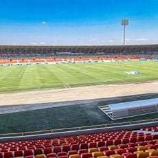
Estadio Bello Horizonte - Rey Pelé
543.9 km
Chiribiquete National Park
335.7 km
Amacayacu National Park
508.9 km
Cerro Autana
496.3 km
The Hub on Causeway
200.2 km
Piedra del Cocuy
333.4 km
Pico da Neblina National Park
438.6 km
Pico 31 de Março
424.6 km
Serranía La Neblina National Park
420.2 km
Piedra del Cocuy Natural Monument
333.4 km
Yaigojé-Apaporis National Park
200.7 km
Yapacana National Park
444.5 km
Chiribiquete's rock shelters
329.5 km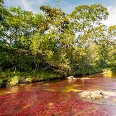
Tinigua National Natural Park
508.3 km
Cerro Duida
529.7 km
Morro dos Seis Lagos Biological Reserve
357.2 km
Central Amazon Ecological Corridor
533.3 km
Forte de São José de Marabitanas
332.6 km
Cué-cué/Marabitanas Indigenous Territory
326.8 km
Auatí-Paraná Extractive Reserve
519.1 km
Cerros Vinilla y Aratitiyope Natural Monument
495 km
Cuao-Sipapo y Moriche Massif Natural Monument
518.7 km
Monumento Natural Cerro Autana
496.3 km
Sierra Unturan Natural Monument
493.5 km
Jardín Botánico de La Macarena
459.4 km
Reviews
Visited this place? Tap the stars to rate it and share your experience / photos with the community! Try now! You can cancel it anytime.
Discover hidden gems everywhere you go!
From secret cafés to breathtaking viewpoints, skip the crowded tourist spots and find places that match your style. Our app makes it easy with voice search, smart filtering, route optimization, and insider tips from travelers worldwide. Download now for the complete mobile experience.

A unique approach to discovering new places❞
— Le Figaro
All the places worth exploring❞
— France Info
A tailor-made excursion in just a few clicks❞
— 20 Minutes