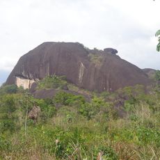
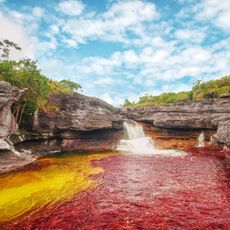
Vaupés Department, Administrative division in southeastern Colombia.
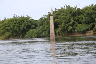
Vaupés is an administrative region covered by Amazon rainforest with many rivers that serve as natural transportation routes across the territory. These waterways connect scattered settlements and are essential to how the area functions.
The territory was first a commissary before becoming an official department in 1991 after the country adopted a new constitution. This change gave the region greater autonomy and administrative recognition.
Multiple indigenous communities live here, including the Tucano people, who speak their own languages and practice traditions that shape how they live and interact with the land.
Travel here happens mainly by boat or plane since roads between settlements are scarce. Visitors should prepare for basic conditions and plan flexible schedules.
The region has only about 0.75 inhabitants per square kilometer, making it the least populated department in the country. This sparse settlement pattern is unusual for an official administrative region.
Location: Colombia
Inception: 1991
Capital city: Mitú
Elevation above the sea: 293 m
Reference: VAU
Shares border with: Guainía Department, Guaviare Department, Caquetá Department, Amazonas Department, Amazonas
Website: http://vaupes.gov.co
GPS coordinates: 0.55000,-70.55000
Latest update: December 14, 2025 19:06
Caño Cristales
408.4 km
Serranía de la Macarena
415 km
Pico da Neblina
506.2 km
Chiribiquete National Park
251.6 km
Amacayacu National Park
450.7 km
Cerros de Mavecure
432.8 km
Piedra del Cocuy
422.1 km
Pico da Neblina National Park
513.3 km
Pico 31 de Março
506.5 km
Serranía La Neblina National Park
504.1 km
Piedra del Cocuy Natural Monument
422.1 kmReserva nacional natural Nukak
188.4 km
Yaigojé-Apaporis National Park
126 kmCahuinarí National Natural Park
228.4 km
Chiribiquete's rock shelters
260.9 kmLa Paya Natural National Park
523 kmPuinawai Natural Reserve
247.1 kmParque nacional natural Río Puré
283.5 km
Tinigua National Natural Park
456.1 km
Santa Rosa Island
535.9 kmAiro Pai Communal Reserve
503.7 km
Morro dos Seis Lagos Biological Reserve
430.2 kmForte de São Gabriel da Cachoeira
392.6 km
Sunrise
408.3 kmHuimeki Communal Reserve
500.4 km
Central Amazon Ecological Corridor
521.7 kmCastle Fort San Felipe
414 km
Forte de São José de Marabitanas
418.6 kmVisited this place? Tap the stars to rate it and share your experience / photos with the community! Try now! You can cancel it anytime.
Discover hidden gems everywhere you go!
From secret cafés to breathtaking viewpoints, skip the crowded tourist spots and find places that match your style. Our app makes it easy with voice search, smart filtering, route optimization, and insider tips from travelers worldwide. Download now for the complete mobile experience.
A unique approach to discovering new places❞
— Le Figaro
All the places worth exploring❞
— France Info
A tailor-made excursion in just a few clicks❞
— 20 Minutes