Cachoeira Taina, Wasserfall in Brasilien
Location: Amazonas
Elevation above the sea: 160 m
GPS coordinates: 1.09167,-69.67139
Latest update: April 17, 2025 20:45

Serranía de la Macarena
483.1 km
Pico da Neblina
408.9 km
Chiribiquete National Park
351.5 km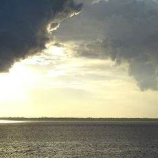
Amacayacu National Park
512.7 km
Cerro Autana
486.3 km
The Hub on Causeway
209.8 km
Piedra del Cocuy
317.6 km
Pico da Neblina National Park
423.7 km
Pico 31 de Março
409.1 km
Serranía La Neblina National Park
404.7 km
Piedra del Cocuy Natural Monument
317.6 km
Yapacana National Park
431.3 km
Chiribiquete's rock shelters
344.9 km
Tinigua National Natural Park
522.4 km
Cerro Duida
515 km
Morro dos Seis Lagos Biological Reserve
342.6 km
Central Amazon Ecological Corridor
529.4 km
Forte de São José de Marabitanas
316.9 km
Cué-cué/Marabitanas Indigenous Territory
311.4 km
Auatí-Paraná Extractive Reserve
510.5 km
Cerros Vinilla y Aratitiyope Natural Monument
479.3 km
Cuao-Sipapo y Moriche Massif Natural Monument
509 km
Monumento Natural Cerro Autana
486.3 km
Sipapo Forest Reserve
547.6 km
Sierra Unturan Natural Monument
477.7 km
Cerros Tapirapecó y Tamacuari Natural Monument
546.7 km
Jardín Botánico de La Macarena
473.9 km
Reviews
Visited this place? Tap the stars to rate it and share your experience / photos with the community! Try now! You can cancel it anytime.
Discover hidden gems everywhere you go!
From secret cafés to breathtaking viewpoints, skip the crowded tourist spots and find places that match your style. Our app makes it easy with voice search, smart filtering, route optimization, and insider tips from travelers worldwide. Download now for the complete mobile experience.

A unique approach to discovering new places❞
— Le Figaro
All the places worth exploring❞
— France Info
A tailor-made excursion in just a few clicks❞
— 20 Minutes