Cerro Punta, Agricultural village in Chiriquí Province, Panama
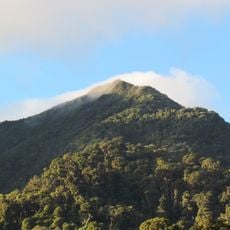
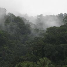
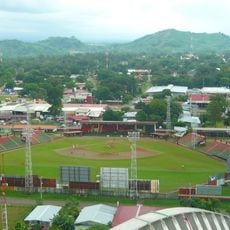
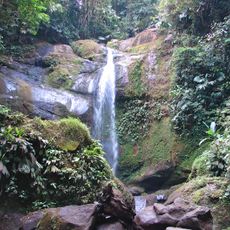
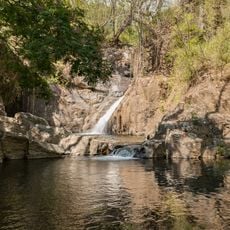
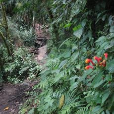
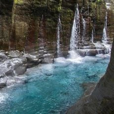
Cerro Punta is an agricultural village in Chiriquí Province, Panama, situated at elevations between 1900 and 2300 meters. The settlement spreads across steep terrain with scattered houses and farming areas that cover much of the landscape.
The highland village was discovered in 1921 by three explorers—Abraham Candanedo, Abel Candanedo, and Andrés Gutiérrez—during their expeditions through the mountains. This exploration marked the opening up of this remote region during Panama's second republican period.
The population of 7,754 residents includes three primary demographic groups: 60 percent white and mestizo, 30 percent indigenous people, and 10 percent foreign inhabitants.
The region stays cool year-round with temperatures between 11 and 18 degrees Celsius and frequent rain. Frost can occur during the dry season, so bring warm clothing and be prepared for muddy or slippery paths.
Local farmers grow vegetables and fruits in volcanic soil, with harvests that differ from crops elsewhere in Panama. This highland location is the highest settlement in the province, creating conditions that enable a distinct form of agriculture.
Location: Chiriquí Province
GPS coordinates: 8.85000,-82.56667
Latest update: December 6, 2025 16:04
Panama offers much more than its famous canal. The places in this collection show the country's range and variety. In the west, mountain landscapes and volcanoes rise above the land. Volcan Baru offers views of both oceans on clear days. Along the coasts, islands sit with tropical beaches and coral...
Stone spheres of Costa Rica
100.4 km
Volcan Baru
5.3 km
Corcovado National Park
116.8 km
Cerro Chirripó
123.5 km
La Amistad International Park
73.9 km
Volcán Barú National Park
5.4 km
Cahuita National Park
101.9 km
Bastimentos Island National Marine Park
68.6 km
Chirripó National Park
122.4 km
Talamanca Reserve
74.3 km
Barriles
15.7 km
Piedras Blancas National Park
78.2 km
The Ara Project
87.3 km
Estadio Kenny Sarracín
47.9 km
Estadio San Cristóbal
49.8 km
Volio Waterfall
94.5 km
Starfish Beach
67.3 km
Lucero Golf Country Club
24.1 km
Talamanca Range-La Amistad Reserves
74.3 km
Antigua Estación del Ferrocarril de Bugaba
37.7 km
The Lost Waterfalls
10.3 km
Sendero Los Quetzales
3.7 km
Macho de Monte Cascadas
18.8 km
Gobernación de Bocas del Toro
65.4 km
Catedral de San José de David
50 km
Residencia de José de Obaldía
49.9 km
Playa Las Lajas
106.6 km
Los Cangilones de Gualaca
45 kmVisited this place? Tap the stars to rate it and share your experience / photos with the community! Try now! You can cancel it anytime.
Discover hidden gems everywhere you go!
From secret cafés to breathtaking viewpoints, skip the crowded tourist spots and find places that match your style. Our app makes it easy with voice search, smart filtering, route optimization, and insider tips from travelers worldwide. Download now for the complete mobile experience.
A unique approach to discovering new places❞
— Le Figaro
All the places worth exploring❞
— France Info
A tailor-made excursion in just a few clicks❞
— 20 Minutes