Enable Location

We need your location to show you interesting places around you

Discover nearby places

Find interesting locations and hidden gems around you

Precise directions

Get accurate directions and distances to places

Your location is never shared with other users. It's only used when you tap the location button.

Chilapa de Álvarez

Log in to your account

Start exploring — it's free

Trusted by 62,127 travelers worldwide

Continue with Google
Continue with Apple
or

We will send you a code to connect

By continuing, you accept our Terms and Conditions and our Privacy Policy

Check your inbox

We've sent a pincode in your inbox. Please enter the code below.

Chilapa de Álvarez

Chilapa de Álvarez, Mountain municipality capital in central Guerrero, Mexico

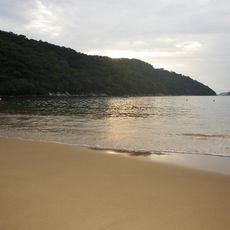
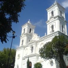
Chilapa de Álvarez is a municipality capital situated across valleys and hills at about 1400 meters in elevation, surrounded by agricultural areas and natural mountain formations. The settlement blends inhabited zones with open countryside throughout its territory.

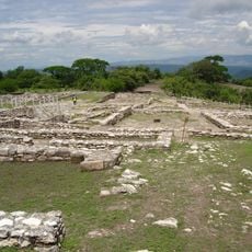
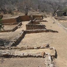
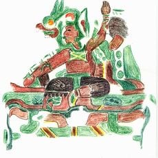
The settlement developed from a pre-Hispanic agricultural center into a significant regional hub during the colonial period of New Spain. This evolution shaped its role as a local center.

Residents speak Spanish and indigenous languages while maintaining traditional crafts such as textile weaving and pottery. These handmade practices are part of everyday life in the community.

The municipality offers basic services including public transportation, markets, and healthcare facilities distributed throughout the territory. Visitors will find necessary infrastructure for a comfortable stay.

The region produces specific varieties of chili peppers that supply regional markets through weekly trading activities. These peppers are an important part of local commerce.

The community of curious travelers

AroundUs brings together thousands of curated places, local tips, and hidden gems, enriched daily by 60,000 contributors worldwide.

Start exploring
Elevation above the sea
1,413 m
GPS coordinates
17.59312,-99.17792
Latest update
December 20, 2025 13:23
« Chilapa de Álvarez - Mountain municipality capital in central Guerrero, Mexico » is provided by Around Us (aroundus.com). Images and texts are derived from Wikimedia project under a Creative Commons license. You are allowed to copy, distribute, and modify copies of this page, under the conditions set by the license, as long as this note is clearly visible.

Discover hidden gems everywhere you go!

From secret cafés to breathtaking viewpoints, skip the crowded tourist spots and find places that match your style. Our app makes it easy with voice search, smart filtering, route optimization, and insider tips from travelers worldwide. Download now for the complete mobile experience.

Around Us App Screenshot

A unique approach to discovering new places

Le Figaro

All the places worth exploring

France Info

A tailor-made excursion in just a few clicks

20 Minutes

Around Us
Travel Guide & Maps
Download

Send to your phone

QR Code
1

Open the camera app on your mobile.

2

Point at the QR code with your camera. A notification will appear.

3

Tap the notification to open the link.