Maverick County

Log in to your account

AroundUs is a community-driven map of interesting places, built by curious explorers like you. It grows with every review, story, and photo you share.
Connect to save your favorite spots, contribute locations, and create personalized routes.
By continuing, you accept our Terms and Conditions and our Privacy Policy
Add to collection
Map
Suggest a change
Share

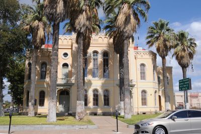
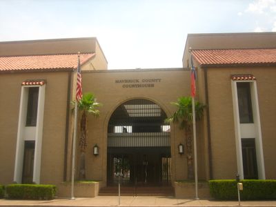
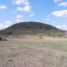
Maverick County, Administrative division in southwestern Texas, United States

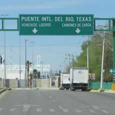
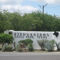
Maverick County is an administrative area in southwestern Texas along the Rio Grande, with landscapes ranging from urban zones to rural countryside near the Mexican border. Eagle Pass serves as the county seat and main hub with schools, hospitals, and important highway connections.

The area was established as a county in 1856 and named after Samuel Maverick, a Texas rancher known for his unconventional approach to cattle ranching. The region played an important role along the border during periods of conflict between the United States and Mexico.

The communities here blend Mexican and American traditions together, visible in local celebrations featuring music, dance, and regional food that draw people from throughout the area. This cultural mix shapes daily life and gives the region its distinctive character.

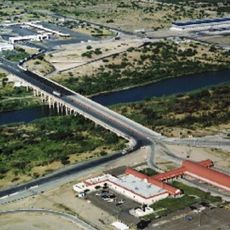
Travel within the area follows highways 57 and 277, which connect the main towns and provide basic orientation for visitors. Since much of the region is rural, it helps to plan ahead and check where specific services and amenities are located before visiting.

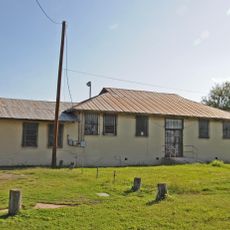
Fort Duncan, strategically positioned on the Rio Grande, was an important military post during border conflicts between the United States and Mexico. This historic fort shaped the military and political history of the entire region.

Location: Texas

Inception: 1871

Capital city: Eagle Pass

Shares border with: Dimmit County, Kinney County, Zavala County, Webb County, Guerrero Municipality, Jiménez Municipality, Uvalde County

Website: http://co.maverick.tx.us

GPS coordinates: 28.75000,-100.32000

Latest update: December 7, 2025 10:06

Photos
Around this place
Show the full map
Garner State Park
United States of America

Garner State Park

108.6 km
Colombia – Solidarity International Bridge
Mexico

Colombia – Solidarity International Bridge

129.8 km
Amistad Reservoir
Mexico

Amistad Reservoir

106 km
Fort Clark
United States of America

Fort Clark

62.7 km
Sleeping Spring Draw
United States of America

Sleeping Spring Draw

53.2 km
Amistad National Recreation Area
United States of America

Amistad National Recreation Area

104.3 km
Fort Inge
United States of America

Fort Inge

72.1 km
Fort Duncan
United States of America

Fort Duncan

18.9 km
Eagle Pass – Piedras Negras International Bridge
Mexico

Eagle Pass – Piedras Negras International Bridge

19.4 km
John Nance Garner House
United States of America

John Nance Garner House

72.8 km
Del Río – Ciudad Acuña International Bridge
Mexico

Del Río – Ciudad Acuña International Bridge

87.3 km
Lake Amistad Dam International Crossing
United States of America

Lake Amistad Dam International Crossing

105.9 km
Camino Real International Bridge
United States of America

Camino Real International Bridge

19.5 km
Whitehead Memorial Museum
United States of America

Whitehead Memorial Museum

87.5 km
Grand Opera House
United States of America

Grand Opera House

73 km
Rio San Rodrigo
Mexico

Rio San Rodrigo

34.8 km
Union Pacific International Railroad Bridge
Mexico

Union Pacific International Railroad Bridge

19.5 km
Martyrs of Christ the King Cathedral, Piedras Negras
Mexico

Martyrs of Christ the King Cathedral, Piedras Negras

24.7 km
Asher and Mary Isabelle Richardson House
United States of America

Asher and Mary Isabelle Richardson House

64.4 km
State Highway 3 Bridge at the Nueces River
United States of America

State Highway 3 Bridge at the Nueces River

65 km
Desert Lanes
United States of America

Desert Lanes

16 km
Uvalde Downtown Historic District
United States of America

Uvalde Downtown Historic District

72.9 km
La Salle County Courthouse
United States of America

La Salle County Courthouse

111.5 km
Popeye statue in Crystal City
United States of America

Popeye statue in Crystal City

48.5 km
St. Philip's Episcopal Church
United States of America

St. Philip's Episcopal Church

73.1 km
Aztec Theatre
United States of America

Aztec Theatre

18.4 km
Combination Building
United States of America

Combination Building

109 km
Nicolas Street School
United States of America

Nicolas Street School

71.9 km
Show the full map
Reviews

Visited this place? Tap the stars to rate it and share your experience / photos with the community! Try now! You can cancel it anytime.

Administrative divisions
« Maverick County - Administrative division in southwestern Texas, United States » is provided by Around Us (aroundus.com). Images and texts are derived from Wikimedia project under a Creative Commons license. You are allowed to copy, distribute, and modify copies of this page, under the conditions set by the license, as long as this note is clearly visible.

Discover hidden gems everywhere you go!

From secret cafés to breathtaking viewpoints, skip the crowded tourist spots and find places that match your style. Our app makes it easy with voice search, smart filtering, route optimization, and insider tips from travelers worldwide. Download now for the complete mobile experience.

Around Us App Screenshot

A unique approach to discovering new places

Le Figaro

All the places worth exploring

France Info

A tailor-made excursion in just a few clicks

20 Minutes