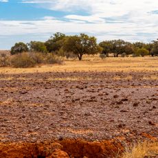
Munga-Thirri National Park, Protected sand dunes expanse in Queensland, Australia.
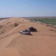
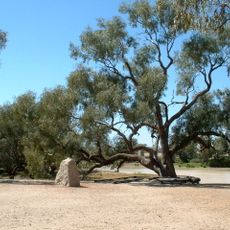
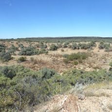
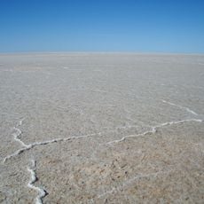
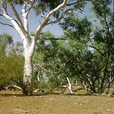
Munga-Thirri is a national park in Queensland's outback covered by an expansive sand dune desert with dunes that stretch for hundreds of kilometers. The landscape features deep red sand formations shaped by extreme heat and sparse rainfall.
The conservation area was proposed in 1965 by the National Parks Association and officially established as a national park in 1967. This designation marked the beginning of systematic efforts to protect the desert landscape.
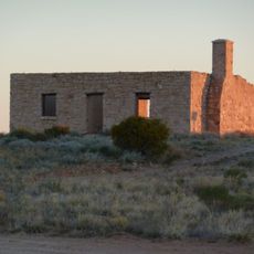
Aboriginal peoples have inhabited this desert for thousands of years, developing deep knowledge of water sources and navigation techniques essential for survival. This heritage remains visible through traditional stories and connection to the land that define the region's cultural identity.
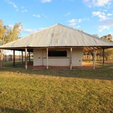
The park requires four-wheel-drive vehicles and becomes extremely hot during summer months, making visits uncomfortable without proper preparation. Visitors should bring adequate water and supplies while expecting limited facilities and services.
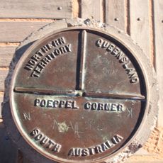
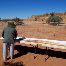
At Poeppel Corner, visitors can stand simultaneously at the border where Queensland, South Australia, and Northern Territory meet. This spot attracts those seeking a photo at the junction of three states at once.
Location: Queensland
Inception: 1967
Elevation above the sea: 56 m
Website: https://parks.des.qld.gov.au/parks/munga-thirri
GPS coordinates: -25.14250,138.24000
Latest update: December 12, 2025 14:23
Deserts of Australia
104.5 km
Anna Creek station
412.9 km
Lake Eyre basin
98.1 km
Australian Overland Telegraph Line
339.5 km
Burke and Wills Dig Tree
395.3 km
Poeppel Corner
98.1 km
Dalhousie Springs
312.7 km
Boxhole crater
418.7 km
Kati Thanda-Lake Eyre National Park
396.8 km
Algebuckina Bridge
391 km
Witjira National Park
295.3 km
Diamantina National Park
355.4 km
Astrebla Downs National Park
250.8 km
Birdsville Hotel
139.8 km
Royal Hotel, Birdsville
140 km
Huckitta
398.7 km
Kidman's Tree of Knowledge
142.2 km
Australian Inland Mission Hospital, Birdsville
140.1 kmBitter Springs Group
422.9 km
Poeppel Corner Survey Marker
98.1 km
Malkumba-Coongie Lakes National Park
301 km
Boulia Stone House
300.5 km
Birdsville Courthouse
139.7 km
Moonah Creek Hanging Tree
411 km
Ethabuka Reserve
145.3 km
Carcory Homestead Ruin
133.7 km
Bedourie Pisé House and Aboriginal Tracker's Hut
151.7 km
Lone Gum Tree
171.2 kmVisited this place? Tap the stars to rate it and share your experience / photos with the community! Try now! You can cancel it anytime.
Discover hidden gems everywhere you go!
From secret cafés to breathtaking viewpoints, skip the crowded tourist spots and find places that match your style. Our app makes it easy with voice search, smart filtering, route optimization, and insider tips from travelers worldwide. Download now for the complete mobile experience.
A unique approach to discovering new places❞
— Le Figaro
All the places worth exploring❞
— France Info
A tailor-made excursion in just a few clicks❞
— 20 Minutes