Lexington County

Log in to your account

AroundUs is a community-driven map of interesting places, built by curious explorers like you. It grows with every review, story, and photo you share.
Connect to save your favorite spots, contribute locations, and create personalized routes.
Continue with Google
Continue with Apple
Continue with X
Continue with Facebook
Continue with email
By continuing, you accept our Terms and Conditions and our Privacy Policy
Create an account
Add to collection
Map
Suggest a change
Share

Lexington County, Administrative division in South Carolina, United States

Lexington County occupies the central region of South Carolina, comprising several municipalities and residential communities alongside Lake Murray. The area blends developed zones with landscapes shaped by this major water body.

The county was established to create administrative structures in the central region and serve its communities. Since then, the area has continually adapted its governance to support a growing population.

Residents regularly gather for community meetings and public hearings where they can voice their views on local matters. This civic participation shapes how the county develops and makes decisions.

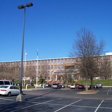
County administration provides online access to reports, documents, and program applications through a digital portal. This makes information available to residents and visitors from anywhere.

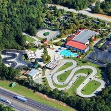
Lake Murray extends beyond county borders and offers water-based recreation that shapes daily life and infrastructure throughout the region. The lake serves as a central focus for many local activities.

Location: South Carolina

Inception: 1804

Capital city: Lexington

Shares border with: Richland County, Orangeburg County, Calhoun County, Aiken County, Saluda County, Newberry County

Website: http://lex-co.com

GPS coordinates: 33.90000,-81.27000

Latest update: December 20, 2025 02:37

Photos
Around this place
Lake Murray
United States of America

Lake Murray

19.2 km
United States of America

Alcohol and Drug Abuse Lake

33.9 km
Best Friend of Charleston
United States of America

Best Friend of Charleston

23.3 km
Benedict College
United States of America

Benedict College

26.3 km
South Carolina State House
United States of America

South Carolina State House

24.6 km
Williams-Brice Stadium
United States of America

Williams-Brice Stadium

24.6 km
Riverbanks Zoo
United States of America

Riverbanks Zoo

22 km
South Carolina Governor's Mansion
United States of America

South Carolina Governor's Mansion

24.1 km
Mills Building, South Carolina State Hospital
United States of America

Mills Building, South Carolina State Hospital

25.3 km
South Carolina State Museum
United States of America

South Carolina State Museum

23.3 km
Babcock Building, South Carolina State Hospital
United States of America

Babcock Building, South Carolina State Hospital

25.5 km
United States of America

Columbia Speedway

18.9 km
Columbia Museum of Art
United States of America

Columbia Museum of Art

24.6 km
First Presbyterian Church (Columbia)
United States of America

First Presbyterian Church (Columbia)

25 km
United States of America

Koger Center for the Arts

24.3 km
Robert Mills House
United States of America

Robert Mills House

25.4 km
Capitol Center
United States of America

Capitol Center

24.5 km
Columbia Township Auditorium
United States of America

Columbia Township Auditorium

25.5 km
Frankie's Fun Park
United States of America

Frankie's Fun Park

23 km
Riverbanks Botanical Garden
United States of America

Riverbanks Botanical Garden

21.3 km
Columbia Canal
United States of America

Columbia Canal

23.5 km
United States of America

Dreher Island State Recreation Area

23.7 km
Old Campus District, University of South Carolina
United States of America

Old Campus District, University of South Carolina

24.8 km
Trinity Episcopal Cathedral
United States of America

Trinity Episcopal Cathedral

24.8 km
EdVenture
United States of America

EdVenture

23.2 km
Millwood
United States of America

Millwood

30 km
Harbison State Forest
United States of America

Harbison State Forest

25.3 km
Charlie W. Johnson Stadium
United States of America

Charlie W. Johnson Stadium

27.3 km
Show the full map
Reviews

Visited this place? Tap the stars to rate it and share your experience / photos with the community! Try now! You can cancel it anytime.

Administrative divisions
« Lexington County - Administrative division in South Carolina, United States » is provided by Around Us (aroundus.com). Images and texts are derived from Wikimedia project under a Creative Commons license. You are allowed to copy, distribute, and modify copies of this page, under the conditions set by the license, as long as this note is clearly visible.

Discover hidden gems everywhere you go!

From secret cafés to breathtaking viewpoints, skip the crowded tourist spots and find places that match your style. Our app makes it easy with voice search, smart filtering, route optimization, and insider tips from travelers worldwide. Download now for the complete mobile experience.

Around Us App Screenshot

A unique approach to discovering new places

Le Figaro

All the places worth exploring

France Info

A tailor-made excursion in just a few clicks

20 Minutes