Chest opened
+${chestReward.xp} XP
Explorer
NOUVEAU ×${chestReward.collectible.quantity}
tapez pour fermer
Chest locked

Open chests in the app

Around Us is built for your phone — chests unlock when you walk, explore and capture nearby places.

Enable Location

We need your location to show you interesting places around you

Discover nearby places

Find interesting locations and hidden gems around you

Precise directions

Get accurate directions and distances to places

Your location is never shared with other users. It's only used when you tap the location button.

Log in to your account

Start exploring — it's free

Trusted by 73,085 travelers worldwide

Continue with Google
Continue with Apple
or

We will send you a code to connect

By continuing, you accept our Terms and Conditions and our Privacy Policy

Check your inbox

We've sent a pincode in your inbox. Please enter the code below.

Jack and Laura Dangermond Preserve
Discussion Reviews Photo
5.5k Popularity

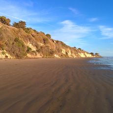
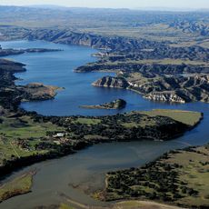
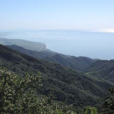
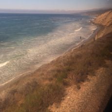
Jack and Laura Dangermond Preserve, Protected coastal area at Point Conception, California, US.

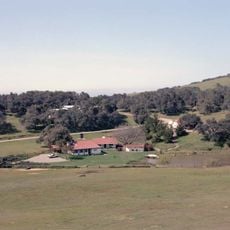
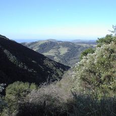
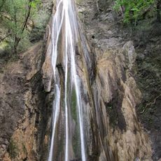
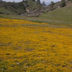
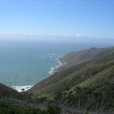
The Jack and Laura Dangermond Preserve is a protected coastal area around Point Conception in California, covering roughly 8 miles (13 km) of shoreline. The terrain climbs from sea level up into the Santa Ynez Mountains, taking in beaches, chaparral slopes, and woodland along the way.

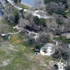
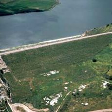
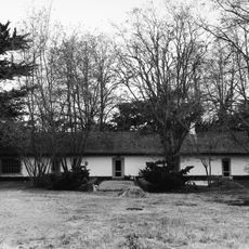
The land functioned as a family-owned cattle ranch for close to a century before being donated to The Nature Conservancy in 2017. That gift ended decades of ranching and kept the area from development.

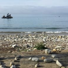
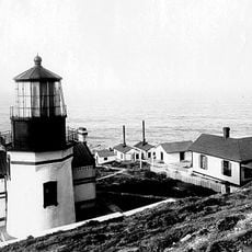
The Chumash people consider this coastline a sacred place, referring to it as the western gate to the spirit world. Traces of their presence, including ancient sites, can still be found across the land today.

Access to the preserve is limited since it is not a public park, and visits require prior arrangement with The Nature Conservancy. The terrain is rough and open, so sturdy footwear and enough water are important for any outing here.

Point Conception is considered one of the most ecologically important stretches of coastline in North America because two major ocean ecosystems meet here. Cold currents from the north and warmer waters from the south come together, drawing an unusual mix of marine life to the same spot.

The community of curious travelers

AroundUs brings together thousands of curated places, local tips, and hidden gems, enriched daily by 60,000 contributors worldwide.

Start exploring
GPS coordinates
34.56000,-120.40200
Latest update
March 3, 2026 10:08
Around this place
Neverland Ranch
United States of America

Neverland Ranch

35.4 km
Rancho del Cielo
United States of America

Rancho del Cielo

30.1 km
Mission Santa Inés
United States of America

Mission Santa Inés

24.6 km
United States of America

Offshore oil and gas in California

49.3 km
Refugio State Beach
United States of America

Refugio State Beach

32.1 km
Gaviota State Park
United States of America

Gaviota State Park

17.7 km
Nojoqui Falls
United States of America

Nojoqui Falls

21.3 km
El Capitán State Beach
United States of America

El Capitán State Beach

36.4 km
Figueroa Mountain
United States of America

Figueroa Mountain

43.3 km
Las Cumbres Observatory Global Telescope Network
United States of America

Las Cumbres Observatory Global Telescope Network

51.4 km
Point Sal State Beach
United States of America

Point Sal State Beach

44.2 km
Point Conception Light
United States of America

Point Conception Light

13.9 km
OstrichLand USA
United States of America

OstrichLand USA

21.3 km
Twitchell Reservoir
United States of America

Twitchell Reservoir

49.2 km
Lake Cachuma
United States of America

Lake Cachuma

38.7 km
Point Arguello Light
United States of America

Point Arguello Light

22.6 km
La Purisima Mission
United States of America

La Purisima Mission

12.4 km
Solvang Vintage Motorcycle Museum
United States of America

Solvang Vintage Motorcycle Museum

24.5 km
Bradbury Dam
United States of America

Bradbury Dam

38.7 km
Vandenberg Space Force Base Space Launch Complex 10
United States of America

Vandenberg Space Force Base Space Launch Complex 10

30.4 km
Gaviota Peak
United States of America

Gaviota Peak

19.7 km
Los Alamos Ranch House
United States of America

Los Alamos Ranch House

22.7 km
Chapel of San Ramon
United States of America

Chapel of San Ramon

35.3 km
Elverhøj Museum of History and Art
United States of America

Elverhøj Museum of History and Art

24 km
Solvang Park
United States of America

Solvang Park

24.4 km
Espada Bluff
United States of America

Espada Bluff

11.5 km
Solvang Festival Theater
United States of America

Solvang Festival Theater

24.2 km
Gaviota Beach
United States of America

Gaviota Beach

19.1 km
Show the full map
Reviews
Share your experience

No review yet

Discussions
Start a discussion...

No discussion yet

« Jack and Laura Dangermond Preserve - Protected coastal area at Point Conception, California, US » is provided by Around Us (aroundus.com). Images and texts are derived from Wikimedia project under a Creative Commons license. You are allowed to copy, distribute, and modify copies of this page, under the conditions set by the license, as long as this note is clearly visible.

Discover hidden gems everywhere you go!

From secret cafés to breathtaking viewpoints, skip the crowded tourist spots and find places that match your style. Our app makes it easy with voice search, smart filtering, route optimization, and insider tips from travelers worldwide. Download now for the complete mobile experience.

Around Us App Screenshot

A unique approach to discovering new places

Le Figaro

All the places worth exploring

France Info

A tailor-made excursion in just a few clicks

20 Minutes

Around Us
Travel Guide & Maps
Download

Send to your phone

QR Code
1

Open the camera app on your mobile.

2

Point at the QR code with your camera. A notification will appear.

3

Tap the notification to open the link.