Chest opened
+${chestReward.xp} XP
Explorer
NOUVEAU ×${chestReward.collectible.quantity}
tapez pour fermer
Chest locked

Open chests in the app

Around Us is built for your phone — chests unlock when you walk, explore and capture nearby places.

Enable Location

We need your location to show you interesting places around you

Discover nearby places

Find interesting locations and hidden gems around you

Precise directions

Get accurate directions and distances to places

Your location is never shared with other users. It's only used when you tap the location button.

Log in to your account

Start exploring — it's free

Trusted by 72,999 travelers worldwide

Continue with Google
Continue with Apple
or

We will send you a code to connect

By continuing, you accept our Terms and Conditions and our Privacy Policy

Check your inbox

We've sent a pincode in your inbox. Please enter the code below.

Cambria State Marine Conservation Area
Discussion Reviews Photo
3.5k Popularity

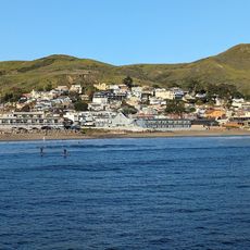
Cambria State Marine Conservation Area, Marine conservation area in Cambria, California.

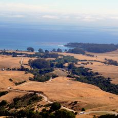
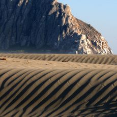
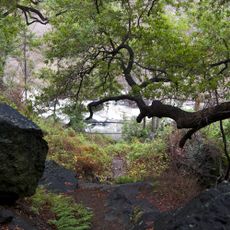
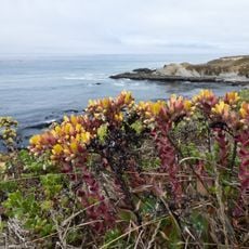
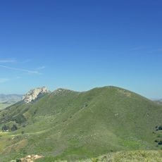
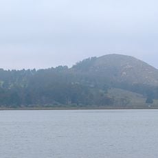
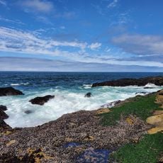
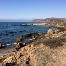
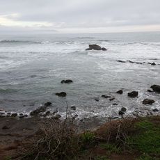
Cambria State Marine Conservation Area is a protected marine zone along the central California coast featuring diverse underwater habitats. The area includes rocky reefs, sandy beaches, offshore rock formations, and kelp forest ecosystems that support sea otters and fish species.

The conservation area was created in 2007 as part of California's marine protection strategy to preserve fish populations and natural habitats. This action was one step in a statewide effort to safeguard coastal marine environments.

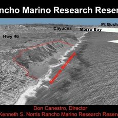
Local researchers regularly study the underwater habitats here using diving expeditions and camera systems to understand marine animal populations. This scientific work shapes how people view ocean protection along the California coast.

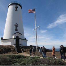
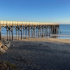
Access to this area is typically from the shore, and visitors should be aware of local tidal conditions and coastal weather patterns. Water recreation users are expected to follow wildlife protection rules and behave responsibly while visiting.

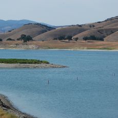
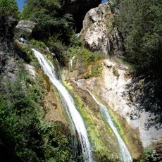
The area contains steelhead streams flowing from the coast inland, creating a rare connection between marine and freshwater ecosystems. This blend of water systems makes the location ecologically distinct from typical coastal reserves.

The community of curious travelers

AroundUs brings together thousands of curated places, local tips, and hidden gems, enriched daily by 60,000 contributors worldwide.

Start exploring
GPS coordinates
35.58833,-121.12750
Latest update
December 12, 2025 07:54
Around this place
Hearst Castle
United States of America

Hearst Castle

11.4 km
Morro Rock
United States of America

Morro Rock

33.9 km
Nitt Witt Ridge
United States of America

Nitt Witt Ridge

3.8 km
Lake Nacimiento
United States of America

Lake Nacimiento

22.9 km
DSRV-2 Avalon
United States of America

DSRV-2 Avalon

34.6 km
Hearst Ranch
United States of America

Hearst Ranch

12.9 km
Lake San Antonio
United States of America

Lake San Antonio

32.5 km
Hearst San Simeon State Park
United States of America

Hearst San Simeon State Park

745 m
Morro Bay State Park
United States of America

Morro Bay State Park

38.3 km
Morro Strand State Beach
United States of America

Morro Strand State Beach

33.7 km
Piedras Blancas Light Station
United States of America

Piedras Blancas Light Station

16.6 km
William Randolph Hearst Memorial State Beach
United States of America

William Randolph Hearst Memorial State Beach

8.2 km
Cayucos State Beach
United States of America

Cayucos State Beach

25.4 km
Salmon Creek Falls
United States of America

Salmon Creek Falls

32.8 km
Silver Peak Wilderness
United States of America

Silver Peak Wilderness

31.4 km
Whale Rock Reservoir
United States of America

Whale Rock Reservoir

27.3 km
Harmony Headlands State Park
United States of America

Harmony Headlands State Park

17.3 km
Cerro Cabrillo
United States of America

Cerro Cabrillo

38.7 km
Black Hill
United States of America

Black Hill

37.1 km
Morro Rock Beach
United States of America

Morro Rock Beach

33.8 km
Morro Bay State Park Museum of Natural History
United States of America

Morro Bay State Park Museum of Natural History

37.2 km
Estero Bluffs State Park
United States of America

Estero Bluffs State Park

23.6 km
Kenneth S. Norris Rancho Marino Reserve
United States of America

Kenneth S. Norris Rancho Marino Reserve

8.2 km
Sebastian Store
United States of America

Sebastian Store

8.4 km
William Randolph Hearst Memorial Beach
United States of America

William Randolph Hearst Memorial Beach

8.2 km
Cayucos Beach
United States of America

Cayucos Beach

25.4 km
Call-Booth House
United States of America

Call-Booth House

39.2 km
Cayucos State Beach
United States of America

Cayucos State Beach

25.6 km
Show the full map
Reviews
Share your experience

No review yet

Discussions
Start a discussion...

No discussion yet

« Cambria State Marine Conservation Area - Marine conservation area in Cambria, California » is provided by Around Us (aroundus.com). Images and texts are derived from Wikimedia project under a Creative Commons license. You are allowed to copy, distribute, and modify copies of this page, under the conditions set by the license, as long as this note is clearly visible.

Discover hidden gems everywhere you go!

From secret cafés to breathtaking viewpoints, skip the crowded tourist spots and find places that match your style. Our app makes it easy with voice search, smart filtering, route optimization, and insider tips from travelers worldwide. Download now for the complete mobile experience.

Around Us App Screenshot

A unique approach to discovering new places

Le Figaro

All the places worth exploring

France Info

A tailor-made excursion in just a few clicks

20 Minutes

Around Us
Travel Guide & Maps
Download

Send to your phone

QR Code
1

Open the camera app on your mobile.

2

Point at the QR code with your camera. A notification will appear.

3

Tap the notification to open the link.