Enable Location

We need your location to show you interesting places around you

Discover nearby places

Find interesting locations and hidden gems around you

Precise directions

Get accurate directions and distances to places

Your location is never shared with other users. It's only used when you tap the location button.

Mount Thayer

Log in to your account

Start exploring — it's free

Trusted by 62,901 travelers worldwide

Continue with Google
Continue with Apple
or

We will send you a code to connect

By continuing, you accept our Terms and Conditions and our Privacy Policy

Check your inbox

We've sent a pincode in your inbox. Please enter the code below.

Mount Thayer
Discussion Reviews 1 Photos
1.7k Popularity

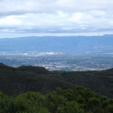
Mount Thayer, Mountain summit in Santa Clara County, California, US.

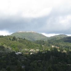
Mount Thayer is a summit in the Santa Cruz Mountains rising 3,479 feet (1,060 m) with steep slopes dropping on all sides. An abandoned structure sits at its peak, visible from surrounding areas.

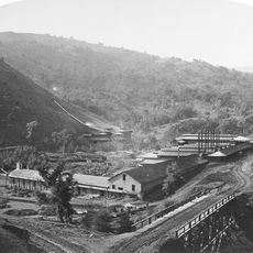
The mountain was home to Almaden Air Force Station during the Cold War when it served as a military outpost. The facility was decommissioned over time, leaving behind the ruins visible today.

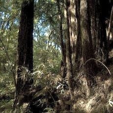
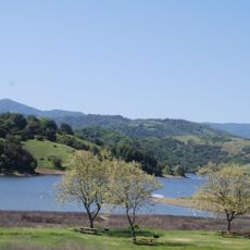
Located in Sierra Azul Open Space Preserve, Mount Thayer stands as a representation of California's military defense infrastructure from the twentieth century.

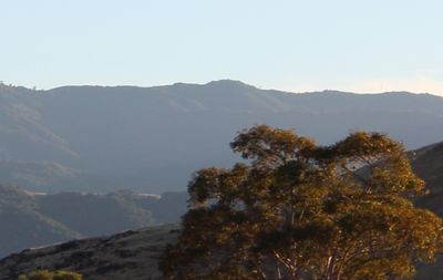
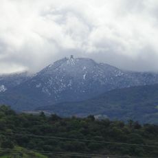
The summit is closed to public access with no maintained pathways to reach the top. Visitors can view the mountain from the surrounding areas of Sierra Azul Open Space Preserve.

Mount Thayer ranks as the second highest point in the Sierra Azul Open Space Preserve, positioned one mile west of Mount Umunhum.

The community of curious travelers

AroundUs brings together thousands of curated places, local tips, and hidden gems, enriched daily by 60,000 contributors worldwide.

Start exploring
Location
GPS coordinates
37.16368,-121.91943
Latest update
December 14, 2025 12:20
Around this place
Mount Umunhum
United States of America

Mount Umunhum

1.9 km
Hayes Mansion
United States of America

Hayes Mansion

14 km
Loma Prieta
United States of America

Loma Prieta

8.9 km
New Almaden
United States of America

New Almaden

7.7 km
The Forest of Nisene Marks State Park
United States of America

The Forest of Nisene Marks State Park

13.6 km
Hakone Gardens
United States of America

Hakone Gardens

14.6 km
Montalvo Arts Center
United States of America

Montalvo Arts Center

13.3 km
Uvas Canyon County Park
United States of America

Uvas Canyon County Park

14.8 km
Calero Reservoir
United States of America

Calero Reservoir

12.6 km
Vasona Lake County Park
United States of America

Vasona Lake County Park

9.6 km
Forbes Mill
United States of America

Forbes Mill

8.5 km
Almaden Reservoir
United States of America

Almaden Reservoir

8.1 km
Ainsley House
United States of America

Ainsley House

14.1 km
Guadalupe Reservoir
United States of America

Guadalupe Reservoir

5.4 km
Old Almaden Winery
United States of America

Old Almaden Winery

8.6 km
New Museum Los Gatos
United States of America

New Museum Los Gatos

8.2 km
El Sereno Open Space
United States of America

El Sereno Open Space

11.2 km
Los Gatos Creek Park
United States of America

Los Gatos Creek Park

12.1 km
Yung See San Fong House
United States of America

Yung See San Fong House

6.8 km
Galindo-Leigh House
United States of America

Galindo-Leigh House

13.5 km
Warner Hutton House
United States of America

Warner Hutton House

14.2 km
McCullagh-Jones House
United States of America

McCullagh-Jones House

9.6 km
Capt. James A. Hamilton House
United States of America

Capt. James A. Hamilton House

13.2 km
Церковь Святого Николая
United States of America

Церковь Святого Николая

15.1 km
Netflix - Building D
United States of America

Netflix - Building D

11.2 km
Xander's Crossing
United States of America

Xander's Crossing

14.6 km
Los Gatos Public Library
United States of America

Los Gatos Public Library

8.2 km
Campbell Union High School Historic District
United States of America

Campbell Union High School Historic District

14.2 km
Show the full map
« Mount Thayer - Mountain summit in Santa Clara County, California, US » is provided by Around Us (aroundus.com). Images and texts are derived from Wikimedia project under a Creative Commons license. You are allowed to copy, distribute, and modify copies of this page, under the conditions set by the license, as long as this note is clearly visible.

Discover hidden gems everywhere you go!

From secret cafés to breathtaking viewpoints, skip the crowded tourist spots and find places that match your style. Our app makes it easy with voice search, smart filtering, route optimization, and insider tips from travelers worldwide. Download now for the complete mobile experience.

Around Us App Screenshot

A unique approach to discovering new places

Le Figaro

All the places worth exploring

France Info

A tailor-made excursion in just a few clicks

20 Minutes

Around Us
Travel Guide & Maps
Download

Send to your phone

QR Code
1

Open the camera app on your mobile.

2

Point at the QR code with your camera. A notification will appear.

3

Tap the notification to open the link.