McLaughlin Natural Reserve

Log in to your account

AroundUs is a community-driven map of interesting places, built by curious explorers like you. It grows with every review, story, and photo you share.
Connect to save your favorite spots, contribute locations, and create personalized routes.
By continuing, you accept our Terms and Conditions and our Privacy Policy

McLaughlin Natural Reserve

Add to collection
Map
Suggest a change
Share

McLaughlin Natural Reserve, Protected natural area in Northern California, United States

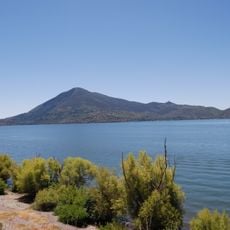
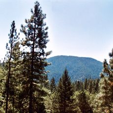
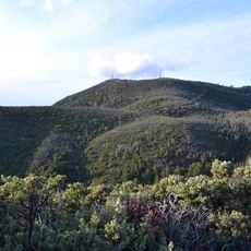
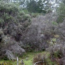
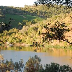
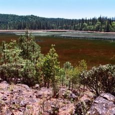
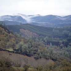
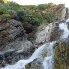
McLaughlin Natural Reserve spans thousands of acres across Napa and Lake counties, displaying a patchwork of woodlands, chaparral scrub, and open grasslands. The landscape shifts noticeably depending on elevation and soil type throughout the property.

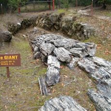
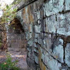
The land was previously the site of an active gold mine operating from 1985 to 2002 before being converted to a research reserve. This transformation from mining operations to protected habitat marks a shift toward ecological restoration.

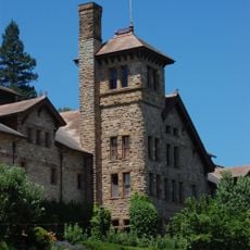
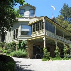
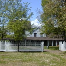
The Ray Krauss Field Station serves as a teaching hub where university students come to study geology, plant evolution, and ecological genetics. Visitors can observe researchers working in the field and using the facilities for hands-on learning.

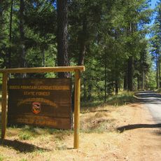
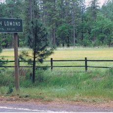
The reserve provides visitor access to trails and diverse habitats across its lands. Bring sturdy footwear and water, as conditions vary significantly by season and elevation.

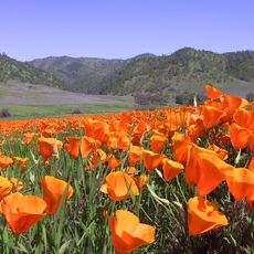
The reserve contains rare serpentine soil deposits that support specialized plants and endemic insects found nowhere else. These unusual soils create isolated ecosystems with remarkable biodiversity.

Location: California

GPS coordinates: 38.87390,-122.43200

Latest update: December 10, 2025 20:05

Photos
Around this place
Petrified Forest
United States of America

Petrified Forest

39.7 km
Mount Konocti
United States of America

Mount Konocti

31.1 km
Culinary Institute of America at Greystone
United States of America

Culinary Institute of America at Greystone

40.3 km
Berryessa Snow Mountain National Monument
United States of America

Berryessa Snow Mountain National Monument

25.8 km
Cobb Mountain
United States of America

Cobb Mountain

27.8 km
Robert Louis Stevenson State Park
United States of America

Robert Louis Stevenson State Park

28.7 km
Bothe-Napa Valley State Park
United States of America

Bothe-Napa Valley State Park

36.7 km
Schramsberg Vineyards
United States of America

Schramsberg Vineyards

37.2 km
Clear Lake State Park
United States of America

Clear Lake State Park

36 km
Anderson Marsh State Historic Park
United States of America

Anderson Marsh State Historic Park

18.9 km
Boggs Mountain Demonstration State Forest
United States of America

Boggs Mountain Demonstration State Forest

23.2 km
Elmshaven
United States of America

Elmshaven

37.7 km
Boggs Lake Ecological Reserve
United States of America

Boggs Lake Ecological Reserve

29.9 km
Blue Ridge Berryessa Natural Area
United States of America

Blue Ridge Berryessa Natural Area

14.1 km
Loch Lomond Vernal Pool Ecological Reserve
United States of America

Loch Lomond Vernal Pool Ecological Reserve

25 km
Cache Creek Wilderness
United States of America

Cache Creek Wilderness

8.1 km
Pacific Union College Church
United States of America

Pacific Union College Church

33.8 km
Sacramento Valley Museum
United States of America

Sacramento Valley Museum

38.8 km
Zim Zim Falls
United States of America

Zim Zim Falls

14.3 km
Sam Brannan Cottage
United States of America

Sam Brannan Cottage

34.8 km
Pope Street Bridge
United States of America

Pope Street Bridge

40.4 km
California Coast Ranges Biosphere Reserve
United States of America

California Coast Ranges Biosphere Reserve

41.6 km
James H. Francis House
United States of America

James H. Francis House

35.5 km
Grace Episcopal Church
United States of America

Grace Episcopal Church

41.4 km
Chateau Pacheteau
United States of America

Chateau Pacheteau

36.8 km
Swartz Creek Bridge on Aetna Springs Road
United States of America

Swartz Creek Bridge on Aetna Springs Road

24.8 km
St. Helena Historic Commercial District
United States of America

St. Helena Historic Commercial District

41.2 km
Maxwell Creek Bridge on Hardin Road
United States of America

Maxwell Creek Bridge on Hardin Road

30.8 km
Show the full map
Reviews

Visited this place? Tap the stars to rate it and share your experience / photos with the community! Try now! You can cancel it anytime.

« McLaughlin Natural Reserve - Protected natural area in Northern California, United States » is provided by Around Us (aroundus.com). Images and texts are derived from Wikimedia project under a Creative Commons license. You are allowed to copy, distribute, and modify copies of this page, under the conditions set by the license, as long as this note is clearly visible.

Discover hidden gems everywhere you go!

From secret cafés to breathtaking viewpoints, skip the crowded tourist spots and find places that match your style. Our app makes it easy with voice search, smart filtering, route optimization, and insider tips from travelers worldwide. Download now for the complete mobile experience.

Around Us App Screenshot

A unique approach to discovering new places

Le Figaro

All the places worth exploring

France Info

A tailor-made excursion in just a few clicks

20 Minutes