Chest opened
+${chestReward.xp} XP
Explorer
NOUVEAU ×${chestReward.collectible.quantity}
tapez pour fermer
Chest locked

Open chests in the app

Around Us is built for your phone — chests unlock when you walk, explore and capture nearby places.

Enable Location

We need your location to show you interesting places around you

Discover nearby places

Find interesting locations and hidden gems around you

Precise directions

Get accurate directions and distances to places

Your location is never shared with other users. It's only used when you tap the location button.

Log in to your account

Start exploring — it's free

Trusted by 73,067 travelers worldwide

Continue with Google
Continue with Apple
or

We will send you a code to connect

By continuing, you accept our Terms and Conditions and our Privacy Policy

Check your inbox

We've sent a pincode in your inbox. Please enter the code below.

Lake of the Woods
Discussion Reviews Photo
10.2k Popularity

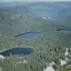
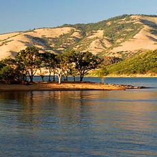
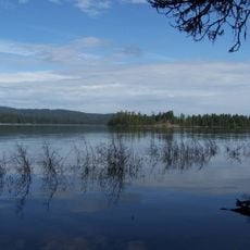
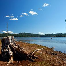
Lake of the Woods, Natural lake in Klamath County, Oregon.

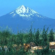
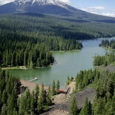
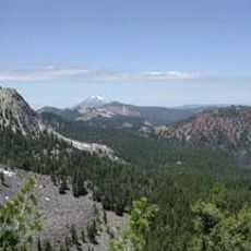
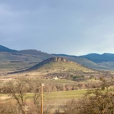
Lake of the Woods is a natural lake in southern Oregon's Klamath County, sitting at roughly 5,000 feet (1,500 m) elevation near the southern Cascade Range. Mixed conifer forest lines its shores, and the lake has several access points around its perimeter for different uses.

Oliver C. Applegate gave the lake its current name in 1870 while surveying the region for the state of Oregon. In the early 1900s the surrounding land was folded into the national forest system, which brought new rules for how the area could be used.

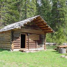
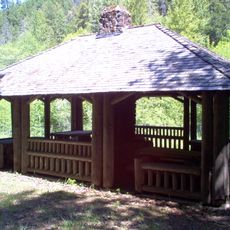
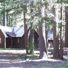
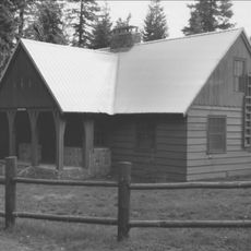
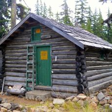
On summer weekends, the lake draws families who come to fish for trout and bass from small boats or along the shore. The resort at the water's edge gives the place a relaxed, camp-like feel that has stayed largely the same for decades.

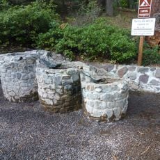
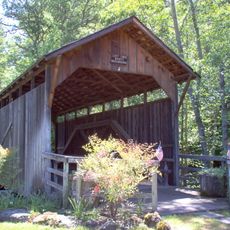
A resort on the shore offers cabin rentals and boat hire, and several campgrounds around the lake are open for those staying overnight. The road to the lake can be affected by snow in late fall and winter, so a visit in late spring through early fall gives the most reliable access.

The lake is fed mostly by groundwater seeping up from below rather than by rivers or streams flowing into it, which is uncommon for a lake of this size. Because of this hidden source, the water level stays fairly steady even during dry summers.

The community of curious travelers

AroundUs brings together thousands of curated places, local tips, and hidden gems, enriched daily by 60,000 contributors worldwide.

Start exploring
Location
GPS coordinates
42.36930,-122.21600
Latest update
March 3, 2026 08:21
Around this place
Mount McLoughlin
United States of America

Mount McLoughlin

11.7 km
Train Mountain Railroad
United States of America

Train Mountain Railroad

34.4 km
Link River Dam
United States of America

Link River Dam

37.3 km
Sky Lakes Wilderness
United States of America

Sky Lakes Wilderness

27.8 km
Emigrant Lake
United States of America

Emigrant Lake

39.5 km
Fish Lake
United States of America

Fish Lake

10.9 km
John C. Boyle Dam
United States of America

John C. Boyle Dam

30.7 km
Lake Ewauna
United States of America

Lake Ewauna

40 km
Mountain Lakes Wilderness
United States of America

Mountain Lakes Wilderness

9.8 km
Howard Prairie Lake
United States of America

Howard Prairie Lake

21.5 km
Upper Klamath National Wildlife Refuge
United States of America

Upper Klamath National Wildlife Refuge

21.1 km
Fourmile Lake
United States of America

Fourmile Lake

11.2 km
Tub Springs State Wayside
United States of America

Tub Springs State Wayside

33.6 km
Hyatt Reservoir
United States of America

Hyatt Reservoir

28.3 km
Baldwin Hotel
United States of America

Baldwin Hotel

39 km
Lost Creek Bridge
United States of America

Lost Creek Bridge

29.9 km
Willow Prairie Cabin
United States of America

Willow Prairie Cabin

15.1 km
Dead Indian Soda Springs
United States of America

Dead Indian Soda Springs

19.5 km
Imnaha Guard Station
United States of America

Imnaha Guard Station

38.5 km
Lake of the Woods Ranger Station
United States of America

Lake of the Woods Ranger Station

2.1 km
Klamath Falls City Hall
United States of America

Klamath Falls City Hall

39.3 km
Nils Ahlstrom House
United States of America

Nils Ahlstrom House

33 km
Blackburn Sanitarium
United States of America

Blackburn Sanitarium

39.6 km
Judge Henry L. Benson House
United States of America

Judge Henry L. Benson House

39 km
Honeymoon Creek Snow-Survey Cabin
United States of America

Honeymoon Creek Snow-Survey Cabin

33.3 km
Richardson–Ulrich House
United States of America

Richardson–Ulrich House

38.5 km
Pompadour Bluff
United States of America

Pompadour Bluff

40.1 km
Klamath County Museum
United States of America

Klamath County Museum

39.6 km
Show the full map
Reviews
Share your experience

No review yet

Discussions
Start a discussion...

No discussion yet

« Lake of the Woods - Natural lake in Klamath County, Oregon » is provided by Around Us (aroundus.com). Images and texts are derived from Wikimedia project under a Creative Commons license. You are allowed to copy, distribute, and modify copies of this page, under the conditions set by the license, as long as this note is clearly visible.

Discover hidden gems everywhere you go!

From secret cafés to breathtaking viewpoints, skip the crowded tourist spots and find places that match your style. Our app makes it easy with voice search, smart filtering, route optimization, and insider tips from travelers worldwide. Download now for the complete mobile experience.

Around Us App Screenshot

A unique approach to discovering new places

Le Figaro

All the places worth exploring

France Info

A tailor-made excursion in just a few clicks

20 Minutes

Around Us
Travel Guide & Maps
Download

Send to your phone

QR Code
1

Open the camera app on your mobile.

2

Point at the QR code with your camera. A notification will appear.

3

Tap the notification to open the link.