Chest opened
+${chestReward.xp} XP
Explorer
NOUVEAU ×${chestReward.collectible.quantity}
tapez pour fermer
Chest locked

Open chests in the app

Around Us is built for your phone — chests unlock when you walk, explore and capture nearby places.

Enable Location

We need your location to show you interesting places around you

Discover nearby places

Find interesting locations and hidden gems around you

Precise directions

Get accurate directions and distances to places

Your location is never shared with other users. It's only used when you tap the location button.

Log in to your account

Start exploring — it's free

Trusted by 72,890 travelers worldwide

Continue with Google
Continue with Apple
or

We will send you a code to connect

By continuing, you accept our Terms and Conditions and our Privacy Policy

Check your inbox

We've sent a pincode in your inbox. Please enter the code below.

Discussion Reviews Photo
2.7k Popularity

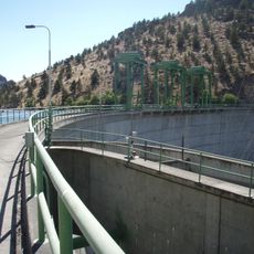
Round Butte Dam, Hydroelectric power station in Jefferson County, Oregon, US

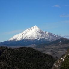
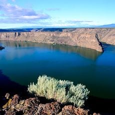
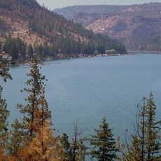
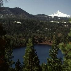
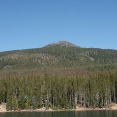
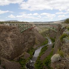
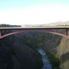
Round Butte Dam is an embankment dam crossing the Deschutes River in Oregon. The structure creates a large reservoir called Lake Billy Chinook that serves both power generation and water storage purposes for the surrounding area.

The dam was completed in 1965 as part of regional hydroelectric development efforts. Its construction represented a major engineering undertaking that transformed water management in central Oregon.

The Confederated Tribes of Warm Springs co-manage the dam with Portland General Electric, ensuring sustainable water resource management for local communities.

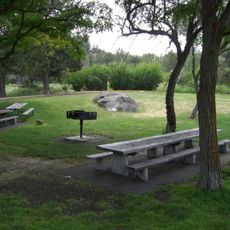
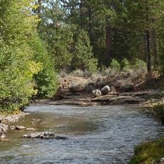
Lake Billy Chinook offers boating, fishing, and camping opportunities at various locations around its shoreline. Water conditions and facility access vary seasonally, so checking current conditions before visiting is helpful.

The facility includes specialized fish passage systems built into its structure to allow salmon and steelhead to migrate upstream. This feature represents an effort to maintain native fish populations despite the dam's presence.

The community of curious travelers

AroundUs brings together thousands of curated places, local tips, and hidden gems, enriched daily by 60,000 contributors worldwide.

Start exploring
Location
Length
421 m
GPS coordinates
44.60310,-121.27800
Latest update
December 12, 2025 14:20
Around this place
Smith Rock State Park
United States of America

Smith Rock State Park

28.3 km
Mount Jefferson
United States of America

Mount Jefferson

42.1 km
Lake Billy Chinook
United States of America

Lake Billy Chinook

7.1 km
The Cove Palisades State Park
United States of America

The Cove Palisades State Park

120 m
Petersen Rock Garden
United States of America

Petersen Rock Garden

44.5 km
Mount Jefferson Wilderness
United States of America

Mount Jefferson Wilderness

42 km
Cline Falls State Scenic Viewpoint
United States of America

Cline Falls State Scenic Viewpoint

37.3 km
Crooked River High Bridge
United States of America

Crooked River High Bridge

24.4 km
Blue Lake Crater
United States of America

Blue Lake Crater

44.8 km
Peter Skene Ogden State Scenic Viewpoint
United States of America

Peter Skene Ogden State Scenic Viewpoint

24.5 km
Olallie Butte
United States of America

Olallie Butte

45.5 km
Elliott Corbett Memorial State Recreation Site
United States of America

Elliott Corbett Memorial State Recreation Site

44.9 km
Crooked River Railroad Bridge
United States of America

Crooked River Railroad Bridge

24.5 km
Pelton Dam
United States of America

Pelton Dam

10.8 km
Crooked River Gorge
United States of America

Crooked River Gorge

21.1 km
Sisters State Park
United States of America

Sisters State Park

40.7 km
Skylight Cave
United States of America

Skylight Cave

44.9 km
Rex T. Barber Veterans Memorial Bridge
United States of America

Rex T. Barber Veterans Memorial Bridge

24.3 km
Milton Odem House
United States of America

Milton Odem House

37.8 km
The Museum at Warm Springs
United States of America

The Museum at Warm Springs

17.9 km
New Redmond Hotel
United States of America

New Redmond Hotel

37.7 km
First Presbyterian Church of Redmond
United States of America

First Presbyterian Church of Redmond

37.5 km
Grizzly Mountain
United States of America

Grizzly Mountain

31.5 km
Sisters High School
United States of America

Sisters High School

40.7 km
Camp Sherman Community Hall
United States of America

Camp Sherman Community Hall

34.6 km
Jefferson Park Glacier
United States of America

Jefferson Park Glacier

42.8 km
Whitewater Glacier
United States of America

Whitewater Glacier

41.6 km
Max and Ollie Lueddemann House
United States of America

Max and Ollie Lueddemann House

12.7 km
Show the full map
Reviews
Share your experience

No review yet

Discussions
Start a discussion...

No discussion yet

« Round Butte Dam - Hydroelectric power station in Jefferson County, Oregon, US » is provided by Around Us (aroundus.com). Images and texts are derived from Wikimedia project under a Creative Commons license. You are allowed to copy, distribute, and modify copies of this page, under the conditions set by the license, as long as this note is clearly visible.

Discover hidden gems everywhere you go!

From secret cafés to breathtaking viewpoints, skip the crowded tourist spots and find places that match your style. Our app makes it easy with voice search, smart filtering, route optimization, and insider tips from travelers worldwide. Download now for the complete mobile experience.

Around Us App Screenshot

A unique approach to discovering new places

Le Figaro

All the places worth exploring

France Info

A tailor-made excursion in just a few clicks

20 Minutes

Around Us
Travel Guide & Maps
Download

Send to your phone

QR Code
1

Open the camera app on your mobile.

2

Point at the QR code with your camera. A notification will appear.

3

Tap the notification to open the link.