Stein River, Mountain river in Thompson-Nicola Regional District, Canada
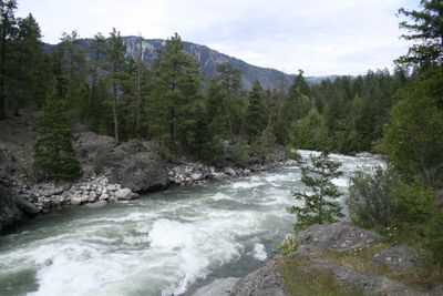
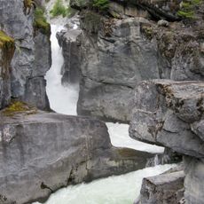
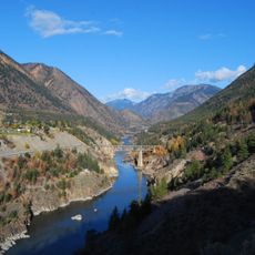
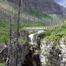
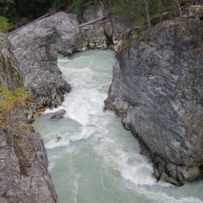
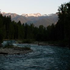
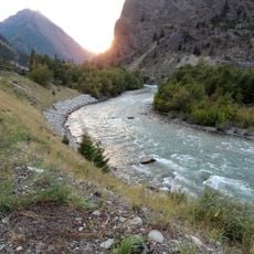
Stein River flows 50 kilometers from Tundra Lake through dense forests and steep cliffs before joining the Fraser River near Lytton. The system forms an unbroken river network with numerous waterfalls and narrow gorges throughout its length.
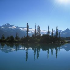
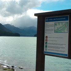
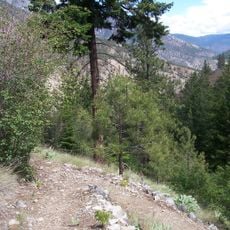
The Nlaka'pamux named the river system Stagyn, meaning hidden place, referring to the valley's concealed nature. The region has been inhabited for thousands of years and remains significant to these communities today.
The valley holds several archaeological sites showing long settlement by the Nlaka'pamux people. Visitors can still see traces of this history in the landscape and in the names that shape the valley today.
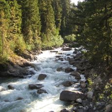
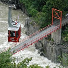
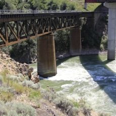
The best time for kayaking is between July and August when water levels allow safe navigation. Visitors should prepare for challenging conditions and only venture into these waters with proper experience.
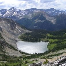
This is one of only two unlogged watersheds larger than 50 kilometers south of Prince George in British Columbia. The fact that the system has remained untouched by logging makes it a rare example of largely unchanged river landscapes in the region.
Location: Thompson-Nicola Regional District
GPS coordinates: 50.28575,-121.97773
Latest update: December 14, 2025 16:44
Joffre Lakes Provincial Park
36.2 km
Garibaldi Provincial Park
68.8 km
Nairn Falls Provincial Park
59.8 km
Cisco Bridges
32 km
Lillooet River
59.4 km
Cayoosh Creek
27.7 km
Birkenhead Lake Provincial Park
64 km
Stein Valley Nlaka'pamux Heritage Park
3.7 km
Duffey Lake Provincial Park
29 km
Marble Canyon
64.4 km
Hell's Gate Airtram
67.7 km
Church of the Holy Cross, Skatin
49.5 km
Green River
62.6 km
Birkenhead River
57.2 kmMarble Canyon Provincial Park
67.3 km
Skihist Provincial Park
32.4 km
Miyazaki House
45.5 km
Blackcomb Glacier Provincial Park
67.2 km
Bridge of the Twenty-Three Camels
44.4 kmBridge River Rapids
51.8 km
Lillooet Suspension Bridge
47.6 km
Lytton CNR Fraser Bridge
28.8 km
Seton River
45.8 km
Gallery and Gift Shop
71.6 km
Lytton CNR Thompson Bridge
28.8 km
Nlháxten/Cerise Creek Conservancy
33.4 km
CPR Cisco Bridge
32.3 km
Highway 99 (BC) (South)
45.3 kmVisited this place? Tap the stars to rate it and share your experience / photos with the community! Try now! You can cancel it anytime.
Discover hidden gems everywhere you go!
From secret cafés to breathtaking viewpoints, skip the crowded tourist spots and find places that match your style. Our app makes it easy with voice search, smart filtering, route optimization, and insider tips from travelers worldwide. Download now for the complete mobile experience.
A unique approach to discovering new places❞
— Le Figaro
All the places worth exploring❞
— France Info
A tailor-made excursion in just a few clicks❞
— 20 Minutes