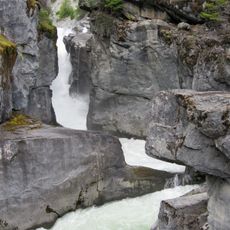
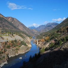
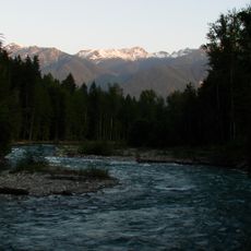
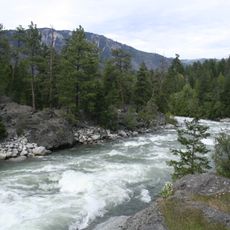
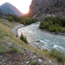
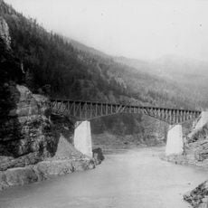
Bridge River Rapids, Rapids in Fraser River, British Columbia.
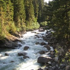
Bridge River Rapids form a narrow section of the Fraser River where water flows with intense force between steep banks. The water moves rapidly through this compressed stretch, creating a dramatic section of the river corridor.
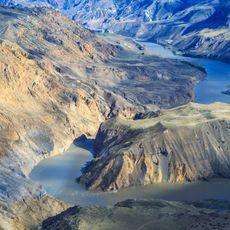
These rapids formed through natural geological processes and were used for generations by indigenous communities for salmon fishing. The Bridge River Power Project in 1958 significantly altered the natural water flow patterns that had existed for centuries.
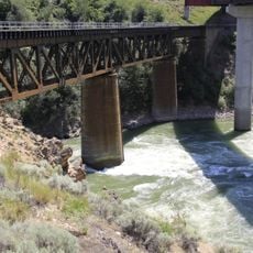
Indigenous peoples established specific fishing methods here, with traditional platforms built to catch salmon during seasonal migrations through these rapids.
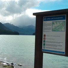
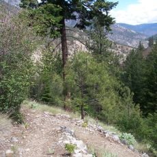
Access requires permission from local Indigenous groups, and parking is limited to designated areas near the site. Wear sturdy footwear and prepare for slippery surfaces, especially when water levels are high after rainfall or snowmelt.
Local fishers built specialized structures over the water that offered protection from rain while remaining open to natural air flow. These ingenious platforms took advantage of strong local winds for drying their catch efficiently.
Location: British Columbia
Elevation above the sea: 304 m
GPS coordinates: 50.75000,-121.93300
Latest update: December 14, 2025 17:41
Joffre Lakes Provincial Park
59.4 km
Nairn Falls Provincial Park
80.7 km
McAbee Fossil Beds
56 km
Bridge River
53.3 km
Cisco Bridges
71.1 km
Lillooet River
77 km
Cayoosh Creek
35 km
Birkenhead Lake Provincial Park
60.6 km
Stein Valley Nlaka'pamux Heritage Park
55.1 km
Duffey Lake Provincial Park
48.1 km
Marble Canyon
19.9 km
Carpenter Lake
41.4 km
Chasm Provincial Park
59.1 km
Churn Creek Protected Area
81.6 km
Birkenhead River
63.6 km
Marble Canyon Provincial Park
20 km
Skihist Provincial Park
61.6 km
Miyazaki House
6.3 km
Bridge of the Twenty-Three Camels
7.4 km
Stein River
51.8 km
Juniper Beach Provincial Park
60 km
Lillooet Suspension Bridge
4.5 km
Lytton CNR Fraser Bridge
63.5 km
Seton River
15 km
Lytton CNR Thompson Bridge
62.3 km
French Bar Canyon
54.1 km
Nlháxten/Cerise Creek Conservancy
56.2 km
CPR Cisco Bridge
71.5 kmVisited this place? Tap the stars to rate it and share your experience / photos with the community! Try now! You can cancel it anytime.
Discover hidden gems everywhere you go!
From secret cafés to breathtaking viewpoints, skip the crowded tourist spots and find places that match your style. Our app makes it easy with voice search, smart filtering, route optimization, and insider tips from travelers worldwide. Download now for the complete mobile experience.
A unique approach to discovering new places❞
— Le Figaro
All the places worth exploring❞
— France Info
A tailor-made excursion in just a few clicks❞
— 20 Minutes