Chest opened
+${chestReward.xp} XP
Explorer
NOUVEAU ×${chestReward.collectible.quantity}
tapez pour fermer
Chest locked

Open chests in the app

Around Us is built for your phone — chests unlock when you walk, explore and capture nearby places.

Enable Location

We need your location to show you interesting places around you

Discover nearby places

Find interesting locations and hidden gems around you

Precise directions

Get accurate directions and distances to places

Your location is never shared with other users. It's only used when you tap the location button.

Dumont Dunes

Log in to your account

Start exploring — it's free

Trusted by 72,883 travelers worldwide

Continue with Google
Continue with Apple
or

We will send you a code to connect

By continuing, you accept our Terms and Conditions and our Privacy Policy

Check your inbox

We've sent a pincode in your inbox. Please enter the code below.

Dumont Dunes
Discussion Reviews 1 Photos
10.4k Popularity

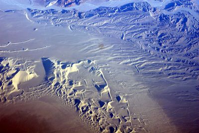
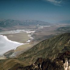
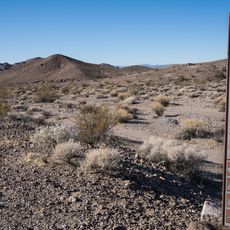
Dumont Dunes, Sand dunes in Mojave Desert, California.

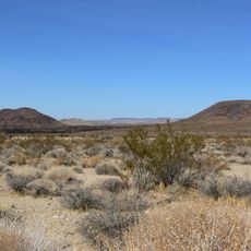
Dumont Dunes is an expanse of sand formations in California's Mojave Desert with rolling hills and flatter sections that create varied terrain for visitors to explore. The site is managed as an off-highway vehicle recreation area where motorized activities take place across the open landscape.

The dunes were named after Harry Dumont, a borax industry figure whose work connected him to railroad development in the early 1900s. The area subsequently became designated as public land managed for vehicle recreation purposes.

This area has become a gathering place for off-highway vehicle enthusiasts who enjoy riding and driving across the sand. People come from surrounding regions to experience the freedom of motorized recreation in an open desert setting.

Before heading into the dunes, visitors should prepare their vehicles and check current conditions, as the shifting sand can create challenging driving situations. It is wise to understand terrain hazards and ensure your vehicle is properly equipped before spending time here.

The Mojave fringe-toed lizard has adapted specially to survive in these shifting sand dunes and extreme desert temperatures. This small reptile uses its unique feet to move efficiently through the sand and burrows to escape the heat.

The community of curious travelers

AroundUs brings together thousands of curated places, local tips, and hidden gems, enriched daily by 60,000 contributors worldwide.

Start exploring
Location
Part of
Mojave Desert
GPS coordinates
35.68333,-116.21944
Latest update
December 10, 2025 15:54
Around this place
Chicken Ranch
United States of America

Chicken Ranch

49.5 km
Deep Space Network
United States of America

Deep Space Network

67.1 km
Goldstone Deep Space Communications Complex
United States of America

Goldstone Deep Space Communications Complex

67.1 km
Desperado
United States of America

Desperado

76 km
Dante's View
United States of America

Dante's View

75.3 km
Amargosa Opera House and Hotel
United States of America

Amargosa Opera House and Hotel

71.1 km
World's Tallest Thermometer
United States of America

World's Tallest Thermometer

48.3 km
Cima volcanic field
United States of America

Cima volcanic field

64.3 km
Spring Mountain Motorsports Ranch
United States of America

Spring Mountain Motorsports Ranch

61 km
Mojave Memorial Cross
United States of America

Mojave Memorial Cross

73.2 km
Cima Dome & Volcanic Field National Natural Landmark
United States of America

Cima Dome & Volcanic Field National Natural Landmark

64.3 km
Goldstone Solar System Radar
United States of America

Goldstone Solar System Radar

67.1 km
Clark Mountain
United States of America

Clark Mountain

59.7 km
Mount Charleston Wilderness
United States of America

Mount Charleston Wilderness

80.1 km
Aztec Sandstone
United States of America

Aztec Sandstone

73 km
Goodsprings Schoolhouse
United States of America

Goodsprings Schoolhouse

72.7 km
United States of America

Carpenter Canyon

67.5 km
Potosi Mining District
United States of America

Potosi Mining District

69.1 km
Saddle Peak Hills Wilderness
United States of America

Saddle Peak Hills Wilderness

15.7 km
Saratoga Springs
United States of America

Saratoga Springs

18.5 km
Griffith Peak
United States of America

Griffith Peak

80 km
Jubilee Pass
United States of America

Jubilee Pass

41.2 km
DSS 14
United States of America

DSS 14

67.1 km
Salsberry Pass
United States of America

Salsberry Pass

33 km
DSS 13
United States of America

DSS 13

67.1 km
Badwater Observation Point
United States of America

Badwater Observation Point

78.4 km
Black Velvet Canyon
United States of America

Black Velvet Canyon

79.7 km
Pioneer Saloon
United States of America

Pioneer Saloon

73.1 km
Show the full map
Reviews
Share your experience

No review yet

Discussions
Start a discussion...

No discussion yet

« Dumont Dunes - Sand dunes in Mojave Desert, California » is provided by Around Us (aroundus.com). Images and texts are derived from Wikimedia project under a Creative Commons license. You are allowed to copy, distribute, and modify copies of this page, under the conditions set by the license, as long as this note is clearly visible.

Discover hidden gems everywhere you go!

From secret cafés to breathtaking viewpoints, skip the crowded tourist spots and find places that match your style. Our app makes it easy with voice search, smart filtering, route optimization, and insider tips from travelers worldwide. Download now for the complete mobile experience.

Around Us App Screenshot

A unique approach to discovering new places

Le Figaro

All the places worth exploring

France Info

A tailor-made excursion in just a few clicks

20 Minutes

Around Us
Travel Guide & Maps
Download

Send to your phone

QR Code
1

Open the camera app on your mobile.

2

Point at the QR code with your camera. A notification will appear.

3

Tap the notification to open the link.