Red Slate Mountain, Mountain summit in Mono County, California
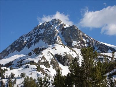
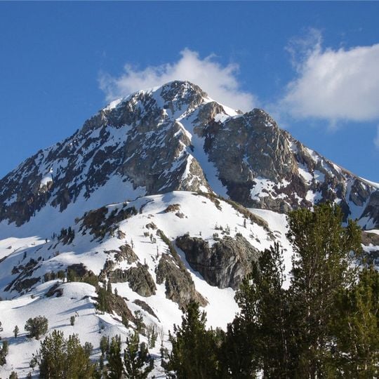
Red Slate Mountain rises to 4013 meters (13,165 feet) in the Sierra Nevada and forms a natural boundary between Fresno and Mono Counties. The peak sits along the high ridge crest that divides these two regions.
The California Geological Survey named the peak in 1873, though it is unclear whether the name was meant for this summit or for the mountain now called Red and White Mountain. The first recorded ascent, by Joseph LeConte and Clarence Cory, came in 1898.
The name was assigned by the California Geological Survey in 1873, though it is unclear whether the survey meant this peak or the one now called Red-and-White Mountain. Climbers today reach the summit by scrambling from McGee Pass or from Bighorn Lake.
The summit is reached by scrambling, with routes starting either from McGee Pass or from Bighorn Lake. Both approaches cross high alpine terrain, so plan for snow on the upper slopes and exposed rock near the top. The peak sits on the Sierra Crest dividing Fresno and Mono Counties.
The peak's name was assigned by the California Geological Survey in 1873, but the survey's records leave it unclear whether the name was meant for this summit or for the mountain now called Red-and-White Mountain. The area north of the mountain is among the most seismically active in California, linked to the Long Valley Caldera.
The community of curious travelers
AroundUs brings together thousands of curated places, local tips, and hidden gems, enriched daily by 93,109 contributors worldwide.