Chest opened
+${chestReward.xp} XP
Explorer
NOUVEAU ×${chestReward.collectible.quantity}
tapez pour fermer
Chest locked

Open chests in the app

Around Us is built for your phone — chests unlock when you walk, explore and capture nearby places.

Enable Location

We need your location to show you interesting places around you

Discover nearby places

Find interesting locations and hidden gems around you

Precise directions

Get accurate directions and distances to places

Your location is never shared with other users. It's only used when you tap the location button.

Cal-Nev-Ari

Log in to your account

Start exploring — it's free

Trusted by 72,900 travelers worldwide

Continue with Google
Continue with Apple
or

We will send you a code to connect

By continuing, you accept our Terms and Conditions and our Privacy Policy

Check your inbox

We've sent a pincode in your inbox. Please enter the code below.

Discussion Reviews 1 Photos
15.9k Popularity

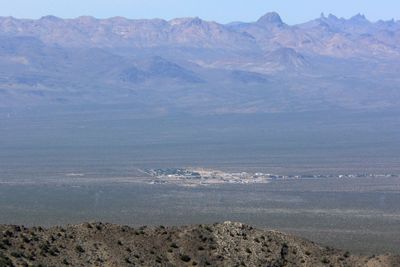
Cal-Nev-Ari, Desert settlement in Clark County, United States.

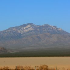
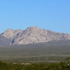
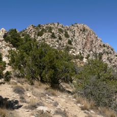
Cal-Nev-Ari is a small desert settlement located where Nevada, California, and Arizona meet, serving as a remote outpost in an otherwise isolated landscape. The community features a casino, motel, RV parks, and a private airstrip that caters to travelers passing through this tri-state region.

The settlement was established in 1965 by Nancy and Everette Kidwell after purchasing 640 acres from the federal government. Their private venture aimed to create an independent community in one of the country's most remote locations.

The population of 133 residents maintains a close connection through community events and shared appreciation for rural desert living.

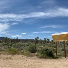
The settlement requires a car to reach and demands adequate fuel for the long desert drive through remote highways. Visitors should prepare for extreme heat, limited services, and considerable distances to other towns and cities.

The community's name combines syllables from its three neighboring states, marking the symbolic meeting point of their borders. This geographical quirk makes it an unusual stop for adventurers and curious travelers from around the world.

The community of curious travelers

AroundUs brings together thousands of curated places, local tips, and hidden gems, enriched daily by 60,000 contributors worldwide.

Start exploring
Location
GPS coordinates
35.30333,-114.88083
Latest update
December 7, 2025 19:28
Around this place
Mojave National Preserve
United States of America

Mojave National Preserve

89.3 km
United States of America

AN/URC-117 Ground Wave Emergency Network

69.2 km
Desperado
United States of America

Desperado

57.3 km
Black Canyon of the Colorado
United States of America

Black Canyon of the Colorado

58 km
Mitchell Caverns
United States of America

Mitchell Caverns

70.4 km
Castle Mountains National Monument
United States of America

Castle Mountains National Monument

17 km
Sloan Canyon National Conservation Area
United States of America

Sloan Canyon National Conservation Area

68 km
El Dorado Canyon
United States of America

El Dorado Canyon

47.7 km
Grapevine Canyon Petroglyphs
United States of America

Grapevine Canyon Petroglyphs

19.6 km
Mojave Memorial Cross
United States of America

Mojave Memorial Cross

60.8 km
Providence Mountains State Recreation Area
United States of America

Providence Mountains State Recreation Area

69.5 km
Havasu National Wildlife Refuge
United States of America

Havasu National Wildlife Refuge

65.8 km
Clark Mountain
United States of America

Clark Mountain

68.8 km
Spirit Mountain
United States of America

Spirit Mountain

14.6 km
Bigelow Cholla Garden Wilderness
United States of America

Bigelow Cholla Garden Wilderness

52.1 km
Dead Mountains
United States of America

Dead Mountains

36.9 km
Spirit Mountain Wilderness
United States of America

Spirit Mountain Wilderness

22.2 km
Warm Springs Wilderness
United States of America

Warm Springs Wilderness

69.1 km
United States of America

Bridge Canyon Wilderness

18.6 km
Boundary Cone
United States of America

Boundary Cone

55.3 km
Hardyville Cemetery
United States of America

Hardyville Cemetery

33.5 km
Grapevine Canyon
United States of America

Grapevine Canyon

19.6 km
United States of America

Alexey W. Von Schmidt

37.9 km
Goffs Schoolhouse
United States of America

Goffs Schoolhouse

45.5 km
Wee Thump Joshua Tree Wilderness, Nevada
United States of America

Wee Thump Joshua Tree Wilderness, Nevada

32.4 km
Oatman Drug Company Building
United States of America

Oatman Drug Company Building

54.9 km
Seven Magic Mountains
United States of America

Seven Magic Mountains

69.4 km
Emerald Cove
United States of America

Emerald Cove

67.7 km
Show the full map
Reviews
Share your experience

No review yet

Discussions
Start a discussion...

No discussion yet

« Cal-Nev-Ari - Desert settlement in Clark County, United States » is provided by Around Us (aroundus.com). Images and texts are derived from Wikimedia project under a Creative Commons license. You are allowed to copy, distribute, and modify copies of this page, under the conditions set by the license, as long as this note is clearly visible.

Discover hidden gems everywhere you go!

From secret cafés to breathtaking viewpoints, skip the crowded tourist spots and find places that match your style. Our app makes it easy with voice search, smart filtering, route optimization, and insider tips from travelers worldwide. Download now for the complete mobile experience.

Around Us App Screenshot

A unique approach to discovering new places

Le Figaro

All the places worth exploring

France Info

A tailor-made excursion in just a few clicks

20 Minutes

Around Us
Travel Guide & Maps
Download

Send to your phone

QR Code
1

Open the camera app on your mobile.

2

Point at the QR code with your camera. A notification will appear.

3

Tap the notification to open the link.