Chest opened
+${chestReward.xp} XP
Explorer
NOUVEAU ×${chestReward.collectible.quantity}
tapez pour fermer
Chest locked

Open chests in the app

Around Us is built for your phone — chests unlock when you walk, explore and capture nearby places.

Enable Location

We need your location to show you interesting places around you

Discover nearby places

Find interesting locations and hidden gems around you

Precise directions

Get accurate directions and distances to places

Your location is never shared with other users. It's only used when you tap the location button.

Log in to your account

Start exploring — it's free

Trusted by 72,891 travelers worldwide

Continue with Google
Continue with Apple
or

We will send you a code to connect

By continuing, you accept our Terms and Conditions and our Privacy Policy

Check your inbox

We've sent a pincode in your inbox. Please enter the code below.

Shadow Mountains
Discussion Reviews Photo
14.7k Popularity

Shadow Mountains, Mountain range in Mojave Desert, California, United States.

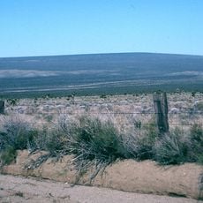
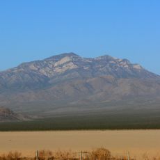
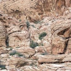
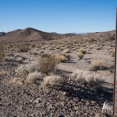
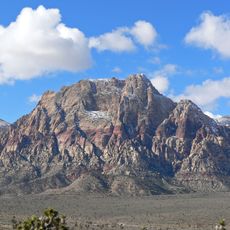
The Shadow Mountains are a mountain range in eastern San Bernardino County that rises to approximately 1,240 meters (4,000 ft). Limestone formations dominate the landscape, creating the distinctive geology of this desert region.

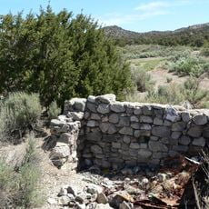
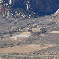
Mining operations shaped the region, with the Eastern Star Mine at the western edge being a key element of this activity. These operations influenced the early development of the area during California's mining era.

Native American tribes traversed these mountains for generations, leaving behind artifacts and stories that connect to their ancestral territories.

Winter offers the best hiking conditions with mild temperatures and clear skies. Access is available via Interstate 15 and Highway 395 near Adelanto.

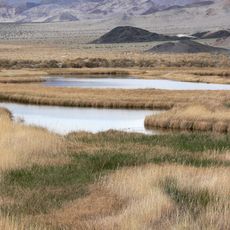
Kingston Spring in the northwestern section provides a rare water source in this arid desert region. This spring has sustained both people and wildlife across generations.

The community of curious travelers

AroundUs brings together thousands of curated places, local tips, and hidden gems, enriched daily by 60,000 contributors worldwide.

Start exploring
Location
Elevation above the sea
1,243 m
GPS coordinates
35.58720,-115.90200
Latest update
December 7, 2025 20:20
Around this place
Chicken Ranch
United States of America

Chicken Ranch

54.4 km
Red Rock Canyon National Conservation Area
United States of America

Red Rock Canyon National Conservation Area

74.6 km
Desperado
United States of America

Desperado

47 km
Bonnie Springs Ranch
United States of America

Bonnie Springs Ranch

66.3 km
World's Tallest Thermometer
United States of America

World's Tallest Thermometer

38.9 km
Spring Mountain Ranch State Park
United States of America

Spring Mountain Ranch State Park

66.8 km
Spring Mountain Motorsports Ranch
United States of America

Spring Mountain Motorsports Ranch

65.1 km
Mojave Memorial Cross
United States of America

Mojave Memorial Cross

44 km
Cima Dome & Volcanic Field National Natural Landmark
United States of America

Cima Dome & Volcanic Field National Natural Landmark

40 km
Clark Mountain
United States of America

Clark Mountain

29.2 km
Aztec Sandstone
United States of America

Aztec Sandstone

54.5 km
Goodsprings Schoolhouse
United States of America

Goodsprings Schoolhouse

50.2 km
United States of America

Carpenter Canyon

66.8 km
Potosi Mining District
United States of America

Potosi Mining District

53.7 km
Saddle Peak Hills Wilderness
United States of America

Saddle Peak Hills Wilderness

45.4 km
Saratoga Springs
United States of America

Saratoga Springs

48.4 km
Mount Wilson
United States of America

Mount Wilson

67.8 km
Sandstone Ranch
United States of America

Sandstone Ranch

66.8 km
Seven Magic Mountains
United States of America

Seven Magic Mountains

63.6 km
Salsberry Pass
United States of America

Salsberry Pass

60.7 km
Main Ranch House
United States of America

Main Ranch House

67 km
Gold Town Casino
United States of America

Gold Town Casino

69.6 km
Black Velvet Canyon
United States of America

Black Velvet Canyon

64.4 km
Juniper Canyon
United States of America

Juniper Canyon

69.6 km
Pioneer Saloon
United States of America

Pioneer Saloon

50.5 km
Oak Creek Canyon
United States of America

Oak Creek Canyon

68.4 km
First Creek Canyon
United States of America

First Creek Canyon

68.6 km
Afton Canyon
United States of America

Afton Canyon

69.8 km
Show the full map
Reviews
Share your experience

No review yet

Discussions
Start a discussion...

No discussion yet

« Shadow Mountains - Mountain range in Mojave Desert, California, United States » is provided by Around Us (aroundus.com). Images and texts are derived from Wikimedia project under a Creative Commons license. You are allowed to copy, distribute, and modify copies of this page, under the conditions set by the license, as long as this note is clearly visible.

Discover hidden gems everywhere you go!

From secret cafés to breathtaking viewpoints, skip the crowded tourist spots and find places that match your style. Our app makes it easy with voice search, smart filtering, route optimization, and insider tips from travelers worldwide. Download now for the complete mobile experience.

Around Us App Screenshot

A unique approach to discovering new places

Le Figaro

All the places worth exploring

France Info

A tailor-made excursion in just a few clicks

20 Minutes

Around Us
Travel Guide & Maps
Download

Send to your phone

QR Code
1

Open the camera app on your mobile.

2

Point at the QR code with your camera. A notification will appear.

3

Tap the notification to open the link.