Chest opened
+${chestReward.xp} XP
Explorer
NOUVEAU ×${chestReward.collectible.quantity}
tapez pour fermer
Chest locked

Open chests in the app

Around Us is built for your phone — chests unlock when you walk, explore and capture nearby places.

Enable Location

We need your location to show you interesting places around you

Discover nearby places

Find interesting locations and hidden gems around you

Precise directions

Get accurate directions and distances to places

Your location is never shared with other users. It's only used when you tap the location button.

Railroad Valley

Log in to your account

Start exploring — it's free

Trusted by 72,892 travelers worldwide

Continue with Google
Continue with Apple
or

We will send you a code to connect

By continuing, you accept our Terms and Conditions and our Privacy Policy

Check your inbox

We've sent a pincode in your inbox. Please enter the code below.

Railroad Valley
Discussion Reviews 1 Photos
2.2k Popularity

Railroad Valley, Desert basin in Nye and White Pine Counties, Nevada, United States

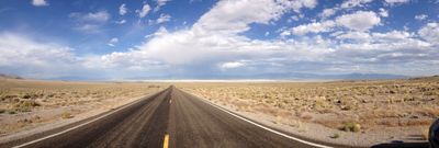
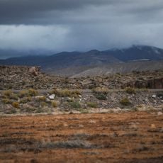
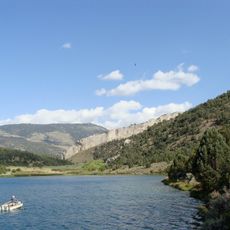
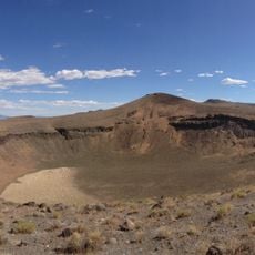
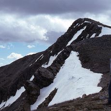
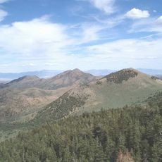
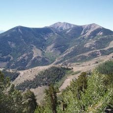
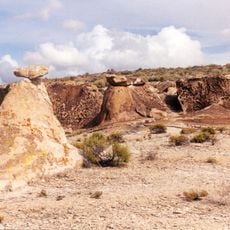
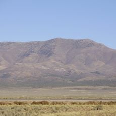
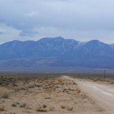
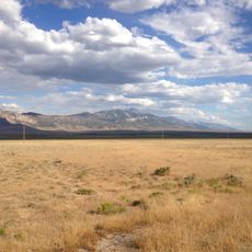
Railroad Valley is a broad desert basin in Nevada bordered by several mountain ranges including Quinn Canyon, Grant, White Pine, Pancake, and Reveille. The landscape consists of open, flat terrain at approximately 5,200 feet elevation surrounded by these rugged peaks.

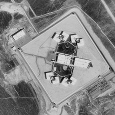
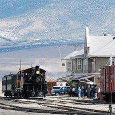
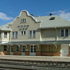
Oil exploration began in 1954 when drilling operations discovered Eagle Springs Field. The site developed into productive operations with multiple wells by the late 1960s.

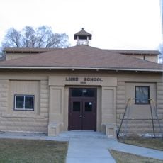
The Tsaidüka band of Western Shoshone, now part of the Duckwater Shoshone Tribe, maintain their ancestral connections to Railroad Valley.

Visitors should carry abundant water, food, and fuel since the location is far from towns and services. The remote setting demands careful planning and proper equipment for safety.

The flat terrain serves space agencies for satellite calibration work. Beneath the surface lie substantial lithium deposits, among the largest in North America.

The community of curious travelers

AroundUs brings together thousands of curated places, local tips, and hidden gems, enriched daily by 60,000 contributors worldwide.

Start exploring
Location
Elevation above the sea
5,200 ft
GPS coordinates
38.87521,-115.60198
Latest update
December 13, 2025 17:07
Around this place
Ely State Prison
United States of America

Ely State Prison

80.7 km
Basin and Range National Monument
United States of America

Basin and Range National Monument

101.9 km
Ward Charcoal Ovens State Historic Park
United States of America

Ward Charcoal Ovens State Historic Park

67.8 km
Nevada Northern Railway Museum
United States of America

Nevada Northern Railway Museum

76.5 km
Hotel Nevada and Gambling Hall
United States of America

Hotel Nevada and Gambling Hall

74 km
Cave Lake State Park
United States of America

Cave Lake State Park

83.7 km
Lunar Crater National Natural Landmark
United States of America

Lunar Crater National Natural Landmark

68.1 km
North Schell Peak
United States of America

North Schell Peak

105.3 km
Red Mountain Wilderness
United States of America

Red Mountain Wilderness

23.5 km
High Schells Wilderness
United States of America

High Schells Wilderness

100.9 km
Quinn Canyon Wilderness
United States of America

Quinn Canyon Wilderness

81 km
Weepah Spring Wilderness
United States of America

Weepah Spring Wilderness

107.1 km
Currant Mountain Wilderness
United States of America

Currant Mountain Wilderness

16 km
South Egan Range Wilderness
United States of America

South Egan Range Wilderness

61.2 km
Diamond Peak
United States of America

Diamond Peak

81.2 km
Central Theatre
United States of America

Central Theatre

75 km
Fortification Range Wilderness
United States of America

Fortification Range Wilderness

105.5 km
Currant Mountain
United States of America

Currant Mountain

15.9 km
Ely L.D.S. Stake Tabernacle
United States of America

Ely L.D.S. Stake Tabernacle

74.4 km
Capital Theatre
United States of America

Capital Theatre

74 km
Troy Peak
United States of America

Troy Peak

62.6 km
White Pine County Courthouse
United States of America

White Pine County Courthouse

74.4 km
Eureka Historic District
United States of America

Eureka Historic District

77.6 km
Lund Grade School
United States of America

Lund Grade School

51.5 km
Bahsahwahbee
United States of America

Bahsahwahbee

103.9 km
Nevada Northern Railway East Ely Yards and Shops
United States of America

Nevada Northern Railway East Ely Yards and Shops

76.5 km
East Ely Depot
United States of America

East Ely Depot

76.5 km
Ward Charcoal Ovens
United States of America

Ward Charcoal Ovens

67.8 km
Show the full map
Reviews
Share your experience

No review yet

Discussions
Start a discussion...

No discussion yet

« Railroad Valley - Desert basin in Nye and White Pine Counties, Nevada, United States » is provided by Around Us (aroundus.com). Images and texts are derived from Wikimedia project under a Creative Commons license. You are allowed to copy, distribute, and modify copies of this page, under the conditions set by the license, as long as this note is clearly visible.

Discover hidden gems everywhere you go!

From secret cafés to breathtaking viewpoints, skip the crowded tourist spots and find places that match your style. Our app makes it easy with voice search, smart filtering, route optimization, and insider tips from travelers worldwide. Download now for the complete mobile experience.

Around Us App Screenshot

A unique approach to discovering new places

Le Figaro

All the places worth exploring

France Info

A tailor-made excursion in just a few clicks

20 Minutes

Around Us
Travel Guide & Maps
Download

Send to your phone

QR Code
1

Open the camera app on your mobile.

2

Point at the QR code with your camera. A notification will appear.

3

Tap the notification to open the link.