Alamosa County

Log in to your account

AroundUs is a community-driven map of interesting places, built by curious explorers like you. It grows with every review, story, and photo you share.
Connect to save your favorite spots, contribute locations, and create personalized routes.
Continue with Google
Continue with Apple
Continue with X
Continue with Facebook
Continue with email
By continuing, you accept our Terms and Conditions and our Privacy Policy
Create an account
Add to collection
Map
Suggest a change
Share

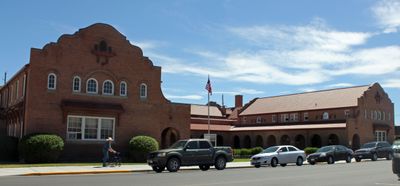
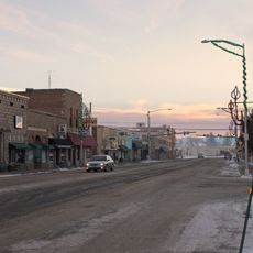
Alamosa County, County in southern Colorado, United States.

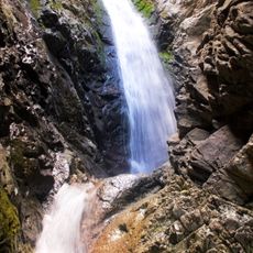
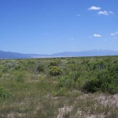
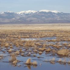
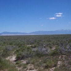
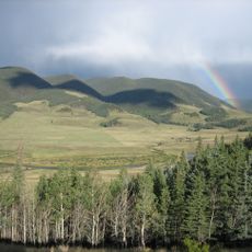
Alamosa County is a county in southern Colorado with mountains, valleys, and protected natural areas spread across the San Luis Valley. The landscape shifts between high plains and mountain ranges that define the region's character.

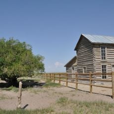
The county was created in 1913 when the Colorado legislature separated the northwestern part of Costilla County to form a new administrative district. This establishment marked an important moment in how the San Luis Valley region was organized.

The name Alamosa comes from Spanish and means cottonwood tree, reflecting the trees that line the Rio Grande throughout the valley. This vegetation shapes how the landscape looks and feels to visitors passing through.

The area is accessible through major highways including US Highway 160 and US Highway 285 that connect to neighboring regions. Keep in mind that the location in a mountain region and spread-out landscape mean longer travel times between different sites.

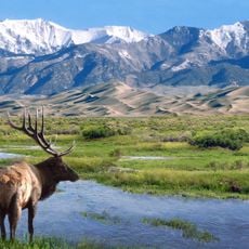
The area contains sections of Great Sand Dunes National Park, which has some of North America's highest sand formations within a protected natural area. These unusual dunes formed over thousands of years and stand out dramatically against the surrounding mountain landscape.

Location: Colorado

Inception: March 8, 1913

Capital city: Alamosa

Shares border with: Saguache County, Huerfano County, Costilla County, Conejos County, Rio Grande County

Website: http://alamosacounty.org

GPS coordinates: 37.57000,-105.78000

Latest update: December 14, 2025 20:26

Photos
Around this place
Blanca Peak
United States of America

Blanca Peak

26 km
Zapata Falls
United States of America

Zapata Falls

20.7 km
Rio Grande Scenic Railroad
United States of America

Rio Grande Scenic Railroad

13.7 km
UFO Watchtower
United States of America

UFO Watchtower

26.1 km
Fort Garland
United States of America

Fort Garland

34.8 km
Little Bear Peak
United States of America

Little Bear Peak

25 km
Mount Lindsey
United States of America

Mount Lindsey

29.6 km
Baca National Wildlife Refuge
United States of America

Baca National Wildlife Refuge

33.1 km
Monte Vista National Wildlife Refuge
United States of America

Monte Vista National Wildlife Refuge

29.2 km
Alamosa National Wildlife Refuge
United States of America

Alamosa National Wildlife Refuge

18 km
Ellingwood Point
United States of America

Ellingwood Point

25.4 km
Pike's Stockade
United States of America

Pike's Stockade

30.9 km
D&RGW 169
United States of America

D&RGW 169

13.3 km
United States of America

San Luis Hills

45 km
Closed Basin Project
United States of America

Closed Basin Project

9.6 km
United States of America

Iron Mountain

47 km
San Luis Valley Conservation Area
United States of America

San Luis Valley Conservation Area

29.7 km
St. Thomas Episcopal Church
United States of America

St. Thomas Episcopal Church

13.5 km
Trujillo Homestead
United States of America

Trujillo Homestead

18.6 km
American National Bank Building
United States of America

American National Bank Building

13.6 km
Carnegie Library
United States of America

Carnegie Library

32.2 km
Superintendent's Residence, Great Sand Dunes National Monument
United States of America

Superintendent's Residence, Great Sand Dunes National Monument

28.8 km
San Luis Southern Railway Trestle
United States of America

San Luis Southern Railway Trestle

29 km
Alamosa County Courthouse
United States of America

Alamosa County Courthouse

13.6 km
Monte Vista Downtown Historic District
United States of America

Monte Vista Downtown Historic District

32.4 km
Husung Hardware
United States of America

Husung Hardware

13.6 km
Big Spring Creek
United States of America

Big Spring Creek

25.8 km
Medano Ranch Headquarters
United States of America

Medano Ranch Headquarters

18.3 km
Show the full map
Reviews

Visited this place? Tap the stars to rate it and share your experience / photos with the community! Try now! You can cancel it anytime.

Administrative divisions
« Alamosa County - County in southern Colorado, United States » is provided by Around Us (aroundus.com). Images and texts are derived from Wikimedia project under a Creative Commons license. You are allowed to copy, distribute, and modify copies of this page, under the conditions set by the license, as long as this note is clearly visible.

Discover hidden gems everywhere you go!

From secret cafés to breathtaking viewpoints, skip the crowded tourist spots and find places that match your style. Our app makes it easy with voice search, smart filtering, route optimization, and insider tips from travelers worldwide. Download now for the complete mobile experience.

Around Us App Screenshot

A unique approach to discovering new places

Le Figaro

All the places worth exploring

France Info

A tailor-made excursion in just a few clicks

20 Minutes