Chest opened
+${chestReward.xp} XP
Explorer
NOUVEAU ×${chestReward.collectible.quantity}
tapez pour fermer
Chest locked

Open chests in the app

Around Us is built for your phone — chests unlock when you walk, explore and capture nearby places.

Enable Location

We need your location to show you interesting places around you

Discover nearby places

Find interesting locations and hidden gems around you

Precise directions

Get accurate directions and distances to places

Your location is never shared with other users. It's only used when you tap the location button.

Log in to your account

Start exploring — it's free

Trusted by 72,891 travelers worldwide

Continue with Google
Continue with Apple
or

We will send you a code to connect

By continuing, you accept our Terms and Conditions and our Privacy Policy

Check your inbox

We've sent a pincode in your inbox. Please enter the code below.

Discussion Reviews Photo
11.3k Popularity

Jeffrey City, Census-designated place in Fremont County, United States

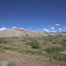
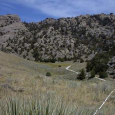
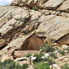
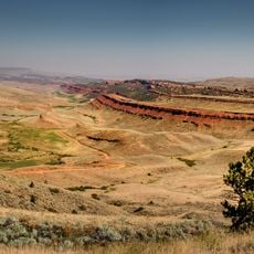
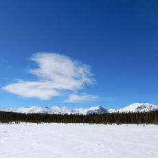
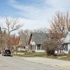
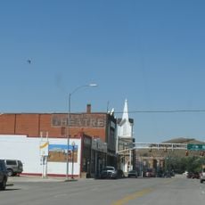
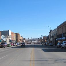
Jeffrey City is a small settlement situated at roughly 1,930 meters in Wyoming's Wind River Basin, surrounded by open plains with distant mountain ranges. The landscape is sparsely developed, with scattered buildings spread across a wide, open terrain.

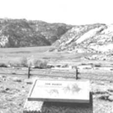
The area started in 1931 as a small homestead called Home on the Range and transformed into a mining center after 1957 when Western Nuclear Corporation began uranium operations. The uranium industry drove economic growth and brought workers to the region.

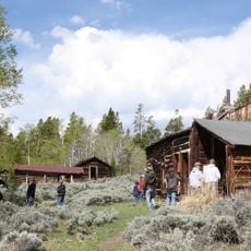
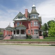
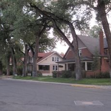
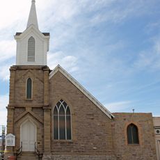
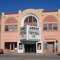
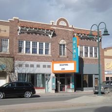
The remaining First Baptist Church, Split Rock Café, and Monk King Bird Pottery studio serve as gathering places where the handful of residents connect with each other. These spaces shape how the community maintains its identity despite its small size.

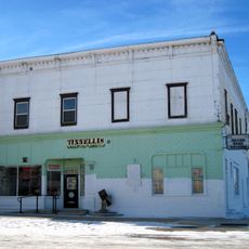
The Green Mountain Motel offers lodging, though services in the area are quite limited for travelers. Check ahead on what is open and available, since options are few and conditions can be sparse.

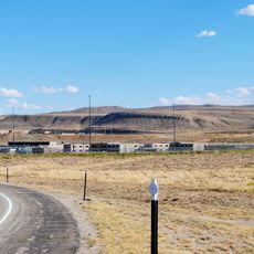
The population fell from several thousand during the uranium mining boom to around 58 residents by 2010. Abandoned buildings now dot the landscape, serving as reminders of the economic shift that reshaped the area.

The community of curious travelers

AroundUs brings together thousands of curated places, local tips, and hidden gems, enriched daily by 60,000 contributors worldwide.

Start exploring
Location
Elevation above the sea
1,931 m
GPS coordinates
42.49056,-107.82833
Latest update
December 8, 2025 13:41
Around this place
Independence Rock
United States of America

Independence Rock

57.4 km
Great Divide Basin
United States of America

Great Divide Basin

62.3 km
Devil's Gate
United States of America

Devil's Gate

50.9 km
Wyoming State Penitentiary
United States of America

Wyoming State Penitentiary

95.2 km
Martin's Cove
United States of America

Martin's Cove

48.6 km
Sinks Canyon State Park
United States of America

Sinks Canyon State Park

85.2 km
Pathfinder Dam
United States of America

Pathfinder Dam

80 km
Miner's Delight
United States of America

Miner's Delight

70 km
Phosphoria Formation
United States of America

Phosphoria Formation

60.6 km
Tom Sun Ranch
United States of America

Tom Sun Ranch

50.4 km
George Ferris Mansion
United States of America

George Ferris Mansion

91.6 km
Seminoe State Park
United States of America

Seminoe State Park

92.3 km
Frontier Formation
United States of America

Frontier Formation

44.6 km
Pathfinder National Wildlife Refuge
United States of America

Pathfinder National Wildlife Refuge

69.6 km
Red Canyon
United States of America

Red Canyon

70.9 km
Jackson Park Town Site Addition Brick Row
United States of America

Jackson Park Town Site Addition Brick Row

83.1 km
Atlantic Peak
United States of America

Atlantic Peak

97.2 km
Castle Gardens Petroglyph Site
United States of America

Castle Gardens Petroglyph Site

51.9 km
Parco Historic District
United States of America

Parco Historic District

98.5 km
Silas Canyon
United States of America

Silas Canyon

94.4 km
Rawlins Residential Historic District
United States of America

Rawlins Residential Historic District

91.8 km
France Memorial United Presbyterian Church
United States of America

France Memorial United Presbyterian Church

92.2 km
C. H. King Company and First National Bank of Shoshoni
United States of America

C. H. King Company and First National Bank of Shoshoni

86 km
United States Post Office and Courthouse
United States of America

United States Post Office and Courthouse

83.2 km
Downtown Rawlins Historic District
United States of America

Downtown Rawlins Historic District

92.2 km
Lander Downtown Historic District
United States of America

Lander Downtown Historic District

83.2 km
Grand Theatre
United States of America

Grand Theatre

83.1 km
Acme Theatre
United States of America

Acme Theatre

75 km
Show the full map
Reviews
Share your experience

No review yet

Discussions
Start a discussion...

No discussion yet

« Jeffrey City - Census-designated place in Fremont County, United States » is provided by Around Us (aroundus.com). Images and texts are derived from Wikimedia project under a Creative Commons license. You are allowed to copy, distribute, and modify copies of this page, under the conditions set by the license, as long as this note is clearly visible.

Discover hidden gems everywhere you go!

From secret cafés to breathtaking viewpoints, skip the crowded tourist spots and find places that match your style. Our app makes it easy with voice search, smart filtering, route optimization, and insider tips from travelers worldwide. Download now for the complete mobile experience.

Around Us App Screenshot

A unique approach to discovering new places

Le Figaro

All the places worth exploring

France Info

A tailor-made excursion in just a few clicks

20 Minutes

Around Us
Travel Guide & Maps
Download

Send to your phone

QR Code
1

Open the camera app on your mobile.

2

Point at the QR code with your camera. A notification will appear.

3

Tap the notification to open the link.