Clark County

Log in to your account

AroundUs is a community-driven map of interesting places, built by curious explorers like you. It grows with every review, story, and photo you share.
Connect to save your favorite spots, contribute locations, and create personalized routes.
By continuing, you accept our Terms and Conditions and our Privacy Policy
Add to collection
Map
Suggest a change
Share

Clark County, Administrative county in eastern Idaho, US
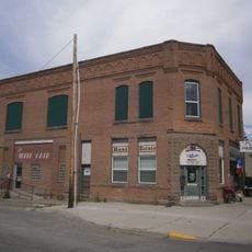
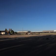
Clark County covers a region in eastern Idaho with Dubois serving as its capital and primary population center within its boundaries.

The county was officially established on February 1, 1919, and received its name from William Clark of the Lewis and Clark Expedition.

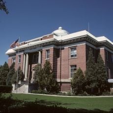
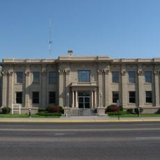
The Eighth Judicial District Court in Clark County maintains comprehensive records and provides essential legal services to all local residents.
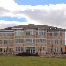
Residents can access court services through online platforms for case lookups, certified document requests, and jury duty registration processes.

The county administration includes specialized divisions for animal protection, code enforcement, and intergovernmental relations to maintain community standards.

Location: Idaho

Inception: February 1, 1919

Capital city: Dubois

Shares border with: Beaverhead County, Butte County, Jefferson County, Lemhi County, Fremont County

Website: http://clark-co.id.gov

GPS coordinates: 44.28000,-112.38000

Latest update: March 8, 2025 07:23

Around this place
Show the full map
Huckleberry Ridge Tuff
United States of America

Huckleberry Ridge Tuff

83.8 km
Island Park Caldera
United States of America

Island Park Caldera

83.8 km
Henry's Fork Caldera
United States of America

Henry's Fork Caldera

83.8 km
Mesa Falls Tuff
United States of America

Mesa Falls Tuff

83.8 km
Henrys Lake
United States of America

Henrys Lake

87.4 km
Rexburg Idaho Temple
United States of America

Rexburg Idaho Temple

71 km
Upper Mesa Falls
United States of America

Upper Mesa Falls

84.4 km
Monida Pass
United States of America

Monida Pass

31.6 km
Red Rock Lakes National Wildlife Refuge
United States of America

Red Rock Lakes National Wildlife Refuge

59.4 km
Camas National Wildlife Refuge
United States of America

Camas National Wildlife Refuge

38.1 km
Lower Mesa Falls
United States of America

Lower Mesa Falls

85.5 km
Birch Creek Charcoal Kilns
United States of America

Birch Creek Charcoal Kilns

63.8 km
Rexburg Stake Tabernacle
United States of America

Rexburg Stake Tabernacle

69.4 km
South Fremont High School
United States of America

South Fremont High School

65.2 km
Camas Meadows Battle Sites
United States of America

Camas Meadows Battle Sites

39.6 km
Bishop Mountain Lookout
United States of America

Bishop Mountain Lookout

66.1 km
St. Anthony Pegram Truss Railroad Bridge
United States of America

St. Anthony Pegram Truss Railroad Bridge

64.5 km
Ririe A Pegram Truss Railroad Bridge
United States of America

Ririe A Pegram Truss Railroad Bridge

85.5 km
Jacob Spori Building
United States of America

Jacob Spori Building

70 km
Conant Creek Pegram Truss Railroad Bridge
United States of America

Conant Creek Pegram Truss Railroad Bridge

86.3 km
Fremont County Courthouse
United States of America

Fremont County Courthouse

65.6 km
Independent Order of Odd Fellows Hall
United States of America

Independent Order of Odd Fellows Hall

78.5 km
Jefferson County Courthouse
United States of America

Jefferson County Courthouse

77.3 km
I.O.O.F. Building
United States of America

I.O.O.F. Building

52.4 km
Madison County Courthouse
United States of America

Madison County Courthouse

69.8 km
Legacy Flight Museum
United States of America

Legacy Flight Museum

67.5 km
St. Anthony Sand Dunes
United States of America

St. Anthony Sand Dunes

55.8 km
Mesa Falls Scenic Byway
United States of America

Mesa Falls Scenic Byway

85.4 km
Show the full map

Reviews

Visited this place? Tap the stars to rate it and share your experience / photos with the community! Try now! You can cancel it anytime.

Administrative divisions
« Clark County: Administrative county in eastern Idaho, US » is provided by Around Us (aroundus.com). Images and texts are derived from Wikimedia project under a Creative Commons license. You are allowed to copy, distribute, and modify copies of this page, under the conditions set by the license, as long as this note is clearly visible.

Discover hidden gems everywhere you go!

From secret cafés to breathtaking viewpoints, skip the crowded tourist spots and find places that match your style. Our app makes it easy with voice search, smart filtering, route optimization, and insider tips from travelers worldwide. Download now for the complete mobile experience.

Around Us App Screenshot

A unique approach to discovering new places

Le Figaro

All the places worth exploring

France Info

A tailor-made excursion in just a few clicks

20 Minutes