Chest opened
+${chestReward.xp} XP
Explorer
NOUVEAU ×${chestReward.collectible.quantity}
tapez pour fermer
Chest locked

Open chests in the app

Around Us is built for your phone — chests unlock when you walk, explore and capture nearby places.

Enable Location

We need your location to show you interesting places around you

Discover nearby places

Find interesting locations and hidden gems around you

Precise directions

Get accurate directions and distances to places

Your location is never shared with other users. It's only used when you tap the location button.

Log in to your account

Start exploring — it's free

Trusted by 72,887 travelers worldwide

Continue with Google
Continue with Apple
or

We will send you a code to connect

By continuing, you accept our Terms and Conditions and our Privacy Policy

Check your inbox

We've sent a pincode in your inbox. Please enter the code below.

Stillwater igneous complex
Discussion Reviews Photo
11k Popularity

Stillwater igneous complex, Geological formation in Stillwater County, Montana, US.

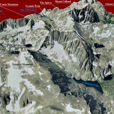
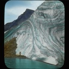
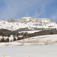
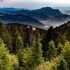
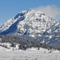
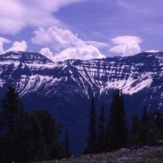
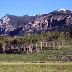
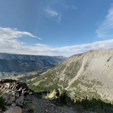
The Stillwater igneous complex is a geological formation in the Beartooth Mountains featuring layered ultrabasic and basic rock types of varying thicknesses. The structure stretches along the range and displays multiple distinct layers formed by ancient magma intrusion.

This formation originated billions of years ago when magma pushed into older rock, marking a period of stable continental development. The rock layers preserve evidence of how Earth's interior cooled and solidified during this ancient time.

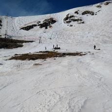
The site served as a training ground for astronauts studying rock formations similar to those found on the moon. Visitors today can observe the coarse crystal textures that continue to capture geologists' interest.

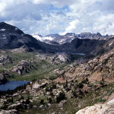
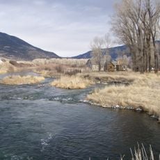
Access to the area is limited because mining operations are active in parts of the complex. Before visiting, check with local authorities about which sections are open to the public and current site conditions.

This complex ranks among the world's oldest layered magma intrusions and holds international recognition from geological scientists. Its remarkable composition makes it a key study site for understanding how Earth's interior evolved in prehistoric times.

The community of curious travelers

AroundUs brings together thousands of curated places, local tips, and hidden gems, enriched daily by 60,000 contributors worldwide.

Start exploring
GPS coordinates
45.38611,-109.90306
Latest update
December 8, 2025 13:43
Around this place
Beartooth Highway
United States of America

Beartooth Highway

57.8 km
Granite Peak
United States of America

Granite Peak

25.3 km
Grasshopper Glacier
United States of America

Grasshopper Glacier

28.1 km
Absaroka-Beartooth Wilderness
United States of America

Absaroka-Beartooth Wilderness

31.9 km
Pilot Peak
United States of America

Pilot Peak

45.6 km
Druid Peak
United States of America

Druid Peak

57.8 km
Mount Wood
United States of America

Mount Wood

14.3 km
Beartooth Basin Summer Ski Area
United States of America

Beartooth Basin Summer Ski Area

58.6 km
Greycliff Prairie Dog Town State Park
United States of America

Greycliff Prairie Dog Town State Park

42.7 km
Northeast Entrance Station
United States of America

Northeast Entrance Station

43.3 km
Abiathar Peak
United States of America

Abiathar Peak

46.8 km
DePuy Spring Creek
United States of America

DePuy Spring Creek

57.1 km
Barronette Peak
United States of America

Barronette Peak

48 km
The Thunderer
United States of America

The Thunderer

55.1 km
Mount Norris
United States of America

Mount Norris

58.9 km
Mount Hornaday
United States of America

Mount Hornaday

52.7 km
Custer Gallatin National Forest

Custer Gallatin National Forest

58.2 km
Michael Jacobs House
United States of America

Michael Jacobs House

57.6 km
Oliver H. Hovda House
United States of America

Oliver H. Hovda House

39.2 km
Carnegie Public Library
United States of America

Carnegie Public Library

49.8 km
Calvary Episcopal Church
United States of America

Calvary Episcopal Church

55.8 km
Clay Butte Lookout
United States of America

Clay Butte Lookout

53.7 km
B Street District
United States of America

B Street District

59.3 km
St. Olaf Lutheran Church
United States of America

St. Olaf Lutheran Church

44.5 km
Big Timber Lutheran Church
United States of America

Big Timber Lutheran Church

49.8 km
St Mark's Episcopal Church (Big Timber)
United States of America

St Mark's Episcopal Church (Big Timber)

49.7 km
Immanuel Lutheran Church (Absarokee)
United States of America

Immanuel Lutheran Church (Absarokee)

38.6 km
Beartooth Mountain Baptist Church (Red Lodge)
United States of America

Beartooth Mountain Baptist Church (Red Lodge)

55.7 km
Show the full map
Reviews
Share your experience

No review yet

Discussions
Start a discussion...

No discussion yet

« Stillwater igneous complex - Geological formation in Stillwater County, Montana, US » is provided by Around Us (aroundus.com). Images and texts are derived from Wikimedia project under a Creative Commons license. You are allowed to copy, distribute, and modify copies of this page, under the conditions set by the license, as long as this note is clearly visible.

Discover hidden gems everywhere you go!

From secret cafés to breathtaking viewpoints, skip the crowded tourist spots and find places that match your style. Our app makes it easy with voice search, smart filtering, route optimization, and insider tips from travelers worldwide. Download now for the complete mobile experience.

Around Us App Screenshot

A unique approach to discovering new places

Le Figaro

All the places worth exploring

France Info

A tailor-made excursion in just a few clicks

20 Minutes

Around Us
Travel Guide & Maps
Download

Send to your phone

QR Code
1

Open the camera app on your mobile.

2

Point at the QR code with your camera. A notification will appear.

3

Tap the notification to open the link.