Bikku Bitti, Mountain summit in Tibesti Mountains, Libya
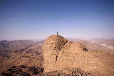
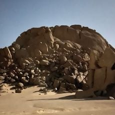
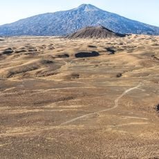
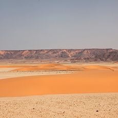
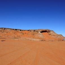
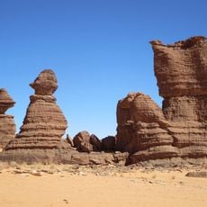
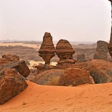
Bikku Bitti is the highest mountain peak in the Tibesti Mountains of Libya, rising approximately 2,267 meters above sea level. The mountain has a distinctive cone shape with rocky slopes and sits in one of the driest and most isolated parts of the Sahara.
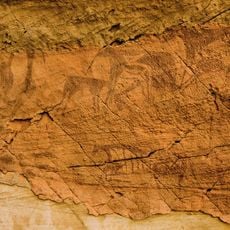
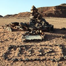
The mountain was known before modern times, as shown by ancient cairns at its summit. The first documented ascent took place in 2005, marking a turning point in the exploration of this remote area.
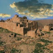
The name comes from Berber traditions and reflects the long history of indigenous peoples in the Tibesti region. These linguistic roots remain alive today in the place names and stories shared by local communities.
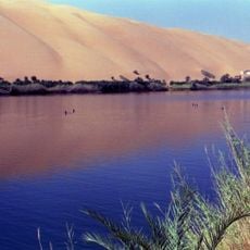
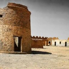
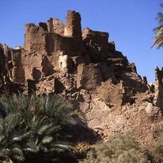
Reaching this location requires thorough preparation as it sits in one of the Sahara's most remote regions. Visitors should expect extreme heat, scarce water, difficult terrain, and should travel with an experienced guide.
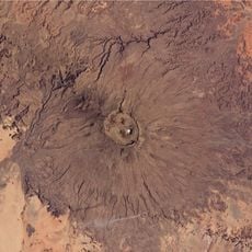
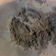
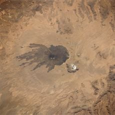
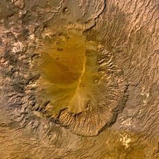
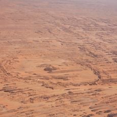
The mountain displays distinctive circular geological formations at its base, clearly visible from space on satellite images. These formations are so striking from orbit that they have been photographed from the International Space Station.
Elevation above the sea: 2,267 m
Address: Bikku Bitti, Libya
GPS coordinates: 22.00367,19.20659
Latest update: December 6, 2025 17:42
Libya holds some of the Mediterranean world's most important ancient ruins. You can walk through Roman cities like Leptis Magna, where a 16,000-seat amphitheater still stands, or explore the Greek settlement of Cyrene, founded more than 2,500 years ago. Berber communities left their mark across the...
Great Manmade River
455.1 km
Cave of Swimmers
643.3 kmChad Basin
625.6 km
Emi Koussi
255.7 km
Ennedi Plateau
652.3 km
Waw an Namus
356.1 km
Cave of the Beasts
637.7 km
Jebel Uweinat
595.8 km
Gebel el Uwaynat
595.8 km
Madama
573.5 km
Lakes of Ounianga
369.1 km
Gaberoun
784.6 km
Pic Toussidé
302.7 km
Tarso Toussidé
302.7 km
Aloba Arch
666.7 km
Gilf Kebir National Park
706.8 km
Tarso Voon
236 km
Cave of the Archers
643.3 km
Magharet el-Qantara
705.7 km
Faya basin
426.9 km
Awayke Rocks
598.2 km
Ohou
586.6 km
Prince Kamal el Dine Memorial
690.5 km
قلعة مرزق Murzuq Castil
692.6 km
Fort of Djado
722.8 km
Five Arch Rock
665.8 km
Réserve de Faune de Ouadi Rimé-Ouadi Achim
690.8 km
Réserve Naturelle et Culturelle de l'Ennedi
628.2 kmVisited this place? Tap the stars to rate it and share your experience / photos with the community! Try now! You can cancel it anytime.
Discover hidden gems everywhere you go!
From secret cafés to breathtaking viewpoints, skip the crowded tourist spots and find places that match your style. Our app makes it easy with voice search, smart filtering, route optimization, and insider tips from travelers worldwide. Download now for the complete mobile experience.
A unique approach to discovering new places❞
— Le Figaro
All the places worth exploring❞
— France Info
A tailor-made excursion in just a few clicks❞
— 20 Minutes