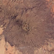
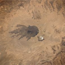
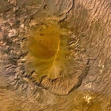
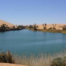
Waw an Namus, Volcanic crater in south-central Sahara, Libya
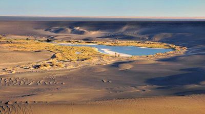
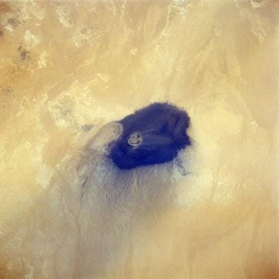
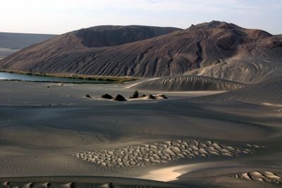
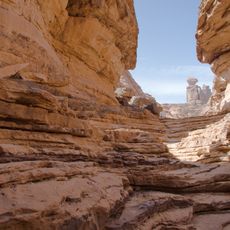
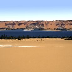
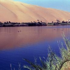
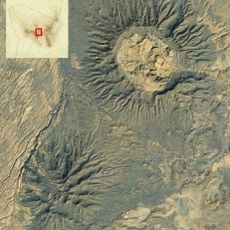
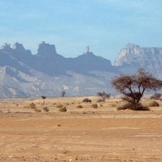
Waw an Namus is a volcanic crater in south-central Libya with three lakes occupying the lowest point of its basin and surrounded by date palms and shrubs. The depression drops steeply down from the sandy plateau above into this sheltered hollow.
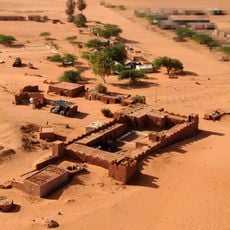
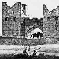
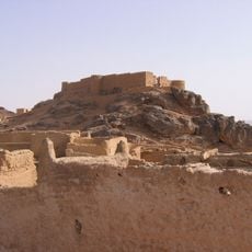
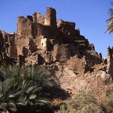
The crater lies along an ancient trade route connecting Kufra and Sebha, where graves indicate it served as a stopping point for desert travelers. This geological landmark helped orient caravans crossing the Sahara.
The name means "Crater of Mosquitoes" in Arabic, a reference to the insects that gather around the freshwater lakes sheltered within the volcanic bowl. Visitors walking the rim notice how life clusters around these rare water sources in an otherwise empty landscape.
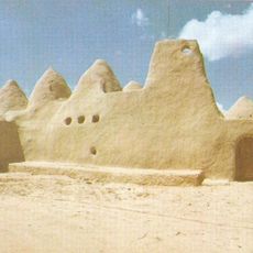
This location lies more than 250 miles from the nearest major town and requires specialized desert vehicles and experienced guides to reach safely. Plan visits during cooler months when desert conditions are less extreme.
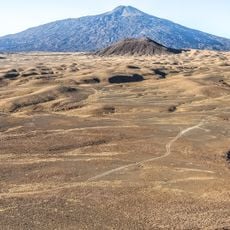
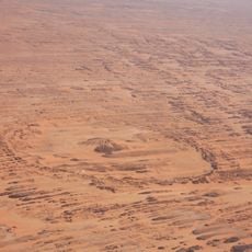
A dark ring of black volcanic ash and rock circles the crater, spreading outward for many kilometers across the yellow dunes. This stark contrast between dark material and pale sand creates a pattern visible even from a distance.
Elevation above the sea: 547 m
Address: Waw an Namus, Libya
GPS coordinates: 24.91397,17.75893
Latest update: December 6, 2025 16:01
Libya is home to many Roman, Greek, and Berber archaeological sites such as Leptis Magna and Cyrene. The country features ancient Saharan cities like Ghadames, religious monuments, and museums with historical collections. The territory also includes significant natural sites with rock carvings, oases, lakes, and mountain ranges.
Great Manmade River
391.7 km
Cave of Swimmers
772.6 km
Emi Koussi
576.3 km
Cave of the Beasts
763.8 km
Tadrart Acacus
749.9 km
Madama
533.7 km
Lakes of Ounianga
725.2 km
Atiq Mosque, Awjila
585.3 km
Gaberoun
472.4 km
Tarso Toussidé
450.9 km
Bikku Bitti
356.1 km
Bu Njem (Gholaia)
671.5 km
Ghirza
743 km
Gheriat el-Garbia
747.3 km
Tarso Voon
448.7 km
Fortress of Ghat
764.9 km
Tarso Toon
435.4 km
Pic Toussidé
450.8 km
Germa Museum
503.6 km
Gheriat esh-Shergia
735.2 km
Idinen
758.3 km
Mafo Lake
474.2 km
Faya basin
772.2 km
Ghirza, necropolis
745.7 km
قلعة مرزق Murzuq Castil
402.7 km
Fort of Djado
707.2 km
Tengerzan lake
479.9 km
Wadi Mathendous
570.1 kmReviews
Visited this place? Tap the stars to rate it and share your experience / photos with the community! Try now! You can cancel it anytime.
Discover hidden gems everywhere you go!
From secret cafés to breathtaking viewpoints, skip the crowded tourist spots and find places that match your style. Our app makes it easy with voice search, smart filtering, route optimization, and insider tips from travelers worldwide. Download now for the complete mobile experience.
A unique approach to discovering new places❞
— Le Figaro
All the places worth exploring❞
— France Info
A tailor-made excursion in just a few clicks❞
— 20 Minutes