Chest opened
+${chestReward.xp} XP
Explorer
NOUVEAU ×${chestReward.collectible.quantity}
tapez pour fermer
Chest locked

Open chests in the app

Around Us is built for your phone — chests unlock when you walk, explore and capture nearby places.

Enable Location

We need your location to show you interesting places around you

Discover nearby places

Find interesting locations and hidden gems around you

Precise directions

Get accurate directions and distances to places

Your location is never shared with other users. It's only used when you tap the location button.

Log in to your account

Start exploring — it's free

Trusted by 72,888 travelers worldwide

Continue with Google
Continue with Apple
or

We will send you a code to connect

By continuing, you accept our Terms and Conditions and our Privacy Policy

Check your inbox

We've sent a pincode in your inbox. Please enter the code below.

Bilafond La
Discussion Reviews Photo
8.9k Popularity

Bilafond La, Mountain pass in Karakoram Range, India and Pakistan.

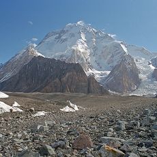
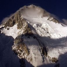
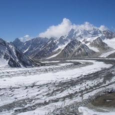
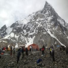
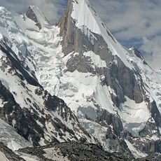
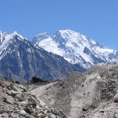
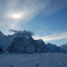
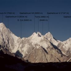
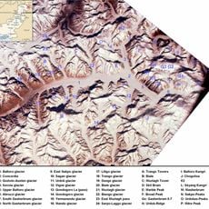
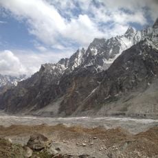
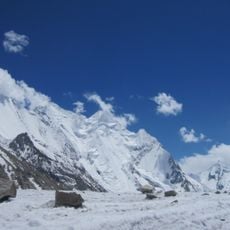
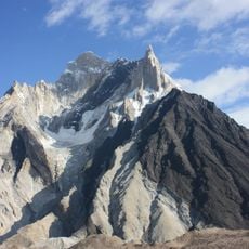
Bilafond La is a mountain pass on the Saltoro Ridge in the Karakoram, sitting at roughly 5,450 meters (17,880 feet) along the disputed boundary between Indian-administered Jammu and Kashmir and Pakistani-administered Gilgit-Baltistan. The pass crosses heavily glaciated terrain, where ice and bare rock dominate the surroundings on all sides.

The pass came to international attention in 1984 when Indian forces occupied it during Operation Meghdoot, taking control of the Saltoro Ridge before Pakistani troops could reach the high ground. Since then, it has remained part of one of the highest military conflicts in the world, with positions on both sides maintained through extreme conditions.

The name Bilafond La comes from the Balti language and means Pass of the Butterflies, a poetic name that stands in sharp contrast to the frozen landscape a visitor actually sees there. The Balti people of this region have long given mountain passes names drawn from nature, animals, and daily life.

Access to the pass is tightly restricted by both countries, and civilian permits are rarely, if ever, granted for this area. Anyone approaching the surrounding region should be prepared for extreme cold, sudden weather changes, and no civilian infrastructure of any kind.

Although the pass lies on one of the most contested ridges in the world, its exact position was never clearly marked on any official map before 1984, which is part of what made the confrontation there possible. The absence of a drawn line on the ground left both sides free to interpret the boundary differently.

The community of curious travelers

AroundUs brings together thousands of curated places, local tips, and hidden gems, enriched daily by 60,000 contributors worldwide.

Start exploring
Location
Elevation above the sea
5,450 m
GPS coordinates
35.38333,76.95000
Latest update
March 3, 2026 08:19
Reviews
Share your experience

No review yet

Discussions
Start a discussion...

No discussion yet

« Bilafond La - Mountain pass in Karakoram Range, India and Pakistan » is provided by Around Us (aroundus.com). Images and texts are derived from Wikimedia project under a Creative Commons license. You are allowed to copy, distribute, and modify copies of this page, under the conditions set by the license, as long as this note is clearly visible.

Discover hidden gems everywhere you go!

From secret cafés to breathtaking viewpoints, skip the crowded tourist spots and find places that match your style. Our app makes it easy with voice search, smart filtering, route optimization, and insider tips from travelers worldwide. Download now for the complete mobile experience.

Around Us App Screenshot

A unique approach to discovering new places

Le Figaro

All the places worth exploring

France Info

A tailor-made excursion in just a few clicks

20 Minutes

Around Us
Travel Guide & Maps
Download

Send to your phone

QR Code
1

Open the camera app on your mobile.

2

Point at the QR code with your camera. A notification will appear.

3

Tap the notification to open the link.