Enable Location

We need your location to show you interesting places around you

Discover nearby places

Find interesting locations and hidden gems around you

Precise directions

Get accurate directions and distances to places

Your location is never shared with other users. It's only used when you tap the location button.

Kuznetsk Alatau

Log in to your account

Start exploring — it's free

Trusted by 63,029 travelers worldwide

Continue with Google
Continue with Apple
or

We will send you a code to connect

By continuing, you accept our Terms and Conditions and our Privacy Policy

Check your inbox

We've sent a pincode in your inbox. Please enter the code below.

Kuznetsk Alatau
Discussion Reviews 1 Photos
25.5k Popularity

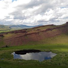
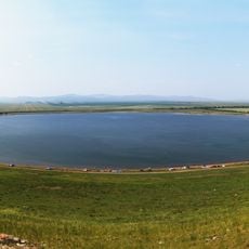
Kuznetsk Alatau, Mountain range in southwestern Siberia, Russia.

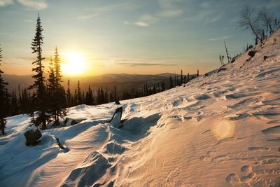
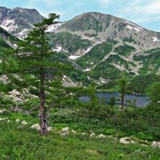
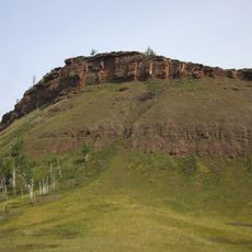
Kuznetsk Alatau is a mountain range in southwestern Siberia that stretches across the region with substantial elevation changes and varied terrain. The highest point, Staraya Krepost, rises prominently above the surrounding landscape.

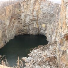
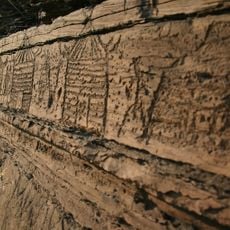
The rock formations date back to the Proterozoic era and consist of metamorphic materials. This ancient geological structure contains mineral deposits that have shaped the region's development.

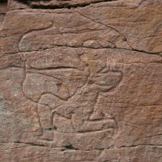
The mountains shape how indigenous Siberian communities relate to their surroundings and sense of place. Local residents view these peaks as woven into their identity and way of living.

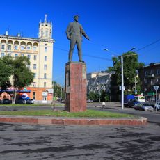
Access to the mountains is available from Mezhdurechensk, where visitors can obtain information and permits for activities. Prepare for rugged conditions and changing weather typical of high mountain terrain.

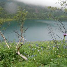
The Kondoma River valley preserves rare Siberian lime-tree forests that have endured since ancient times. These botanical remnants offer insight into an ecosystem that has survived for thousands of years.

The community of curious travelers

AroundUs brings together thousands of curated places, local tips, and hidden gems, enriched daily by 60,000 contributors worldwide.

Start exploring
Location
Location
Elevation above the sea
2,211 m
GPS coordinates
54.13333,88.75000
Latest update
December 13, 2025 21:29
Around this place
Tuim sinkhole
Russian Federation

Tuim sinkhole

78.2 km
Kuznetsk Alatau Nature Reserve
Russian Federation

Kuznetsk Alatau Nature Reserve

48.4 km
Kuznetsk Fortress
Russian Federation

Kuznetsk Fortress

110.1 km
Big Salabyk mound
Russian Federation

Big Salabyk mound

135 km
Sunduki Range
Russian Federation

Sunduki Range

86.9 km
Russian Federation

Kashkulakskaya

70.2 km
Kuznetsk Metallurgists Sports Palace
Russian Federation

Kuznetsk Metallurgists Sports Palace

114.5 km
Novokuznetsk Drama Theatre
Russian Federation

Novokuznetsk Drama Theatre

114.7 km
Russian Federation

Ящик Пандоры (пещера)

56.4 km
Ingol
Russian Federation

Ingol

156.3 km
Russian Federation

Кузедеевская липовая роща

129.8 km
Khankul Lake
Russian Federation

Khankul Lake

163.4 km
Transfiguration Cathedral, Novokuznetsk
Russian Federation

Transfiguration Cathedral, Novokuznetsk

110.4 km
Church of the Nativity of Jesus Christ in Novokuznetsk
Russian Federation

Church of the Nativity of Jesus Christ in Novokuznetsk

99.5 km
Ivanovskie ozyora
Russian Federation

Ivanovskie ozyora

53.8 km
Boyarskaya Pisanitsa
Russian Federation

Boyarskaya Pisanitsa

159.7 km
Sulek petroglyphs
Russian Federation

Sulek petroglyphs

107.4 km
Russian Federation

Хакасский республиканский национальный музей-заповедник

134.2 km
Chebaki fortress
Russian Federation

Chebaki fortress

64 km
Russian Federation

Литературно-мемориальный музей Ф. М. Достоевского

110.2 km
Statue of Vladimir Mayakovsky in Novokuznetsk
Russian Federation

Statue of Vladimir Mayakovsky in Novokuznetsk

114.6 km
Russian Federation

Каратаг (гора)

85.3 km
St. John Chrysostom Church, Novokuznetsk
Russian Federation

St. John Chrysostom Church, Novokuznetsk

102.7 km
Dikoye Lake
Russian Federation

Dikoye Lake

105.3 km
Ilyinsky bridge
Russian Federation

Ilyinsky bridge

107.4 km
Metallurgists' Garden
Russian Federation

Metallurgists' Garden

114.8 km
Musée ethnographique régional de Novokouznetski
Russian Federation

Musée ethnographique régional de Novokouznetski

114.7 km
Beryozovo Reservoir
Russian Federation

Beryozovo Reservoir

161.2 km
Show the full map
Reviews
Share your experience

No review yet

Discussions
Start a discussion...

No discussion yet

« Kuznetsk Alatau - Mountain range in southwestern Siberia, Russia » is provided by Around Us (aroundus.com). Images and texts are derived from Wikimedia project under a Creative Commons license. You are allowed to copy, distribute, and modify copies of this page, under the conditions set by the license, as long as this note is clearly visible.

Discover hidden gems everywhere you go!

From secret cafés to breathtaking viewpoints, skip the crowded tourist spots and find places that match your style. Our app makes it easy with voice search, smart filtering, route optimization, and insider tips from travelers worldwide. Download now for the complete mobile experience.

Around Us App Screenshot

A unique approach to discovering new places

Le Figaro

All the places worth exploring

France Info

A tailor-made excursion in just a few clicks

20 Minutes

Around Us
Travel Guide & Maps
Download

Send to your phone

QR Code
1

Open the camera app on your mobile.

2

Point at the QR code with your camera. A notification will appear.

3

Tap the notification to open the link.