Chest opened
+${chestReward.xp} XP
Explorer
NOUVEAU ×${chestReward.collectible.quantity}
tapez pour fermer
Chest locked

Open chests in the app

Around Us is built for your phone — chests unlock when you walk, explore and capture nearby places.

Enable Location

We need your location to show you interesting places around you

Discover nearby places

Find interesting locations and hidden gems around you

Precise directions

Get accurate directions and distances to places

Your location is never shared with other users. It's only used when you tap the location button.

Raikoke

Log in to your account

Start exploring — it's free

Trusted by 72,879 travelers worldwide

Continue with Google
Continue with Apple
or

We will send you a code to connect

By continuing, you accept our Terms and Conditions and our Privacy Policy

Check your inbox

We've sent a pincode in your inbox. Please enter the code below.

Raikoke
Discussion Reviews 2 Photos
9.6k Popularity

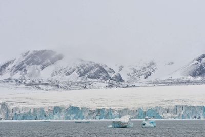
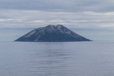
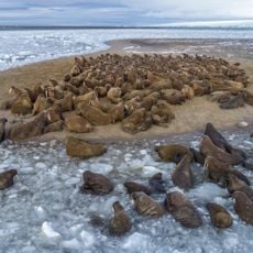
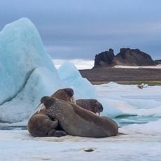
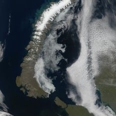
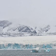
Raikoke, Volcanic island in Severo-Kurilsky District, Russia

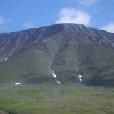
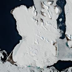
Raikoke is a volcanic island in the Kuril Chain with a steep-walled crater measuring about 700 meters across and 200 meters deep. The island rises 551 meters above sea level and displays the characteristic features of an active volcano.

A devastating eruption in 1778 destroyed the upper third of the island and killed about fifteen people from falling volcanic debris. This eruption demonstrates the destructive power of volcanic activity at this location.

The name comes from the Ainu language and refers to the underworld, reflecting the volcanic nature of this place. You can sense this linguistic connection to the region's indigenous heritage when looking at the dramatic landscape.

Visiting requires special permits from Russian authorities and travel options are limited due to the remote location. Plan accordingly and check current access conditions before your trip.

The 2019 eruption ejected ash and gas to heights between 13,000 and 17,000 meters and altered atmospheric composition. This recent activity shows the volcano remains an active and globally influential force.

The community of curious travelers

AroundUs brings together thousands of curated places, local tips, and hidden gems, enriched daily by 60,000 contributors worldwide.

Start exploring
Elevation above the sea
551 m
Part of
Middle Kurils
GPS coordinates
48.28333,153.25000
Latest update
December 12, 2025 02:13
Around this place
MT-LB
Russian Federation

MT-LB

4727.9 km
Sabetta
Russian Federation

Sabetta

4707.7 km
Great Arctic State Nature Reserve
Russian Federation

Great Arctic State Nature Reserve

4058 km
Obskaya–Bovanenkovo Line
Russian Federation

Obskaya–Bovanenkovo Line

4853.3 km
Varandey
Russian Federation

Varandey

5298.5 km
Het Behouden Huys
Russian Federation

Het Behouden Huys

4715.8 km
Russian Arctic National Park
Russian Federation

Russian Arctic National Park

4923.3 km
Zapovednik Gydansky
Russian Federation

Zapovednik Gydansky

4534.1 km
Nenets Nature Reserve
Russian Federation

Nenets Nature Reserve

5467.3 km
Wildlife Sanctuary Franz Joseph Land
Russian Federation

Wildlife Sanctuary Franz Joseph Land

4884.9 km
Severny Island ice cap
Russian Federation

Severny Island ice cap

4953.9 km
Yuribey Bridge
Russian Federation

Yuribey Bridge

4837.3 km
Buhta Tihaja
Russian Federation

Buhta Tihaja

4932.6 km
Богоявленский собор
Russian Federation

Богоявленский собор

5545 km
Malye Karmakuly
Russian Federation

Malye Karmakuly

5296.5 km
Russian Federation

Памятник «Подвигу участников оленно-транспортных батальонов»

5544.8 km
Памятник Яку-7Б (Нарьян-Мар)
Russian Federation

Памятник Яку-7Б (Нарьян-Мар)

5545 km
Dvorets Kultury Shakterov
Russian Federation

Dvorets Kultury Shakterov

5134.1 km
Inostrantsev Glacier
Russian Federation

Inostrantsev Glacier

4765.2 km
Ненецький краєзнавчий музей
Russian Federation

Ненецький краєзнавчий музей

5544.8 km
Здание почты (Нарьян-Мар)
Russian Federation

Здание почты (Нарьян-Мар)

5545 km
Russian Federation

Ортинское городище

5481 km
Харнаурды-Кеу
Russian Federation

Харнаурды-Кеу

5054.2 km
Здание администрации Ненецкого автономного округа
Russian Federation

Здание администрации Ненецкого автономного округа

5545.1 km
Russian Federation

Памятник экипажу буксирного парохода «Комсомолец» (Нарьян-Мар)

5544.7 km
Russian Federation

Brekhovskie Islands

4324.9 km
MacKlintok Island
Russian Federation

MacKlintok Island

4868.5 km
Russian Federation

Обелиск Победы в Нарьян-Маре

5545 km
Show the full map
Reviews
Share your experience

No review yet

Discussions
Start a discussion...

No discussion yet

« Raikoke - Volcanic island in Severo-Kurilsky District, Russia » is provided by Around Us (aroundus.com). Images and texts are derived from Wikimedia project under a Creative Commons license. You are allowed to copy, distribute, and modify copies of this page, under the conditions set by the license, as long as this note is clearly visible.

Discover hidden gems everywhere you go!

From secret cafés to breathtaking viewpoints, skip the crowded tourist spots and find places that match your style. Our app makes it easy with voice search, smart filtering, route optimization, and insider tips from travelers worldwide. Download now for the complete mobile experience.

Around Us App Screenshot

A unique approach to discovering new places

Le Figaro

All the places worth exploring

France Info

A tailor-made excursion in just a few clicks

20 Minutes

Around Us
Travel Guide & Maps
Download

Send to your phone

QR Code
1

Open the camera app on your mobile.

2

Point at the QR code with your camera. A notification will appear.

3

Tap the notification to open the link.