Enable Location

We need your location to show you interesting places around you

Discover nearby places

Find interesting locations and hidden gems around you

Precise directions

Get accurate directions and distances to places

Your location is never shared with other users. It's only used when you tap the location button.

Mifflin County

Log in to your account

Start exploring — it's free

Trusted by 61,344 travelers worldwide

Continue with Google
Continue with Apple
or

We will send you a code to connect

By continuing, you accept our Terms and Conditions and our Privacy Policy

Check your inbox

We've sent a pincode in your inbox. Please enter the code below.

Mifflin County, Administrative county in central Pennsylvania, United States

Description

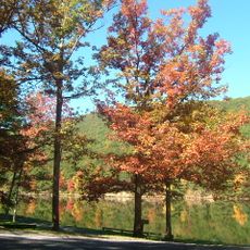
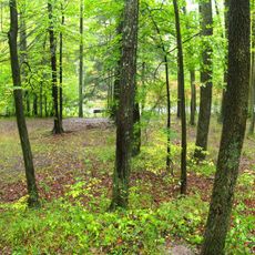
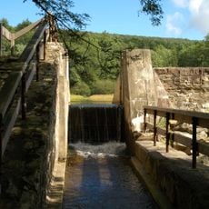
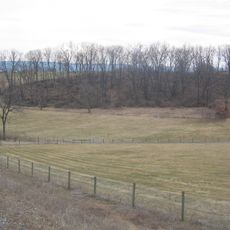
This administrative county in central Pennsylvania features gently rolling hills, extensive farmland, and the Juniata River running through its lower areas. The landscape is shaped by agricultural use and natural waterways.

History

The county was founded in 1789 and named after Thomas Mifflin, the first Governor of Pennsylvania. It was created from parts of the neighboring Cumberland and Northumberland counties.

Culture

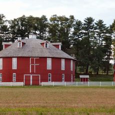
An Amish community shapes daily life here with traditional farming practices and simple ways of living that are visible throughout the rural landscape. Horse-drawn carriages and handcrafted work are common sights in the countryside.

Practical

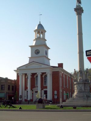
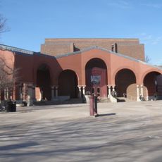
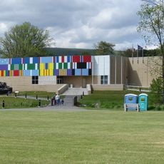
The main town of Lewistown houses the key government offices that serve residents and visitors. The region is accessible by car and offers a mix of rural areas and small urban centers.

Did you know?

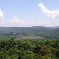
Broad Mountain reaches approximately 2,339 feet above sea level as the highest point in the area and shapes the Appalachian ridge landscape. This peak offers views over the surrounding valleys and serves as a geographic landmark for the region.

Location
Inception
September 19, 1789
Capital city
Lewistown
Shares border with
Centre County, Union County, Juniata County, Snyder County, Huntingdon County
GPS coordinates
40.61000,-77.62000
Latest update
December 20, 2025 13:42

AroundUs brings together thousands of curated places, local tips, and hidden gems, enriched daily by 60,000 contributors worldwide. Discover all places nearby (Pennsylvania).

Around this place
Beaver Stadium
United States of America

Beaver Stadium

30.1 km
Main Line of Public Works
United States of America

Main Line of Public Works

4.3 km
Port Royal Speedway
United States of America

Port Royal Speedway

21.2 km
Nittany Lion Shrine
United States of America

Nittany Lion Shrine

29.6 km
Octacube
United States of America

Octacube

29.2 km
Rothrock State Forest
United States of America

Rothrock State Forest

20.1 km
Harbison-Walker Refractories Company
United States of America

Harbison-Walker Refractories Company

33.8 km
Greenwood Furnace State Park
United States of America

Greenwood Furnace State Park

12.7 km
Poe Valley State Park
United States of America

Poe Valley State Park

26.7 km
Palmer Museum of Art
United States of America

Palmer Museum of Art

29.7 km
Poe Paddy State Park
United States of America

Poe Paddy State Park

30.2 km
Whipple Dam State Park
United States of America

Whipple Dam State Park

22.3 km
United States of America

Tuscarora State Forest

28.2 km
The Arboretum at Penn State
United States of America

The Arboretum at Penn State

29.9 km
Standing Stone Trail
United States of America

Standing Stone Trail

13.6 km
Pennsylvania Military Museum
United States of America

Pennsylvania Military Museum

24.2 km
Garfield Thomas Water Tunnel
United States of America

Garfield Thomas Water Tunnel

29.2 km
Farmers' High School
United States of America

Farmers' High School

29.1 km
Penn-Roosevelt State Park
United States of America

Penn-Roosevelt State Park

14.7 km
Fort Granville
United States of America

Fort Granville

2.9 km
Reeds Gap State Park
United States of America

Reeds Gap State Park

17.4 km
United States of America

State Theatre

28.9 km
Bear Meadows Natural Area
United States of America

Bear Meadows Natural Area

18 km
Neff Round Barn
United States of America

Neff Round Barn

24.1 km
Boal Mansion
United States of America

Boal Mansion

24.2 km
Academia Pomeroy Covered Bridge
United States of America

Academia Pomeroy Covered Bridge

18 km
Tudek Site
United States of America

Tudek Site

30.2 km
Alan Seeger Natural Area
United States of America

Alan Seeger Natural Area

14.6 km
Show the full map
« Mifflin County - Administrative county in central Pennsylvania, United States » is provided by Around Us (aroundus.com). Images and texts are derived from Wikimedia project under a Creative Commons license. You are allowed to copy, distribute, and modify copies of this page, under the conditions set by the license, as long as this note is clearly visible.

Discover hidden gems everywhere you go!

From secret cafés to breathtaking viewpoints, skip the crowded tourist spots and find places that match your style. Our app makes it easy with voice search, smart filtering, route optimization, and insider tips from travelers worldwide. Download now for the complete mobile experience.

Around Us App Screenshot

A unique approach to discovering new places

Le Figaro

All the places worth exploring

France Info

A tailor-made excursion in just a few clicks

20 Minutes

Around Us
Travel Guide & Maps
Download

Send to your phone

QR Code
1

Open the camera app on your mobile.

2

Point at the QR code with your camera. A notification will appear.

3

Tap the notification to open the link.